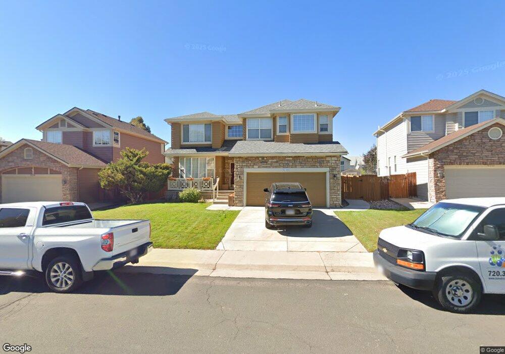
5220 E 130th Cir Thornton, CO 80241
Estimated Value: $572,000 - $681,000
4
Beds
4
Baths
3,469
Sq Ft
$177/Sq Ft
Est. Value
About This Home
This home is located at 5220 E 130th Cir, Thornton, CO 80241 and is currently estimated at $612,871, approximately $176 per square foot. 5220 E 130th Cir is a home located in Adams County with nearby schools including Eagleview Elementary School, Rocky Top Middle School, and Horizon High School.
Ownership History
Date
Name
Owned For
Owner Type
Purchase Details
Closed on
Feb 5, 2024
Sold by
Soria Max and Quintero Ana
Bought by
5220 E 130Th Circle Llc
Current Estimated Value
Purchase Details
Closed on
May 11, 2018
Sold by
Soria Max
Bought by
Soria Max and Quintero Ana
Purchase Details
Closed on
May 31, 2017
Sold by
Noguchi Calvin B and Noguchi Donna N
Bought by
Soria Max
Home Financials for this Owner
Home Financials are based on the most recent Mortgage that was taken out on this home.
Original Mortgage
$260,000
Interest Rate
3.97%
Mortgage Type
New Conventional
Purchase Details
Closed on
Dec 31, 1997
Sold by
The Ryland Group Inc
Bought by
Noguchi Calvin B and Noguchi Donna N
Home Financials for this Owner
Home Financials are based on the most recent Mortgage that was taken out on this home.
Original Mortgage
$155,600
Interest Rate
7.13%
Create a Home Valuation Report for This Property
The Home Valuation Report is an in-depth analysis detailing your home's value as well as a comparison with similar homes in the area
Purchase History
| Date | Buyer | Sale Price | Title Company |
|---|---|---|---|
| 5220 E 130Th Circle Llc | -- | None Listed On Document | |
| Soria Max | -- | Land Title Guarantee Co | |
| Soria Max | $400,000 | Land Title Guarantee Co | |
| Noguchi Calvin B | $194,870 | Land Title |
Source: Public Records
Mortgage History
| Date | Status | Borrower | Loan Amount |
|---|---|---|---|
| Previous Owner | Soria Max | $260,000 | |
| Previous Owner | Noguchi Calvin B | $155,600 |
Source: Public Records
Tax History
| Year | Tax Paid | Tax Assessment Tax Assessment Total Assessment is a certain percentage of the fair market value that is determined by local assessors to be the total taxable value of land and additions on the property. | Land | Improvement |
|---|---|---|---|---|
| 2025 | $4,196 | $40,600 | $9,320 | $31,280 |
| 2024 | $4,196 | $37,310 | $8,560 | $28,750 |
| 2023 | $4,153 | $44,240 | $6,830 | $37,410 |
| 2022 | $3,481 | $31,600 | $7,020 | $24,580 |
| 2021 | $3,596 | $31,600 | $7,020 | $24,580 |
| 2020 | $3,354 | $30,060 | $7,220 | $22,840 |
| 2019 | $3,360 | $30,060 | $7,220 | $22,840 |
| 2018 | $2,994 | $26,020 | $6,840 | $19,180 |
| 2017 | $2,722 | $26,020 | $6,840 | $19,180 |
| 2016 | $2,342 | $21,790 | $4,220 | $17,570 |
| 2015 | $2,338 | $21,790 | $4,220 | $17,570 |
| 2014 | $2,174 | $19,690 | $3,660 | $16,030 |
Source: Public Records
Map
Nearby Homes
- 4756 E 129th Place
- 13222 Clermont Cir
- 13212 Clermont Cir
- 5341 E 129th Way
- 13271 Holly St Unit B
- 5375 E 128th Dr
- 12993 Birch Dr
- 4087 E 133rd Cir
- 5024 E 127th Way
- 5628 Hudson Cir
- 13068 Harrison Dr
- 13064 Harrison Dr
- 12791 Clermont St
- 13004 Harrison Dr
- 13055 Harrison Dr
- 3867 E 133rd Ct
- 13190 Kearney St
- 13349 Krameria St
- 12698 Fairfax St
- 12870 Jasmine St Unit A
- 5228 E 130th Cir
- 5212 E 130th Cir
- 5209 E 130th Way
- 5205 E 130th Way
- 5236 E 130th Cir
- 5201 E 130th Way
- 5215 E 130th Way
- 5225 E 130th Cir
- 5213 E 130th Cir
- 5237 E 130th Cir
- 5221 E 130th Way
- 5244 E 130th Cir
- 13170 Summit Grove Pkwy
- 5249 E 130th Cir
- 5227 E 130th Way
- 13176 Forest St
- 13125 Summit Grove Pkwy
- 5208 E 130th Way
- 5248 E 130th Cir
- 13115 Summit Grove Pkwy
Your Personal Tour Guide
Ask me questions while you tour the home.