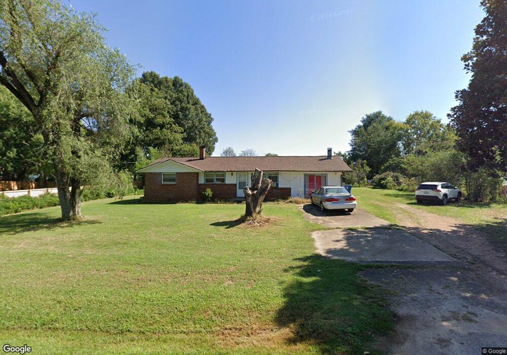
5220 Mays St Conover, NC 28613
Estimated Value: $183,000 - $247,000
3
Beds
2
Baths
1,353
Sq Ft
$164/Sq Ft
Est. Value
About This Home
This home is located at 5220 Mays St, Conover, NC 28613 and is currently estimated at $221,940, approximately $164 per square foot. 5220 Mays St is a home located in Catawba County with nearby schools including Lyle Creek Elementary School, River Bend Middle School, and Bunker Hill High School.
Ownership History
Date
Name
Owned For
Owner Type
Purchase Details
Closed on
Jul 28, 2008
Sold by
Lee Chong and Lee Xai V
Bought by
Lee Pheng Phia and Lee Yer Hang
Current Estimated Value
Home Financials for this Owner
Home Financials are based on the most recent Mortgage that was taken out on this home.
Original Mortgage
$84,671
Outstanding Balance
$55,408
Interest Rate
6.27%
Mortgage Type
FHA
Estimated Equity
$166,532
Purchase Details
Closed on
Aug 10, 2007
Sold by
Ratchford Darrell W and Ratchford Ann Y
Bought by
Lee Chong and Lee Xai
Purchase Details
Closed on
Aug 1, 1977
Create a Home Valuation Report for This Property
The Home Valuation Report is an in-depth analysis detailing your home's value as well as a comparison with similar homes in the area
Home Values in the Area
Average Home Value in this Area
Purchase History
| Date | Buyer | Sale Price | Title Company |
|---|---|---|---|
| Lee Pheng Phia | $86,000 | None Available | |
| Lee Chong | $49,000 | None Available | |
| -- | $32,000 | -- |
Source: Public Records
Mortgage History
| Date | Status | Borrower | Loan Amount |
|---|---|---|---|
| Open | Lee Pheng Phia | $84,671 |
Source: Public Records
Tax History
| Year | Tax Paid | Tax Assessment Tax Assessment Total Assessment is a certain percentage of the fair market value that is determined by local assessors to be the total taxable value of land and additions on the property. | Land | Improvement |
|---|---|---|---|---|
| 2025 | $1,036 | $198,300 | $13,300 | $185,000 |
| 2024 | $1,036 | $198,300 | $13,300 | $185,000 |
| 2023 | $996 | $86,500 | $13,300 | $73,200 |
| 2022 | $601 | $86,500 | $13,300 | $73,200 |
| 2021 | $601 | $86,500 | $13,300 | $73,200 |
| 2020 | $601 | $86,500 | $13,300 | $73,200 |
| 2019 | $601 | $86,500 | $0 | $0 |
| 2018 | $621 | $89,300 | $12,900 | $76,400 |
| 2017 | $621 | $0 | $0 | $0 |
| 2016 | $594 | $0 | $0 | $0 |
| 2015 | $533 | $89,300 | $12,900 | $76,400 |
| 2014 | $533 | $88,800 | $13,900 | $74,900 |
Source: Public Records
Map
Nearby Homes
- 4484 Springs Rd
- 5164 Lavern St Unit 1
- 5309 Hall St
- 5217 Canterbury Dr
- 5505 Creek Point Dr
- 5429 Buddy St Unit LOT 3
- 1246 Houston Mill Rd
- 3785 Pinecrest Dr NE Unit 155
- 3779 Pinecrest Dr NE Unit 154
- 4029 Pinecrest Dr NE Unit 166
- 1098 Remington Dr
- 1113 Pecan St
- 4125 Hideaway Ct NE
- 4014 Tanglewood Ln NE Unit 188
- 5069 W Piedmont Cir
- 3951 Springs Rd
- 1158 Sunset Ct
- 4687 Ransom Dr
- 4874 Stone Dr Unit 125
- 4829 County Home Rd
Your Personal Tour Guide
Ask me questions while you tour the home.