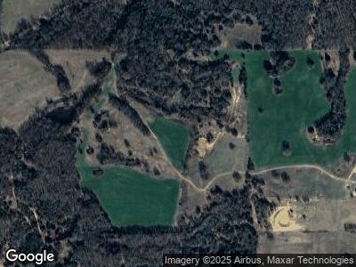
5222 Eastman Rd Overbrook, OK 73453
Estimated Value: $648,000 - $1,268,000
3
Beds
3
Baths
3,302
Sq Ft
$318/Sq Ft
Est. Value
About This Home
This home is located at 5222 Eastman Rd, Overbrook, OK 73453 and is currently estimated at $1,048,505, approximately $317 per square foot. 5222 Eastman Rd is a home located in Love County with nearby schools including Turner High School.
Ownership History
Date
Name
Owned For
Owner Type
Purchase Details
Closed on
Jul 25, 2022
Sold by
Circle D Land & Cattle Company Llc
Bought by
2B Ranch Llc
Current Estimated Value
Purchase Details
Closed on
Dec 17, 2019
Sold by
Robnett Joe C and Robnett Mary B
Bought by
Hart John Wesley and Hart Leann Michelle
Home Financials for this Owner
Home Financials are based on the most recent Mortgage that was taken out on this home.
Original Mortgage
$600,000
Interest Rate
3.12%
Mortgage Type
USDA
Purchase Details
Closed on
Nov 7, 2006
Sold by
Mckay Willis N
Bought by
Hart John Wesley and Hart Leann S
Purchase Details
Closed on
Jan 5, 2000
Sold by
Austin Scotty and Austin Sunnie
Bought by
Mckay Willis N
Purchase Details
Closed on
Nov 29, 1996
Sold by
Price Billy Bob and Price Mary N
Bought by
Austin Scotty and Austin Sunnie
Create a Home Valuation Report for This Property
The Home Valuation Report is an in-depth analysis detailing your home's value as well as a comparison with similar homes in the area
Home Values in the Area
Average Home Value in this Area
Purchase History
| Date | Buyer | Sale Price | Title Company |
|---|---|---|---|
| 2B Ranch Llc | $6,200,000 | None Listed On Document | |
| Hart John Wesley | $800,000 | None Available | |
| Hart John Wesley | -- | -- | |
| Mckay Willis N | $150,000 | -- | |
| Austin Scotty | $120,000 | -- |
Source: Public Records
Mortgage History
| Date | Status | Borrower | Loan Amount |
|---|---|---|---|
| Previous Owner | Hart John Wesley | $600,000 |
Source: Public Records
Tax History Compared to Growth
Tax History
| Year | Tax Paid | Tax Assessment Tax Assessment Total Assessment is a certain percentage of the fair market value that is determined by local assessors to be the total taxable value of land and additions on the property. | Land | Improvement |
|---|---|---|---|---|
| 2024 | $4,975 | $67,802 | $7,200 | $60,602 |
| 2023 | $4,627 | $65,827 | $7,050 | $58,777 |
| 2022 | $3,054 | $43,832 | $6,016 | $37,816 |
| 2021 | $3,099 | $43,832 | $6,016 | $37,816 |
| 2020 | $3,124 | $43,832 | $6,016 | $37,816 |
| 2019 | $3,193 | $44,248 | $6,016 | $38,232 |
| 2018 | $3,354 | $46,087 | $5,992 | $40,095 |
| 2017 | $3,275 | $44,745 | $5,764 | $38,981 |
| 2016 | $3,204 | $43,442 | $4,866 | $38,576 |
| 2015 | $2,972 | $39,805 | $7,345 | $32,460 |
| 2014 | $3,069 | $38,646 | $7,345 | $31,301 |
Source: Public Records
Map
Nearby Homes
- 0 Dogwood Unit 2511071
- 0 Rhonda Unit 2509774
- 0 Quanah Dr
- 1 New Hope Rd
- 0 Arrowhead Dr Unit 2511948
- 0 Arrowhead Dr Unit 2430842
- 9 Mcclure Cir
- 49 Diamondhead Dr
- 3 Huntly Dr
- 0 N Diamondhead Dr
- 0 Franks Unit 2510322
- 7 Golf Club Dr
- 20 Oswalt Rd
- 2 Lakeview Dr
- 17 Valley View Dr Unit B
- 0 Valleyview Dr
- 35 Arrowhead Dr
- 0 Enid Place
- 125 Falconhead Dr Unit G
- 125 Falconhead Dr Unit E
