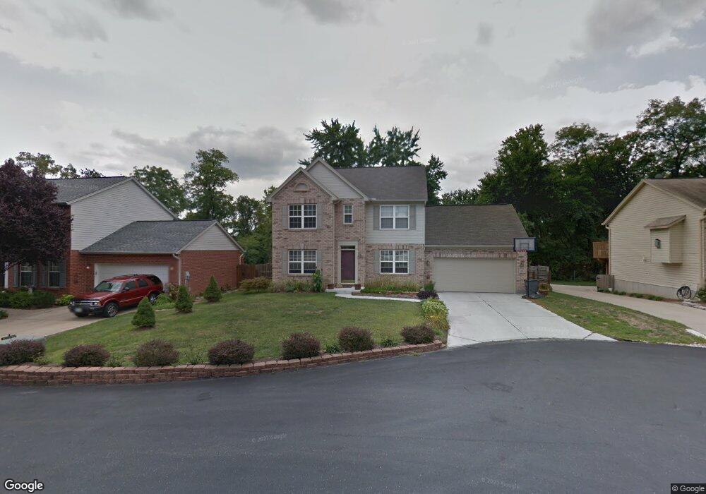
5223 Locust Ave Cincinnati, OH 45238
Central Delhi NeighborhoodEstimated Value: $359,000 - $394,000
3
Beds
3
Baths
1,936
Sq Ft
$191/Sq Ft
Est. Value
About This Home
This home is located at 5223 Locust Ave, Cincinnati, OH 45238 and is currently estimated at $370,135, approximately $191 per square foot. 5223 Locust Ave is a home located in Hamilton County with nearby schools including C.O. Harrison Elementary School, Rapid Run Middle School, and Oak Hills High School.
Ownership History
Date
Name
Owned For
Owner Type
Purchase Details
Closed on
Jul 26, 2002
Sold by
Hensley Homes Inc
Bought by
Sexton Michael A and Sexton Kimberly L
Current Estimated Value
Purchase Details
Closed on
Mar 20, 2002
Sold by
Ronald C Davis Inc
Bought by
Hensley Homes Inc
Home Financials for this Owner
Home Financials are based on the most recent Mortgage that was taken out on this home.
Original Mortgage
$164,800
Interest Rate
7.18%
Create a Home Valuation Report for This Property
The Home Valuation Report is an in-depth analysis detailing your home's value as well as a comparison with similar homes in the area
Home Values in the Area
Average Home Value in this Area
Purchase History
| Date | Buyer | Sale Price | Title Company |
|---|---|---|---|
| Sexton Michael A | $210,700 | -- | |
| Hensley Homes Inc | $45,000 | -- |
Source: Public Records
Mortgage History
| Date | Status | Borrower | Loan Amount |
|---|---|---|---|
| Previous Owner | Hensley Homes Inc | $164,800 |
Source: Public Records
Tax History
| Year | Tax Paid | Tax Assessment Tax Assessment Total Assessment is a certain percentage of the fair market value that is determined by local assessors to be the total taxable value of land and additions on the property. | Land | Improvement |
|---|---|---|---|---|
| 2025 | $6,702 | $112,865 | $10,255 | $102,610 |
| 2023 | $6,558 | $112,865 | $10,255 | $102,610 |
| 2022 | $5,870 | $89,866 | $8,484 | $81,382 |
| 2021 | $5,749 | $89,866 | $8,484 | $81,382 |
| 2020 | $5,831 | $89,866 | $8,484 | $81,382 |
| 2019 | $5,593 | $77,473 | $7,315 | $70,158 |
| 2018 | $5,599 | $77,473 | $7,315 | $70,158 |
| 2017 | $5,054 | $77,473 | $7,315 | $70,158 |
| 2016 | $5,069 | $77,840 | $7,084 | $70,756 |
| 2015 | $5,074 | $77,840 | $7,084 | $70,756 |
| 2014 | $5,081 | $77,840 | $7,084 | $70,756 |
| 2013 | $5,196 | $84,609 | $7,700 | $76,909 |
Source: Public Records
Map
Nearby Homes
- 949 Anderson Ferry Rd
- 951 Villa View Ct
- 5314 Alvera Dr
- 5256 Glen Creek Dr
- 5152 Highview Dr
- 1157 Beechmeadow Ln
- 813 Allenwood Ct
- 5355 Cleander Dr
- 5183 Cleves Warsaw Pike
- 5140 Willnet Dr
- 1141 Covedale Ave
- 1092 Morado Dr
- 5330 Plumridge Dr
- 979 Bandanna Dr
- 5114 Cleves Warsaw Pike
- 5311 Rawhide Ct
- 5012 Garden Grove Ln
- 5019 Garden Grove Ln
- 1086 Benz Ave
- 621 Covedale Ave
- 5223 Locust St
- 5225 Locust St
- 5221 Locust St
- 5225 Locust St
- 5221 Locust St
- 5224 Locust St
- 5224 Locust St
- 5222 Locust St
- 5222 Locust St
- 5226 Locust St
- 5232 Rapid Run Rd
- 982 Anderson Ferry Rd
- 1 Locust Ave
- 991 Beechmeadow Ln
- 5215 Andy Ct
- 995 Beechmeadow Ln
- 987 Beechmeadow Ln
- 5207 Andy Ct
- 978 Anderson Ferry Rd
- 983 Beechmeadow Ln
Your Personal Tour Guide
Ask me questions while you tour the home.