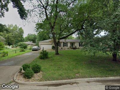
5224 Yavapai Dr Forsyth, IL 62535
Estimated Value: $259,162 - $340,000
3
Beds
3
Baths
3,742
Sq Ft
$80/Sq Ft
Est. Value
About This Home
This home is located at 5224 Yavapai Dr, Forsyth, IL 62535 and is currently estimated at $298,041, approximately $79 per square foot. 5224 Yavapai Dr is a home located in Macon County with nearby schools including Maroa-Forsyth Grade School, Maroa-Forsyth Middle School, and Maroa-Forsyth Senior High School.
Ownership History
Date
Name
Owned For
Owner Type
Purchase Details
Closed on
Oct 13, 2009
Sold by
Shindler George V and Shindler Karen A
Bought by
Damery Phillip L and Damery Linda C
Current Estimated Value
Home Financials for this Owner
Home Financials are based on the most recent Mortgage that was taken out on this home.
Original Mortgage
$150,000
Interest Rate
5.15%
Mortgage Type
New Conventional
Purchase Details
Closed on
Apr 1, 1999
Create a Home Valuation Report for This Property
The Home Valuation Report is an in-depth analysis detailing your home's value as well as a comparison with similar homes in the area
Home Values in the Area
Average Home Value in this Area
Purchase History
| Date | Buyer | Sale Price | Title Company |
|---|---|---|---|
| Damery Phillip L | $195,000 | None Available | |
| -- | $150,000 | -- |
Source: Public Records
Mortgage History
| Date | Status | Borrower | Loan Amount |
|---|---|---|---|
| Open | Damery Phillip L | $147,200 | |
| Closed | Damery Phillip L | $150,000 |
Source: Public Records
Tax History Compared to Growth
Tax History
| Year | Tax Paid | Tax Assessment Tax Assessment Total Assessment is a certain percentage of the fair market value that is determined by local assessors to be the total taxable value of land and additions on the property. | Land | Improvement |
|---|---|---|---|---|
| 2024 | $4,955 | $75,942 | $9,935 | $66,007 |
| 2023 | $4,615 | $69,812 | $9,133 | $60,679 |
| 2022 | $4,254 | $64,748 | $8,470 | $56,278 |
| 2021 | $3,926 | $60,542 | $7,920 | $52,622 |
| 2020 | $3,687 | $59,290 | $7,756 | $51,534 |
| 2019 | $3,687 | $59,290 | $7,756 | $51,534 |
| 2018 | $3,508 | $59,714 | $7,811 | $51,903 |
| 2017 | $3,708 | $62,574 | $8,185 | $54,389 |
| 2016 | $3,759 | $62,725 | $8,205 | $54,520 |
| 2015 | $3,636 | $61,982 | $8,108 | $53,874 |
| 2014 | $3,554 | $59,914 | $8,108 | $51,806 |
| 2013 | $3,379 | $56,823 | $7,690 | $49,133 |
Source: Public Records
Map
Nearby Homes
- 5307 Yavapai Dr
- 5354 N Macarthur Rd
- 7 McDonald Ave
- 0 Route 51 Unit 6241333
- 1250 W Hickory Point Rd
- 4624 Redbud Ct
- 4605 Redbud Ct
- 160 Hickory Point Ct
- 4612 Havenwood Dr
- 95 Hickory Point Ct
- 4545 Havenwood Dr
- 1302 Clement Ave
- 749 Christopher Dr
- 1104 Clement Ave
- 490 Shadow Ln
- 4554 Nicklaus Ct
- 676 Wolf Rd
- 4404 Havenwood Dr
- 291 Michael Ave
- 4027 N Buckingham Dr
- 5224 Yavapai Dr
- 5253 Yavapai Dr
- 5244 Yavapai Dr
- 5204 Yavapai Dr
- 710 Apache Dr
- 605 Hopi Dr
- 701 Apache Dr
- 605 Hopi St
- 711 Apache Dr
- 717 Apache Dr
- 5223 N Macarthur Rd
- 730 Apache Dr
- 610 Hopi St
- 707 Cortez Dr
- 5201 N Macarthur Rd
- 5241 N Macarthur Rd
- 750 Apache Dr
- 5265 N Macarthur Rd
- 713 Cortez Dr
- 600 Hopi St