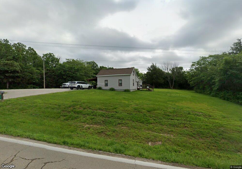
5228 Highway N Robertsville, MO 63072
Estimated Value: $272,000 - $343,000
2
Beds
1
Bath
1,158
Sq Ft
$270/Sq Ft
Est. Value
About This Home
This home is located at 5228 Highway N, Robertsville, MO 63072 and is currently estimated at $312,615, approximately $269 per square foot. 5228 Highway N is a home located in Franklin County with nearby schools including Lonedell Elementary School.
Ownership History
Date
Name
Owned For
Owner Type
Purchase Details
Closed on
Apr 7, 2022
Sold by
Maple Randy T and Maple Christin M
Bought by
Delmain Taylor
Current Estimated Value
Home Financials for this Owner
Home Financials are based on the most recent Mortgage that was taken out on this home.
Original Mortgage
$209,000
Outstanding Balance
$196,639
Interest Rate
4.72%
Mortgage Type
New Conventional
Estimated Equity
$115,976
Purchase Details
Closed on
Jan 13, 2022
Sold by
Maple Randy T
Bought by
Maple Randy T and Maple Christin M
Home Financials for this Owner
Home Financials are based on the most recent Mortgage that was taken out on this home.
Original Mortgage
$131,740
Interest Rate
3.11%
Mortgage Type
New Conventional
Purchase Details
Closed on
Apr 3, 2021
Sold by
Brandie Maple
Bought by
Maple Randy
Create a Home Valuation Report for This Property
The Home Valuation Report is an in-depth analysis detailing your home's value as well as a comparison with similar homes in the area
Home Values in the Area
Average Home Value in this Area
Purchase History
| Date | Buyer | Sale Price | Title Company |
|---|---|---|---|
| Delmain Taylor | -- | None Listed On Document | |
| Maple Randy T | -- | None Listed On Document | |
| Maple Randy | -- | None Listed On Document |
Source: Public Records
Mortgage History
| Date | Status | Borrower | Loan Amount |
|---|---|---|---|
| Open | Delmain Taylor | $209,000 | |
| Previous Owner | Maple Randy T | $131,740 |
Source: Public Records
Tax History Compared to Growth
Tax History
| Year | Tax Paid | Tax Assessment Tax Assessment Total Assessment is a certain percentage of the fair market value that is determined by local assessors to be the total taxable value of land and additions on the property. | Land | Improvement |
|---|---|---|---|---|
| 2025 | $1,405 | $22,770 | $0 | $0 |
| 2024 | $1,405 | $20,012 | $0 | $0 |
| 2023 | $1,166 | $20,012 | $0 | $0 |
| 2022 | $1,115 | $19,115 | $0 | $0 |
| 2021 | $1,111 | $19,115 | $0 | $0 |
| 2020 | $1,067 | $18,055 | $0 | $0 |
| 2019 | $1,066 | $18,055 | $0 | $0 |
| 2018 | $1,030 | $17,329 | $0 | $0 |
| 2017 | $1,021 | $17,329 | $0 | $0 |
| 2016 | $1,001 | $17,010 | $0 | $0 |
| 2015 | $999 | $17,010 | $0 | $0 |
| 2014 | $1,055 | $18,913 | $0 | $0 |
Source: Public Records
Map
Nearby Homes
- 5199 Highway N
- 563 Calvey Heights Ct
- 0 Woodland Valley Dr Unit MAR25002747
- 4373 E Linda Ln
- 0 Watts Ridge Dr
- 2227 State Route N
- 4398 E Linda Ln
- 1811 Hendricks Rd
- 1855 Hendricks Rd
- 0 N Hendricks Rd Unit MIS25078611
- 8716 Highway Hh
- 5563 E Anding Dr
- 4143 Highway N
- 175 Enchanted Oak Ct
- 000 Forest Rd
- 0 Stone Ridge Rd Unit MAR25025168
- 420 Nancy Dr
- 0 Old Cove Rd
- 525 Cedar View Dr
- 1320 & 1330 Lake Shore Dr
- 419 Enchanted Mirror Way
- 5253 Highway N
- 427 Enchanted Mirror Way
- 433 Enchanted Mirror Way
- 435 Enchanted Mirror Way
- 5262 Highway N
- 1714 Drake Ln
- 1638 Drake Ln
- 5273 Highway N
- 5273 Highway N
- 5172 Highway N
- 1633 Drake Ln
- 1671 Drake Ln
- 5300 Highway N
- 5289 Highway N
- 147 Bridle Trail Dr
- 0 Hawthorne Dr Unit 12040489
- 0 Hawthorne Dr Unit 20055259
- 0 Hawthorne Dr Unit 19089371
- 1 Bridle Trail Dr