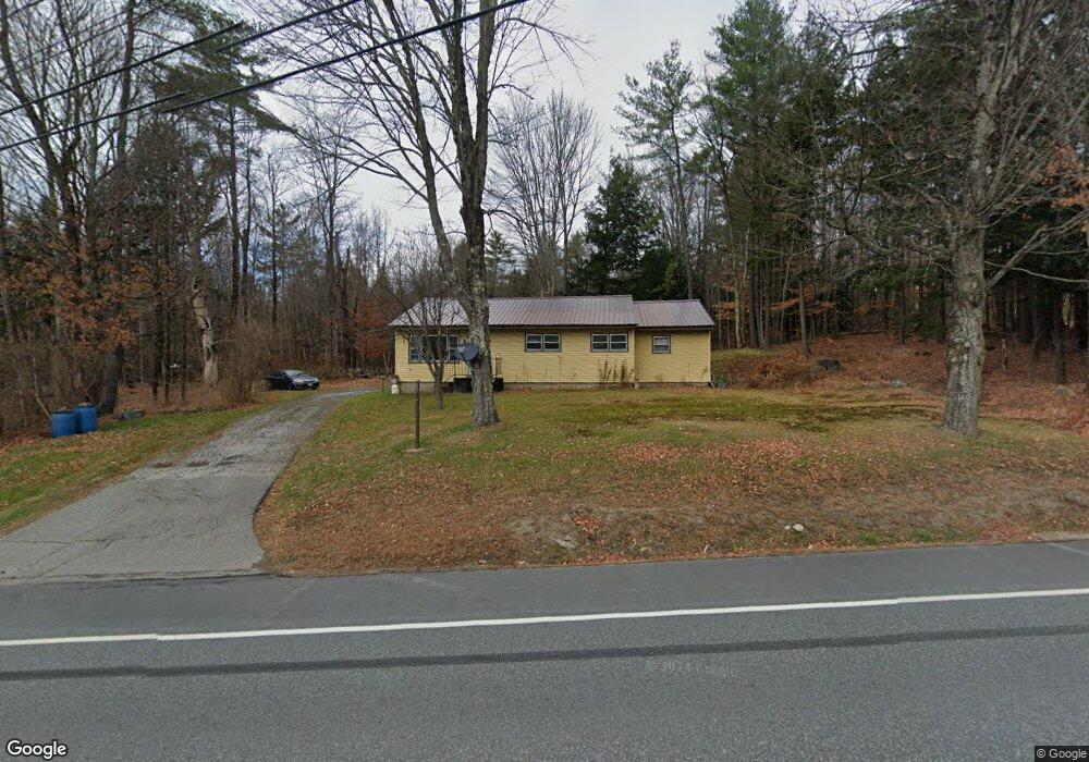
523 John Stark Hwy Newport, NH 03773
Estimated Value: $260,000 - $344,000
3
Beds
1
Bath
1,617
Sq Ft
$192/Sq Ft
Est. Value
About This Home
This home is located at 523 John Stark Hwy, Newport, NH 03773 and is currently estimated at $310,125, approximately $191 per square foot. 523 John Stark Hwy is a home with nearby schools including Richards Elementary School, Newport High School, and Newport Montessori School.
Create a Home Valuation Report for This Property
The Home Valuation Report is an in-depth analysis detailing your home's value as well as a comparison with similar homes in the area
Home Values in the Area
Average Home Value in this Area
Tax History Compared to Growth
Tax History
| Year | Tax Paid | Tax Assessment Tax Assessment Total Assessment is a certain percentage of the fair market value that is determined by local assessors to be the total taxable value of land and additions on the property. | Land | Improvement |
|---|---|---|---|---|
| 2024 | $5,487 | $225,700 | $90,600 | $135,100 |
| 2023 | $5,322 | $225,700 | $90,600 | $135,100 |
| 2022 | $4,717 | $225,700 | $90,600 | $135,100 |
| 2021 | $3,901 | $118,200 | $47,700 | $70,500 |
| 2020 | $3,912 | $118,200 | $47,700 | $70,500 |
| 2019 | $3,712 | $114,100 | $47,700 | $66,400 |
| 2018 | $3,469 | $114,100 | $47,700 | $66,400 |
| 2017 | $3,428 | $114,100 | $47,700 | $66,400 |
| 2016 | $3,471 | $120,800 | $43,500 | $77,300 |
| 2015 | $3,533 | $120,800 | $43,500 | $77,300 |
| 2014 | $3,822 | $120,800 | $43,500 | $77,300 |
| 2013 | $3,623 | $120,800 | $43,500 | $77,300 |
Source: Public Records
Map
Nearby Homes
- 430 John Stark Hwy
- 680-2 John Stark Hwy
- 736 John Stark Hwy
- 146 Elm St
- 12 4th St
- 13 Fairbanks Rd
- 11 Putnam Rd
- 9 Depot St
- 37 Park St
- 151 Cheney St
- 8 Prospect St
- 38 River St
- 150 S Main St
- 0 Unity Rd
- 4 River View Rd Unit Lot 4 Phase II
- 44 Brook View Rd
- 45 Brook View Rd
- 33 Brook View Rd
- 32 Brook View Rd
- 27 Brook View Rd
- 513 John Stark Hwy
- 507 John Stark Hwy
- 00 Endicott Rd
- 8 Endicott Rd
- 14 Endicott Rd
- 525 John Stark Hwy
- 491 John Stark Hwy
- 491 John Stark Hwy Unit 1
- 19 Endicott Rd
- 485 John Stark Hwy
- 32 Endicott Rd
- 35 Endicott Rd
- 14 Blood Rd
- 44 Endicott Rd
- 00 Chandlers Mills Rd
- 475 John Stark Hwy
- 984 John Stark Hwy
- 7 Blood Rd
- 3 Blood Rd
- 591 John Stark Hwy