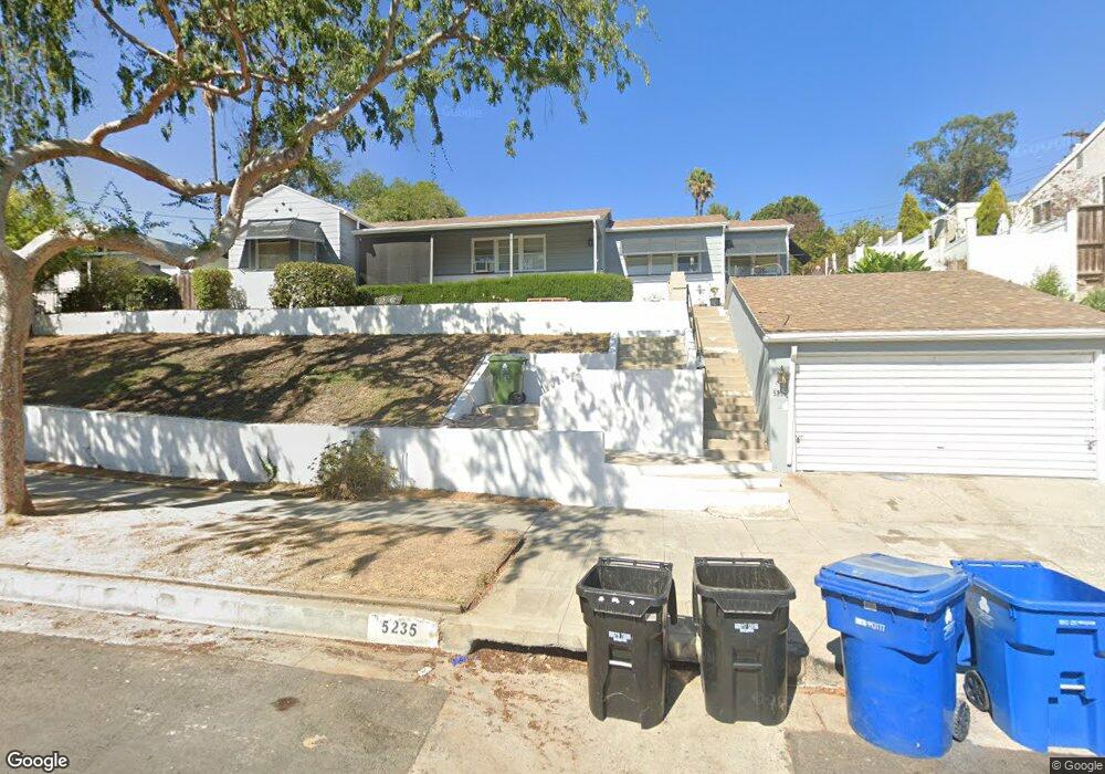
5235 Coringa Dr Los Angeles, CA 90042
Highland Park NeighborhoodEstimated Value: $1,555,000 - $5,572,000
4
Beds
4
Baths
2,981
Sq Ft
$949/Sq Ft
Est. Value
About This Home
This home is located at 5235 Coringa Dr, Los Angeles, CA 90042 and is currently estimated at $2,829,758, approximately $949 per square foot. 5235 Coringa Dr is a home located in Los Angeles County with nearby schools including Buchanan Street Elementary and Franklin Middle School & High School.
Ownership History
Date
Name
Owned For
Owner Type
Purchase Details
Closed on
Apr 13, 2024
Sold by
Canicula Emma S
Bought by
Emma S Canicula Living Trust and Canicula
Current Estimated Value
Purchase Details
Closed on
Aug 9, 2018
Sold by
Canicula Emma S
Bought by
Canicula Emma S and The Canicula 2018 Living Trust
Purchase Details
Closed on
Mar 7, 2002
Sold by
Emma S Canicula Trust
Bought by
Canicula Emma S
Home Financials for this Owner
Home Financials are based on the most recent Mortgage that was taken out on this home.
Original Mortgage
$65,000
Interest Rate
6.99%
Mortgage Type
Stand Alone Second
Purchase Details
Closed on
Oct 1, 1999
Sold by
Canicula Emma S
Bought by
Emma S Canicula Trust
Create a Home Valuation Report for This Property
The Home Valuation Report is an in-depth analysis detailing your home's value as well as a comparison with similar homes in the area
Home Values in the Area
Average Home Value in this Area
Purchase History
| Date | Buyer | Sale Price | Title Company |
|---|---|---|---|
| Emma S Canicula Living Trust | -- | None Listed On Document | |
| Canicula Emma S | -- | None Listed On Document | |
| Canicula Emma S | -- | None Available | |
| Canicula Emma S | -- | Fidelity National Title Co | |
| Emma S Canicula Trust | -- | -- |
Source: Public Records
Mortgage History
| Date | Status | Borrower | Loan Amount |
|---|---|---|---|
| Previous Owner | Canicula Emma S | $65,000 |
Source: Public Records
Tax History
| Year | Tax Paid | Tax Assessment Tax Assessment Total Assessment is a certain percentage of the fair market value that is determined by local assessors to be the total taxable value of land and additions on the property. | Land | Improvement |
|---|---|---|---|---|
| 2025 | $6,293 | $494,072 | $289,511 | $204,561 |
| 2024 | $6,293 | $484,385 | $283,835 | $200,550 |
| 2023 | $6,177 | $474,888 | $278,270 | $196,618 |
| 2022 | $5,900 | $465,577 | $272,814 | $192,763 |
| 2021 | $5,816 | $456,449 | $267,465 | $188,984 |
| 2019 | $5,648 | $442,913 | $259,533 | $183,380 |
| 2018 | $5,505 | $434,230 | $254,445 | $179,785 |
| 2016 | $5,237 | $417,369 | $244,565 | $172,804 |
| 2015 | $5,163 | $411,101 | $240,892 | $170,209 |
| 2014 | $5,189 | $403,049 | $236,174 | $166,875 |
Source: Public Records
Map
Nearby Homes
- 5240 Barker Dr
- 5218 Barker Dr
- 1932 Phillips Way
- 1942 Phillips Way
- 1938 Phillips Way
- 1813 N Avenue 55
- 1817 N Avenue 55
- 1835 N Avenue 55
- 5618 Tehama St
- 1707 Upperton Ave
- 1333 Wildwood Dr
- 0 A Wildwood Dr
- 4920 Stratford Rd
- 5681 Fallston St
- 4631 4637 Loleta Place
- 5624 Stratford Rd
- 5603 E Alloway Ct
- 5606 E Alloway Ct
- 5144 Buchanan St
- 1523 Highgate Ave
- 5227 Coringa Dr
- 1817 Phillips Way
- 1811 Phillips Way
- 1821 Phillips Way
- 5223 Coringa Dr
- 1827 Phillips Way
- 5217 Coringa Dr
- 5234 Coringa Dr
- 5230 Coringa Dr
- 5238 Coringa Dr
- 1816 Phillips Way
- 5226 Coringa Dr
- 5242 Coringa Dr
- 5222 Coringa Dr
- 5211 Coringa Dr
- 5246 Coringa Dr
- 1802 Phillips Way
- 1831 Phillips Way
- 5218 Coringa Dr
- 1820 Phillips Way
Your Personal Tour Guide
Ask me questions while you tour the home.