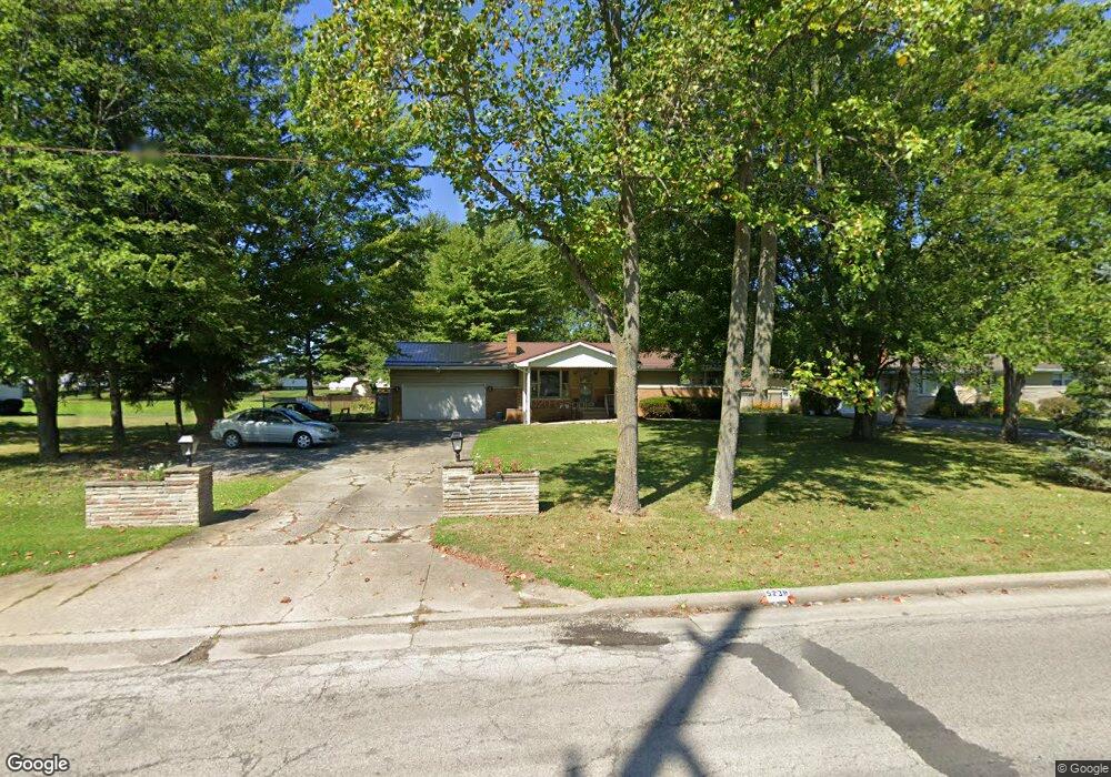
5238 Sheridan Rd Youngstown, OH 44514
Estimated Value: $172,000 - $186,000
3
Beds
2
Baths
1,671
Sq Ft
$107/Sq Ft
Est. Value
About This Home
This home is located at 5238 Sheridan Rd, Youngstown, OH 44514 and is currently estimated at $178,766, approximately $106 per square foot. 5238 Sheridan Rd is a home located in Mahoning County with nearby schools including Darwin L. Gilmore Elementary School, Paul C. Bunn Elementary School, and Bayside Intermediate School.
Ownership History
Date
Name
Owned For
Owner Type
Purchase Details
Closed on
Jul 13, 2000
Sold by
George James
Bought by
Harriger Jeffrey and Harriger Spring
Current Estimated Value
Purchase Details
Closed on
Jun 4, 1996
Sold by
George James
Bought by
Harringer Jeffrey L and Harringer Spring I
Home Financials for this Owner
Home Financials are based on the most recent Mortgage that was taken out on this home.
Original Mortgage
$67,320
Interest Rate
7.99%
Mortgage Type
VA
Purchase Details
Closed on
Apr 22, 1969
Bought by
George James
Create a Home Valuation Report for This Property
The Home Valuation Report is an in-depth analysis detailing your home's value as well as a comparison with similar homes in the area
Home Values in the Area
Average Home Value in this Area
Purchase History
| Date | Buyer | Sale Price | Title Company |
|---|---|---|---|
| Harriger Jeffrey | -- | -- | |
| Harringer Jeffrey L | $66,000 | -- | |
| George James | -- | -- |
Source: Public Records
Mortgage History
| Date | Status | Borrower | Loan Amount |
|---|---|---|---|
| Previous Owner | Harringer Jeffrey L | $67,320 |
Source: Public Records
Tax History Compared to Growth
Tax History
| Year | Tax Paid | Tax Assessment Tax Assessment Total Assessment is a certain percentage of the fair market value that is determined by local assessors to be the total taxable value of land and additions on the property. | Land | Improvement |
|---|---|---|---|---|
| 2024 | $2,591 | $45,910 | $7,920 | $37,990 |
| 2023 | $2,575 | $45,910 | $7,920 | $37,990 |
| 2022 | $2,134 | $28,650 | $7,200 | $21,450 |
| 2021 | $2,135 | $28,650 | $7,200 | $21,450 |
| 2020 | $2,145 | $28,650 | $7,200 | $21,450 |
| 2019 | $2,131 | $24,690 | $6,200 | $18,490 |
| 2018 | $1,982 | $24,690 | $6,200 | $18,490 |
| 2017 | $1,957 | $24,130 | $6,200 | $17,930 |
| 2016 | $2,300 | $30,190 | $7,580 | $22,610 |
| 2015 | $2,259 | $30,190 | $7,580 | $22,610 |
| 2014 | $2,245 | $30,190 | $7,580 | $22,610 |
| 2013 | $2,218 | $30,190 | $7,580 | $22,610 |
Source: Public Records
Map
Nearby Homes
- 1933 Brandon Ave
- 1828 Basil Ave
- 1830 Halbert Dr
- 1919 Wingate Rd
- 1841 Wingate Rd
- 0 Woodlawn Ave
- 0 Lemoyne Ave
- 1720 Sequoya Dr
- 0 Oles Ave
- 1913 Country Club Ave
- 1890 Mathews Rd
- 5710 Youngstown Poland Rd
- 576 W Harvey St
- 1645 Chattanooga Ave
- 1543 Lynn Ave
- 2089 Shetland Ln
- 1514 Thalia Ave
- 550 Brandon Ave
- 0 Mathews Rd Unit 5149232
- 0 Mathews Rd Unit 5143059
- 5234 Sheridan Rd
- 5306 Sheridan Rd
- 5230 Sheridan Rd
- 5317 Linger Place
- 5313 Linger Place
- 5312 Sheridan Rd
- 5321 Linger Place
- 5325 Linger Place
- 5222 Sheridan Rd
- 1876 Basil Ave
- 5329 Linger Place
- 5320 Sheridan Rd
- 5333 Linger Place
- 5235 Sheridan Rd
- 1803 Brandon Ave
- 1870 Basil Ave
- 5231 Sheridan Rd
- 1871 Basil Ave
- 5307 Sheridan Rd
- 1807 Brandon Ave