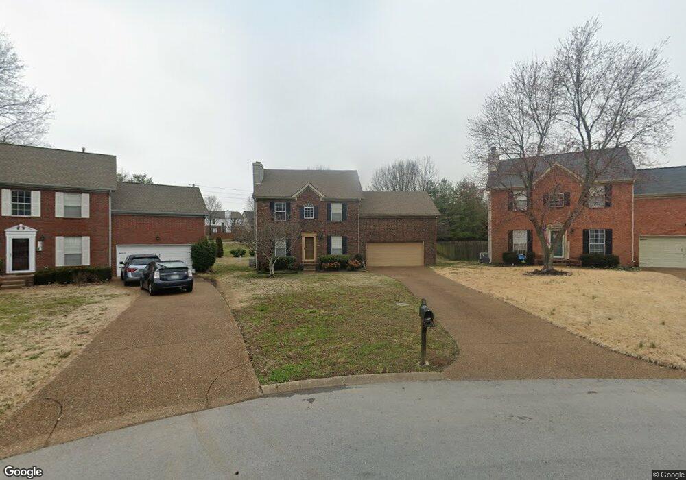
524 Dale Ct Franklin, TN 37067
McEwen NeighborhoodEstimated Value: $579,615 - $640,000
--
Bed
3
Baths
1,880
Sq Ft
$324/Sq Ft
Est. Value
About This Home
This home is located at 524 Dale Ct, Franklin, TN 37067 and is currently estimated at $608,404, approximately $323 per square foot. 524 Dale Ct is a home located in Williamson County with nearby schools including Liberty Elementary School, Freedom Intermediate School, and Freedom Middle School.
Ownership History
Date
Name
Owned For
Owner Type
Purchase Details
Closed on
Feb 23, 2009
Sold by
Cowans Tara Wynee
Bought by
Cowans Kenneth Eric
Current Estimated Value
Home Financials for this Owner
Home Financials are based on the most recent Mortgage that was taken out on this home.
Original Mortgage
$217,514
Outstanding Balance
$138,887
Interest Rate
5.29%
Mortgage Type
FHA
Estimated Equity
$469,517
Purchase Details
Closed on
Jul 13, 2005
Sold by
Mcdougal John Mark and Mcdougal Christina Z
Bought by
Cowans Kenneth E and Cowans Tara W
Home Financials for this Owner
Home Financials are based on the most recent Mortgage that was taken out on this home.
Original Mortgage
$217,779
Interest Rate
5.54%
Mortgage Type
FHA
Purchase Details
Closed on
Sep 20, 1996
Sold by
Uhtenwoldt Eric W
Bought by
Mark Mcdougal John
Create a Home Valuation Report for This Property
The Home Valuation Report is an in-depth analysis detailing your home's value as well as a comparison with similar homes in the area
Home Values in the Area
Average Home Value in this Area
Purchase History
| Date | Buyer | Sale Price | Title Company |
|---|---|---|---|
| Cowans Kenneth Eric | -- | Windmill Title Llc | |
| Cowans Kenneth E | $219,500 | -- | |
| Mark Mcdougal John | $151,900 | -- |
Source: Public Records
Mortgage History
| Date | Status | Borrower | Loan Amount |
|---|---|---|---|
| Open | Cowans Kenneth Eric | $217,514 | |
| Closed | Cowans Kenneth E | $217,779 |
Source: Public Records
Tax History Compared to Growth
Tax History
| Year | Tax Paid | Tax Assessment Tax Assessment Total Assessment is a certain percentage of the fair market value that is determined by local assessors to be the total taxable value of land and additions on the property. | Land | Improvement |
|---|---|---|---|---|
| 2025 | $2,776 | $136,925 | $55,000 | $81,925 |
| 2024 | $2,776 | $98,050 | $30,000 | $68,050 |
| 2023 | $2,668 | $98,050 | $30,000 | $68,050 |
| 2022 | $2,668 | $98,050 | $30,000 | $68,050 |
| 2021 | $2,668 | $98,050 | $30,000 | $68,050 |
| 2020 | $2,373 | $73,525 | $21,250 | $52,275 |
| 2019 | $2,373 | $73,525 | $21,250 | $52,275 |
| 2018 | $2,321 | $73,525 | $21,250 | $52,275 |
| 2017 | $2,285 | $73,525 | $21,250 | $52,275 |
| 2016 | $2,277 | $73,525 | $21,250 | $52,275 |
| 2015 | -- | $57,900 | $18,750 | $39,150 |
| 2014 | -- | $57,900 | $18,750 | $39,150 |
Source: Public Records
Map
Nearby Homes
- 253 Freedom Dr
- 701 Calloway Ct
- 304 Hay Market Ct
- 125 Stanwick Dr
- 224 Logans Cir
- 229 Cambridge Place
- 1311 Huffines Ridge Dr
- 909 Miranda Place
- 769 Glen Oaks Dr
- 831 Pintail Ct
- 633 Grant Park Ct
- 523 Grant Park Ct
- 0 Liberty Pike
- 125 Grant Park Dr
- 1011 Murfreesboro Rd Unit E3
- 1011 Murfreesboro Rd Unit B2
- 1183 Buckingham Cir
- 0 Murfreesboro Rd Unit RTC2654205
- 2433 Kennedy Ct Unit 2433
- 2801 Kennedy Ct Unit 2801
- 528 Dale Ct
- 520 Dale Ct
- 629 Independence Dr E
- 525 Dale Ct
- 516 Dale Ct
- 633 Independence Dr E
- 625 Independence Dr E
- 521 Dale Ct
- 512 Dale Ct
- 205 Toliver Ct
- 517 Dale Ct
- 636 Independence Dr E
- 509 Dale Ct
- 621 Independence Dr E
- 513 Dale Ct
- 207 Toliver Ct
- 508 Dale Ct
- 408 N Cardinal Ct
- 600 Huffine Manor Cir
- 634 Independence Dr E