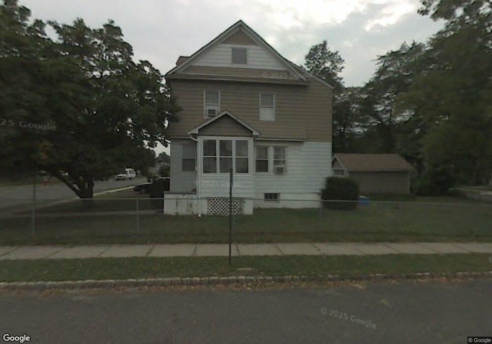
524 Pierson St Westfield, NJ 07090
Estimated Value: $614,000 - $785,000
--
Bed
--
Bath
1,540
Sq Ft
$461/Sq Ft
Est. Value
About This Home
This home is located at 524 Pierson St, Westfield, NJ 07090 and is currently estimated at $710,620, approximately $461 per square foot. 524 Pierson St is a home located in Union County with nearby schools including McKinley Elementary School, Westfield Senior High School, and Holy Trinity School.
Ownership History
Date
Name
Owned For
Owner Type
Purchase Details
Closed on
Jul 14, 2020
Sold by
Tadros John and Tadros Cady H
Bought by
Tadros John
Current Estimated Value
Purchase Details
Closed on
Jun 21, 2013
Sold by
Tadros John
Bought by
Tadros John and Tadros Cady H
Purchase Details
Closed on
Mar 19, 2004
Sold by
Pokora Maciej
Bought by
Tadros John
Home Financials for this Owner
Home Financials are based on the most recent Mortgage that was taken out on this home.
Original Mortgage
$373,500
Outstanding Balance
$173,211
Interest Rate
5.56%
Estimated Equity
$537,409
Purchase Details
Closed on
Aug 22, 2002
Sold by
Sisto James
Bought by
Pokora Maciej and Pokora Izabela
Home Financials for this Owner
Home Financials are based on the most recent Mortgage that was taken out on this home.
Original Mortgage
$272,800
Interest Rate
6.19%
Purchase Details
Closed on
Sep 25, 2001
Sold by
Mallory Cassandra and Brown Natalie
Bought by
Sisto James P and Sisto Kathleen L
Home Financials for this Owner
Home Financials are based on the most recent Mortgage that was taken out on this home.
Original Mortgage
$202,500
Interest Rate
6.48%
Mortgage Type
Purchase Money Mortgage
Create a Home Valuation Report for This Property
The Home Valuation Report is an in-depth analysis detailing your home's value as well as a comparison with similar homes in the area
Home Values in the Area
Average Home Value in this Area
Purchase History
| Date | Buyer | Sale Price | Title Company |
|---|---|---|---|
| Tadros John | -- | None Available | |
| Tadros John | -- | Gent For Stewart Title Gu | |
| Tadros John | $415,000 | -- | |
| Pokora Maciej | $341,000 | -- | |
| Sisto James P | $225,000 | Lawyers Title Insurance Corp |
Source: Public Records
Mortgage History
| Date | Status | Borrower | Loan Amount |
|---|---|---|---|
| Open | Tadros John | $373,500 | |
| Previous Owner | Pokora Maciej | $272,800 | |
| Previous Owner | Sisto James P | $202,500 |
Source: Public Records
Tax History Compared to Growth
Tax History
| Year | Tax Paid | Tax Assessment Tax Assessment Total Assessment is a certain percentage of the fair market value that is determined by local assessors to be the total taxable value of land and additions on the property. | Land | Improvement |
|---|---|---|---|---|
| 2025 | $8,801 | $390,800 | $239,600 | $151,200 |
| 2024 | $8,621 | $390,800 | $239,600 | $151,200 |
| 2023 | $8,621 | $390,800 | $239,600 | $151,200 |
| 2022 | $8,441 | $390,800 | $239,600 | $151,200 |
| 2021 | $8,453 | $390,800 | $239,600 | $151,200 |
| 2020 | $8,433 | $390,800 | $239,600 | $151,200 |
| 2019 | $8,402 | $390,800 | $239,600 | $151,200 |
| 2018 | $9,771 | $105,100 | $33,300 | $71,800 |
| 2017 | $9,718 | $105,100 | $33,300 | $71,800 |
| 2016 | $9,489 | $105,100 | $33,300 | $71,800 |
| 2015 | $9,300 | $105,100 | $33,300 | $71,800 |
| 2014 | $8,993 | $105,100 | $33,300 | $71,800 |
Source: Public Records
Map
Nearby Homes
- 524 Edgar Rd
- 525 Edgar Rd
- 724 South Ave W Unit 724A
- 554 Hort St
- 614 Dorian Rd
- 538 Westfield Ave
- 350 W Dudley Ave
- 119 Lamberts Mill Rd
- 522 Boulevard
- 303 Prospect St
- 260 Prospect St Unit C15
- 2154 W Broad St
- 517 Clark St
- 215 Ross Place Unit J
- 1466 Lamberts Mill Rd
- 203 Ross Place
- 603 Carleton Rd
- 2314 Longfellow Ave
- 143 Stanmore Place
- 304 E Dudley Ave
- 524 Pierson St Unit 2
- 528 Pierson St
- 528 Pierson St Unit 1
- 528 Pierson St Unit 2
- 532 Pierson St
- 536 Pierson St
- 531 Pierson St
- 518 W Broad St
- 522 W Broad St
- 516 W Broad St
- 524 W Broad St
- 510 W Broad St
- 540 Pierson St
- 526 W Broad St
- 508 W Broad St
- 528 W Broad St
- 506 W Broad St
- 537 Pierson St
- 530 W Broad St
- 504 W Broad St