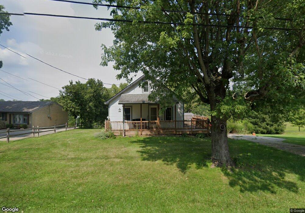
5240 Day Rd Cincinnati, OH 45252
Estimated Value: $197,612 - $233,000
1
Bed
1
Bath
1,044
Sq Ft
$207/Sq Ft
Est. Value
About This Home
This home is located at 5240 Day Rd, Cincinnati, OH 45252 and is currently estimated at $216,403, approximately $207 per square foot. 5240 Day Rd is a home located in Hamilton County with nearby schools including Colerain Elementary School, Colerain Middle School, and Colerain High School.
Ownership History
Date
Name
Owned For
Owner Type
Purchase Details
Closed on
Jan 2, 2026
Sold by
Ostendorf Enterprises Llc
Bought by
Lakehouse Holdings Llc
Current Estimated Value
Home Financials for this Owner
Home Financials are based on the most recent Mortgage that was taken out on this home.
Original Mortgage
$187,800
Outstanding Balance
$187,622
Interest Rate
6.26%
Mortgage Type
Credit Line Revolving
Estimated Equity
$28,781
Purchase Details
Closed on
Dec 3, 2025
Sold by
Lang David W
Bought by
Ostendorf Enterprises Llc
Home Financials for this Owner
Home Financials are based on the most recent Mortgage that was taken out on this home.
Original Mortgage
$187,800
Outstanding Balance
$187,622
Interest Rate
6.26%
Mortgage Type
Credit Line Revolving
Estimated Equity
$28,781
Purchase Details
Closed on
Jul 25, 2022
Sold by
Atwood Cheri A
Bought by
Lang David W
Purchase Details
Closed on
Mar 2, 1992
Sold by
Meckstroth John R Jr Tr
Bought by
Lang David W
Create a Home Valuation Report for This Property
The Home Valuation Report is an in-depth analysis detailing your home's value as well as a comparison with similar homes in the area
Home Values in the Area
Average Home Value in this Area
Purchase History
| Date | Buyer | Sale Price | Title Company |
|---|---|---|---|
| Lakehouse Holdings Llc | $130,000 | None Listed On Document | |
| Ostendorf Enterprises Llc | $50,000 | None Listed On Document | |
| Lang David W | -- | -- | |
| Lang David W | $70,900 | -- |
Source: Public Records
Mortgage History
| Date | Status | Borrower | Loan Amount |
|---|---|---|---|
| Open | Lakehouse Holdings Llc | $187,800 |
Source: Public Records
Tax History
| Year | Tax Paid | Tax Assessment Tax Assessment Total Assessment is a certain percentage of the fair market value that is determined by local assessors to be the total taxable value of land and additions on the property. | Land | Improvement |
|---|---|---|---|---|
| 2025 | $2,766 | $47,765 | $19,058 | $28,707 |
| 2023 | $2,583 | $47,765 | $19,058 | $28,707 |
| 2022 | $2,465 | $37,191 | $19,236 | $17,955 |
| 2021 | $2,446 | $37,191 | $19,236 | $17,955 |
| 2020 | $2,467 | $37,191 | $19,236 | $17,955 |
| 2019 | $2,494 | $35,088 | $18,148 | $16,940 |
| 2018 | $2,238 | $35,088 | $18,148 | $16,940 |
| 2017 | $2,123 | $35,088 | $18,148 | $16,940 |
| 2016 | $1,884 | $30,801 | $17,784 | $13,017 |
| 2015 | $1,902 | $30,801 | $17,784 | $13,017 |
| 2014 | $1,905 | $30,801 | $17,784 | $13,017 |
| 2013 | $1,851 | $31,431 | $18,148 | $13,283 |
Source: Public Records
Map
Nearby Homes
- 10263 Colerain Ave
- 9981 Skyridge Dr
- 9873 Kittywood Dr
- 4198 Intrepid Dr
- 4002 Resolute Cir
- 9940 Regatta Dr
- 4086 Resolute Cir Unit 481
- 3916 Enterprise Cir
- 3918 Enterprise Cir Unit 532
- 3834 Enterprise Cir
- 9805 Regatta Dr
- 4230 Endeavor Dr Unit 101
- 4210 Endeavor Dr
- 9800 Regatta Dr
- 3776 Sagebrush Ln
- 3724 Yellowstone Dr
- 9970 Hollis Dr
- 3785 Susanna Dr
- 3484 Redskin Dr
- Pearson Plan at Villas at Taylor Glen
Your Personal Tour Guide
Ask me questions while you tour the home.