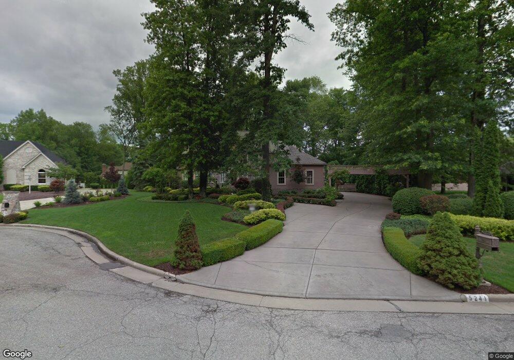
5241 Oyster Bay Dr Youngstown, OH 44512
Estimated Value: $602,068 - $625,000
4
Beds
4
Baths
4,471
Sq Ft
$137/Sq Ft
Est. Value
About This Home
This home is located at 5241 Oyster Bay Dr, Youngstown, OH 44512 and is currently estimated at $613,023, approximately $137 per square foot. 5241 Oyster Bay Dr is a home located in Mahoning County with nearby schools including West Boulevard Elementary School, Boardman Center Middle School, and Boardman High School.
Ownership History
Date
Name
Owned For
Owner Type
Purchase Details
Closed on
Nov 15, 1999
Sold by
Brown Samuel R and Brown Margaret A
Bought by
Demidovich James C and Demidovich Maureen R
Current Estimated Value
Purchase Details
Closed on
Jan 13, 1997
Sold by
Struharik Robert P
Bought by
Brown Samuel R and Brown Margaret A
Home Financials for this Owner
Home Financials are based on the most recent Mortgage that was taken out on this home.
Original Mortgage
$255,000
Interest Rate
6.88%
Mortgage Type
New Conventional
Purchase Details
Closed on
Feb 26, 1991
Bought by
Struharik Robert P
Create a Home Valuation Report for This Property
The Home Valuation Report is an in-depth analysis detailing your home's value as well as a comparison with similar homes in the area
Home Values in the Area
Average Home Value in this Area
Purchase History
| Date | Buyer | Sale Price | Title Company |
|---|---|---|---|
| Demidovich James C | $500,000 | -- | |
| Brown Samuel R | $455,000 | -- | |
| Struharik Robert P | $40,000 | -- |
Source: Public Records
Mortgage History
| Date | Status | Borrower | Loan Amount |
|---|---|---|---|
| Previous Owner | Brown Samuel R | $255,000 | |
| Closed | Demidovich James C | $0 |
Source: Public Records
Tax History Compared to Growth
Tax History
| Year | Tax Paid | Tax Assessment Tax Assessment Total Assessment is a certain percentage of the fair market value that is determined by local assessors to be the total taxable value of land and additions on the property. | Land | Improvement |
|---|---|---|---|---|
| 2024 | $9,676 | $190,710 | $17,700 | $173,010 |
| 2023 | $9,546 | $190,710 | $17,700 | $173,010 |
| 2022 | $10,048 | $153,760 | $17,500 | $136,260 |
| 2021 | $10,055 | $153,760 | $17,500 | $136,260 |
| 2020 | $10,107 | $153,760 | $17,500 | $136,260 |
| 2019 | $10,012 | $136,070 | $15,490 | $120,580 |
| 2018 | $8,738 | $136,070 | $15,490 | $120,580 |
| 2017 | $8,668 | $136,070 | $15,490 | $120,580 |
| 2016 | $8,665 | $134,650 | $15,490 | $119,160 |
| 2015 | $8,493 | $134,650 | $15,490 | $119,160 |
| 2014 | $8,517 | $134,650 | $15,490 | $119,160 |
| 2013 | $8,409 | $134,650 | $15,490 | $119,160 |
Source: Public Records
Map
Nearby Homes
- 990 Westport Dr
- 21.19 acres Truesdale and Lockwood Rd
- 29 Gillian Ln
- 537 W Glen Dr
- 5200 West Blvd Unit 505
- 768 Crestview Dr
- 715 Crestview Dr
- 5670 Tracy Dr
- 772 Ewing Rd
- 272 Shields Rd
- 5020 Friendship Ave
- 813 Brookfield Ave
- 4003 Shelby Rd
- 1342 Shields Rd
- 138 Robinhood Way
- 3927 Hopkins Rd
- 5097 Tippwood Ct
- 6632 Harrington Ave
- 4042 Baymar Dr
- 396 Brookfield Ave
- 5231 Oyster Bay Dr
- 808 Park Harbour Dr
- 806 Park Harbour Dr
- 5220 Royal Palm Dr
- 800 800 Park Harbour Dr
- 5210 Royal Palm Dr
- 810 Park Harbour Dr
- 5201 Oyster Bay Dr
- 5211 Oyster Bay Dr
- 812 Park Harbour Dr
- 807 Park Harbour Dr
- 805 Park Harbour Dr
- 803 Park Harbour Dr
- 5221 Royal Palm Dr
- 809 Park Harbour Dr
- 801 Park Harbour Dr
- 5231 Royal Palm Dr
- 842 Shields Rd
- 5211 Royal Palm Dr
- 854 Shields Rd