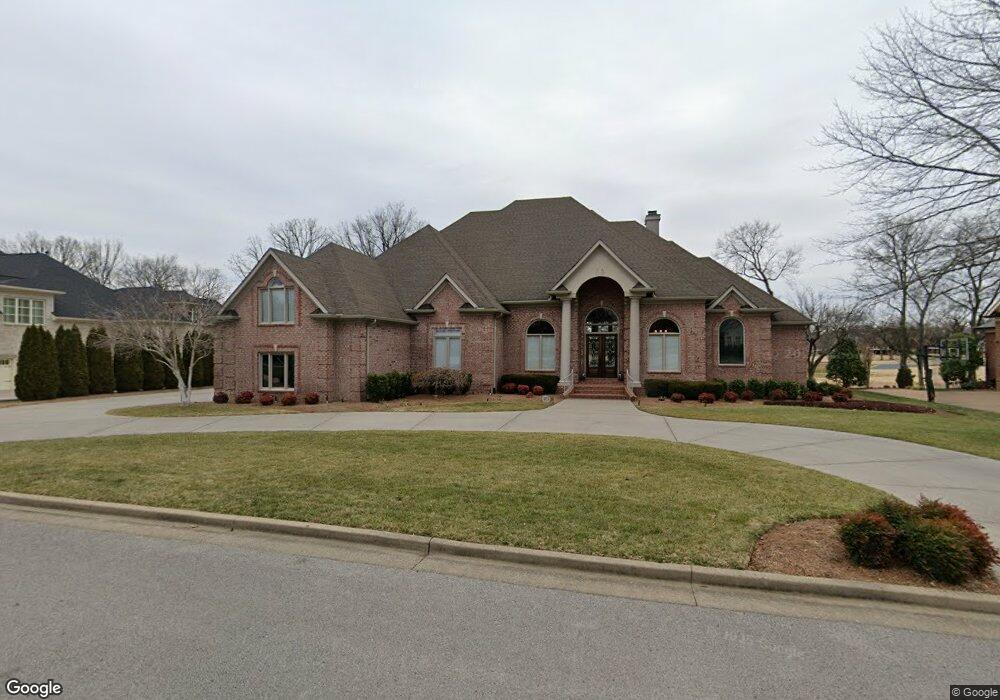
5244 Lysander Ln Brentwood, TN 37027
Estimated Value: $2,284,027 - $2,861,000
--
Bed
7
Baths
4,943
Sq Ft
$542/Sq Ft
Est. Value
About This Home
This home is located at 5244 Lysander Ln, Brentwood, TN 37027 and is currently estimated at $2,676,757, approximately $541 per square foot. 5244 Lysander Ln is a home located in Williamson County with nearby schools including Scales Elementary School, Brentwood Middle School, and Brentwood High School.
Ownership History
Date
Name
Owned For
Owner Type
Purchase Details
Closed on
May 19, 2022
Sold by
Stanley Nancy R
Bought by
Stanley Family Revocable Living Trust
Current Estimated Value
Purchase Details
Closed on
May 20, 2020
Sold by
Stanley Bobby J and Stanley Nancy R
Bought by
Stanley Bobby J and Stanley Nancy R
Home Financials for this Owner
Home Financials are based on the most recent Mortgage that was taken out on this home.
Original Mortgage
$374,000
Interest Rate
3.3%
Mortgage Type
New Conventional
Purchase Details
Closed on
Mar 13, 2018
Sold by
Stanley Bobby J and Stanley Nancy R
Bought by
Stanley Bobby J and Stanley Nancy R
Purchase Details
Closed on
May 11, 2007
Sold by
Stanley Bobby J and Stanley Nancy R
Bought by
Stanley Bobby J
Purchase Details
Closed on
Dec 10, 2004
Sold by
Bobby Stanley General Contractor Inc
Bought by
Stanley Bobby J and Stanley Nancy R
Create a Home Valuation Report for This Property
The Home Valuation Report is an in-depth analysis detailing your home's value as well as a comparison with similar homes in the area
Home Values in the Area
Average Home Value in this Area
Purchase History
| Date | Buyer | Sale Price | Title Company |
|---|---|---|---|
| Stanley Family Revocable Living Trust | -- | Cook Tillman Law Group | |
| Stanley Bobby J | -- | None Available | |
| Stanley Bobby J | -- | None Available | |
| Stanley Bobby J | -- | Riney Title | |
| Stanley Bobby J | -- | Watauga Title Company |
Source: Public Records
Mortgage History
| Date | Status | Borrower | Loan Amount |
|---|---|---|---|
| Previous Owner | Stanley Bobby J | $374,000 |
Source: Public Records
Tax History Compared to Growth
Tax History
| Year | Tax Paid | Tax Assessment Tax Assessment Total Assessment is a certain percentage of the fair market value that is determined by local assessors to be the total taxable value of land and additions on the property. | Land | Improvement |
|---|---|---|---|---|
| 2025 | $517 | $596,825 | $168,150 | $428,675 |
| 2024 | $517 | $366,800 | $71,250 | $295,550 |
| 2023 | $517 | $366,800 | $71,250 | $295,550 |
| 2022 | $7,960 | $366,800 | $71,250 | $295,550 |
| 2021 | $7,960 | $366,800 | $71,250 | $295,550 |
| 2020 | $7,833 | $303,625 | $63,750 | $239,875 |
| 2019 | $7,833 | $303,625 | $63,750 | $239,875 |
| 2018 | $7,621 | $303,625 | $63,750 | $239,875 |
| 2017 | $7,560 | $303,625 | $63,750 | $239,875 |
| 2016 | $7,469 | $303,625 | $63,750 | $239,875 |
| 2015 | -- | $254,675 | $62,500 | $192,175 |
| 2014 | $1,121 | $254,675 | $62,500 | $192,175 |
Source: Public Records
Map
Nearby Homes
- 5238 Lysander Ln
- 653 Chiswell Ct
- 5230 Lysander Ln
- 5154 Hereford Ct
- 566 Midway Cir
- 5102 Pickney Dr
- 5217 Apple Mill Ct
- 761 Sinclair Cir
- 700 Princeton Hills Dr
- 704 Princeton Hills Dr
- 553 Midway Cir
- 5172 Remington Dr
- 721 Princeton Hills Dr
- 531 Midway Cir
- 5013 Woodland Hills Dr
- 404 Cornwall Dr
- 521 Mansion Dr
- 7100 Anna James Ct
- 520 Mansion Dr
- 850 Anna James Ct
- 5246 Lysander Ln
- 5242 Lysander Ln
- 5243 Lysander Ln
- 5245 Lysander Ln
- 5248 Lysander Ln
- 5240 Lysander Ln
- 5241 Lysander Ln
- 5251 Lysander Ln
- 5250 Hayes Place
- 5254 McGavock Rd
- 5256 McGavock Rd
- 5239 Lysander Ln
- 5252 McGavock Rd
- 5252 Hayes Place
- 5258 McGavock Rd
- 5254 Lysander Ln
- 5250 McGavock Rd
- 5237 Lysander Ln
- 5256 Lysander Ln
- 5236 Lysander Ln