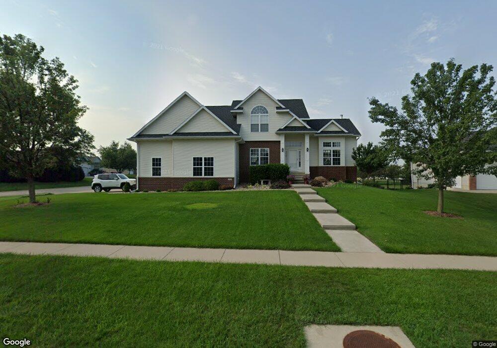
525 Brougham Rd Robins, IA 52328
Estimated Value: $420,847 - $472,000
4
Beds
6
Baths
1,950
Sq Ft
$224/Sq Ft
Est. Value
About This Home
This home is located at 525 Brougham Rd, Robins, IA 52328 and is currently estimated at $436,462, approximately $223 per square foot. 525 Brougham Rd is a home located in Linn County with nearby schools including Echo Hill Elementary School, Oak Ridge School, and Linn-Mar High School.
Ownership History
Date
Name
Owned For
Owner Type
Purchase Details
Closed on
May 22, 2019
Sold by
Ask Inc
Bought by
Lkj Enterprises Llc
Current Estimated Value
Purchase Details
Closed on
Aug 28, 2002
Sold by
Koski Melvin J and Koski Judith A
Bought by
Oshea Robert J and Oshea Kristi J
Home Financials for this Owner
Home Financials are based on the most recent Mortgage that was taken out on this home.
Original Mortgage
$305,000
Interest Rate
6.41%
Purchase Details
Closed on
Apr 20, 2002
Sold by
Zeran Roger W
Bought by
Koski Melvin J and Koski Judith A
Purchase Details
Closed on
Mar 30, 1999
Sold by
Zingula R Curtis and Zingula Gayle
Bought by
Zingula R Curtis and Zingula Gayle
Create a Home Valuation Report for This Property
The Home Valuation Report is an in-depth analysis detailing your home's value as well as a comparison with similar homes in the area
Home Values in the Area
Average Home Value in this Area
Purchase History
| Date | Buyer | Sale Price | Title Company |
|---|---|---|---|
| Lkj Enterprises Llc | $300,000 | None Available | |
| Oshea Robert J | $33,500 | -- | |
| Koski Melvin J | -- | -- | |
| Zingula R Curtis | -- | -- |
Source: Public Records
Mortgage History
| Date | Status | Borrower | Loan Amount |
|---|---|---|---|
| Previous Owner | Oshea Robert J | $305,000 |
Source: Public Records
Tax History Compared to Growth
Tax History
| Year | Tax Paid | Tax Assessment Tax Assessment Total Assessment is a certain percentage of the fair market value that is determined by local assessors to be the total taxable value of land and additions on the property. | Land | Improvement |
|---|---|---|---|---|
| 2025 | $6,382 | $426,100 | $51,200 | $374,900 |
| 2024 | $5,852 | $425,100 | $51,200 | $373,900 |
| 2023 | $5,852 | $425,100 | $51,200 | $373,900 |
| 2022 | $6,072 | $353,000 | $51,200 | $301,800 |
| 2021 | $6,044 | $353,000 | $51,200 | $301,800 |
| 2020 | $6,044 | $328,300 | $51,200 | $277,100 |
| 2019 | $5,584 | $304,700 | $51,200 | $253,500 |
| 2018 | $5,382 | $304,700 | $51,200 | $253,500 |
| 2017 | $5,454 | $297,700 | $51,200 | $246,500 |
| 2016 | $5,454 | $297,700 | $51,200 | $246,500 |
| 2015 | $5,470 | $297,700 | $51,200 | $246,500 |
| 2014 | $5,310 | $297,700 | $51,200 | $246,500 |
| 2013 | $5,114 | $297,700 | $51,200 | $246,500 |
Source: Public Records
Map
Nearby Homes
- 0 Maple St
- 545 Evergreen Ln
- 9014 Grand Oaks Dr NE
- 9124 Grand Oaks Dr NE
- 8926 Norway Dr NE
- 165 Timber Ln
- 8908 Norway Dr NE
- 8809 Middlebury Ct NE
- 1332 Stratton Dr NE
- 70.78 Acres M L Quass Rd
- Lot 9 Kervin Ct
- Lot 10 Kervin Ct
- 3230 N Center Point Rd Unit Lot 3
- 8201 Council St NE
- 923 Messina Dr NE
- 929 Messina Dr NE
- 8139 Turtlerun Dr NE
- 207 Meadows Field Dr NE
- 219 Meadows Field Dr NE
- 1127 Tiara Dr NE
- 545 Brougham Rd
- 435 Phaeton Dr
- 505 Brougham Rd
- 565 Brougham Rd
- 520 Brougham Rd
- 425 Phaeton Dr
- 440 Phaeton Dr
- 540 Brougham Rd
- 510 Brougham Rd
- 495 Brougham Rd
- 480 Landau St
- 560 Brougham Rd
- 430 Phaeton Dr
- 585 Brougham Rd
- 500 Brougham Rd
- 415 Phaeton Dr
- 460 Landau St
- 420 Phaeton Dr
- 580 Brougham Rd
- 490 Brougham Rd