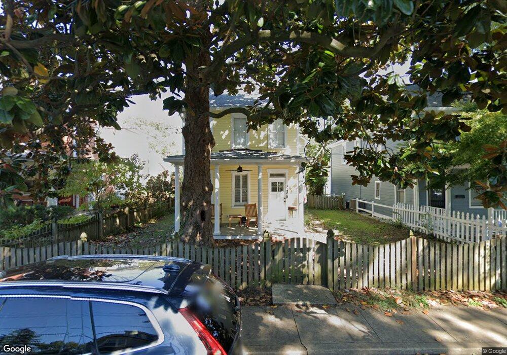
525 Burnside St Annapolis, MD 21403
Eastport NeighborhoodEstimated Value: $901,000 - $1,475,000
3
Beds
1
Bath
2,910
Sq Ft
$411/Sq Ft
Est. Value
About This Home
This home is located at 525 Burnside St, Annapolis, MD 21403 and is currently estimated at $1,196,226, approximately $411 per square foot. 525 Burnside St is a home located in Anne Arundel County with nearby schools including Eastport Elementary School, Annapolis Middle School, and Annapolis High School.
Ownership History
Date
Name
Owned For
Owner Type
Purchase Details
Closed on
Dec 14, 2006
Sold by
Velenovsky Marie J
Bought by
Ahern Denis A and Ahern Claire A
Current Estimated Value
Home Financials for this Owner
Home Financials are based on the most recent Mortgage that was taken out on this home.
Original Mortgage
$415,000
Outstanding Balance
$248,669
Interest Rate
6.35%
Mortgage Type
Purchase Money Mortgage
Estimated Equity
$947,557
Purchase Details
Closed on
Dec 8, 2006
Sold by
Velenovsky Marie J
Bought by
Ahern Denis A and Ahern Claire A
Home Financials for this Owner
Home Financials are based on the most recent Mortgage that was taken out on this home.
Original Mortgage
$415,000
Outstanding Balance
$248,669
Interest Rate
6.35%
Mortgage Type
Purchase Money Mortgage
Estimated Equity
$947,557
Purchase Details
Closed on
Nov 19, 1997
Sold by
Velenovsky Josephine C
Bought by
Velenovsky Marie J
Create a Home Valuation Report for This Property
The Home Valuation Report is an in-depth analysis detailing your home's value as well as a comparison with similar homes in the area
Home Values in the Area
Average Home Value in this Area
Purchase History
| Date | Buyer | Sale Price | Title Company |
|---|---|---|---|
| Ahern Denis A | $525,000 | -- | |
| Ahern Denis A | $525,000 | -- | |
| Velenovsky Marie J | -- | -- |
Source: Public Records
Mortgage History
| Date | Status | Borrower | Loan Amount |
|---|---|---|---|
| Open | Ahern Denis A | $415,000 | |
| Closed | Ahern Denis A | $415,000 |
Source: Public Records
Tax History Compared to Growth
Tax History
| Year | Tax Paid | Tax Assessment Tax Assessment Total Assessment is a certain percentage of the fair market value that is determined by local assessors to be the total taxable value of land and additions on the property. | Land | Improvement |
|---|---|---|---|---|
| 2025 | $9,972 | $812,933 | -- | -- |
| 2024 | $9,972 | $758,567 | $0 | $0 |
| 2023 | $9,435 | $704,200 | $515,700 | $188,500 |
| 2022 | $8,842 | $660,800 | $0 | $0 |
| 2021 | $7,985 | $617,400 | $0 | $0 |
| 2020 | $7,985 | $574,000 | $488,900 | $85,100 |
| 2019 | $7,929 | $574,000 | $488,900 | $85,100 |
| 2018 | $7,763 | $574,000 | $488,900 | $85,100 |
| 2017 | $7,605 | $625,700 | $0 | $0 |
| 2016 | -- | $581,300 | $0 | $0 |
| 2015 | -- | $536,900 | $0 | $0 |
| 2014 | -- | $492,500 | $0 | $0 |
Source: Public Records
Map
Nearby Homes
- 600 Sixth St
- 4 Little Harbor Way
- 320 Chester Ave
- 10 Sailors Way
- 319 6th St Unit SLIP 39
- 796 Fairview Ave Unit 796 E
- 520 Second St
- 934 Bay Ridge Ave Unit 308
- 316 Burnside St Unit 101
- 316 Burnside St Unit 304
- 541 Second St
- 794 Fairview Ave Unit 794 C
- 759 Fairview Ave Unit 759 F
- 312 Severn Ave Unit W-401
- 301 Burnside St Unit C 202
- 310 Adams St
- 287 State St Unit 3
- 287 State St Unit 2
- 417 Second St
- 412 Jefferson St
- 527 Burnside St
- 527 Burnside St Unit & 617 CHESTER AVE.
- 523 Burnside St
- 521 Burnside St
- 532 Burnside St
- 534 Burnside St
- 612 Chester Ave
- 601 Burnside St
- 519 Burnside St
- 524 Burnside St
- 600 Burnside St
- 613 Chester Ave
- 605 Burnside St
- 517 Burnside St
- 611 Chester Ave
- 518 Burnside St
- 607 Burnside St
- 602 Burnside St
- 514 Burnside St
- 609 Burnside St