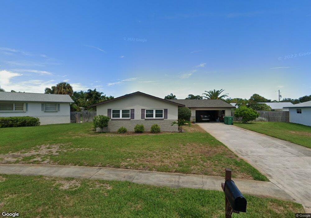
525 Caribbean Dr Satellite Beach, FL 32937
Estimated Value: $589,000 - $618,000
3
Beds
2
Baths
1,742
Sq Ft
$343/Sq Ft
Est. Value
About This Home
This home is located at 525 Caribbean Dr, Satellite Beach, FL 32937 and is currently estimated at $597,936, approximately $343 per square foot. 525 Caribbean Dr is a home located in Brevard County with nearby schools including Satellite Senior High School, Ocean Breeze Elementary School, and DeLaura Middle School.
Ownership History
Date
Name
Owned For
Owner Type
Purchase Details
Closed on
Dec 9, 2024
Sold by
Kaminski Mary C and Culberston William J
Bought by
Mary Culbertson Kaminski Revocable Living Tru and Kaminski
Current Estimated Value
Purchase Details
Closed on
Dec 19, 2019
Sold by
Reynolds Susan G and Kaminski Mary C
Bought by
Kaminski Marc C and Culbertson Williams J
Purchase Details
Closed on
Oct 9, 2007
Sold by
Culbertson Dorothy
Bought by
Reynolds Susan G and Kaminski Mary C
Create a Home Valuation Report for This Property
The Home Valuation Report is an in-depth analysis detailing your home's value as well as a comparison with similar homes in the area
Home Values in the Area
Average Home Value in this Area
Purchase History
| Date | Buyer | Sale Price | Title Company |
|---|---|---|---|
| Mary Culbertson Kaminski Revocable Living Tru | $100 | None Listed On Document | |
| Mary Culbertson Kaminski Revocable Living Tru | $100 | None Listed On Document | |
| Kaminski Marc C | -- | None Available | |
| Reynolds Susan G | -- | Attorney |
Source: Public Records
Tax History Compared to Growth
Tax History
| Year | Tax Paid | Tax Assessment Tax Assessment Total Assessment is a certain percentage of the fair market value that is determined by local assessors to be the total taxable value of land and additions on the property. | Land | Improvement |
|---|---|---|---|---|
| 2025 | $8,285 | $470,690 | -- | -- |
| 2024 | $7,901 | $483,840 | -- | -- |
| 2023 | $7,901 | $470,150 | $0 | $0 |
| 2022 | $7,070 | $445,620 | $0 | $0 |
| 2021 | $6,381 | $313,730 | $138,000 | $175,730 |
| 2020 | $6,092 | $294,680 | $125,000 | $169,680 |
| 2019 | $2,332 | $145,440 | $0 | $0 |
| 2018 | $2,329 | $142,730 | $0 | $0 |
| 2017 | $2,167 | $139,800 | $0 | $0 |
| 2016 | $2,170 | $136,930 | $85,000 | $51,930 |
| 2015 | $2,221 | $135,980 | $75,000 | $60,980 |
| 2014 | $2,222 | $134,910 | $70,000 | $64,910 |
Source: Public Records
Map
Nearby Homes
- 620 Jamaica Blvd
- 435 Desoto Pkwy
- 431 E Amherst Cir
- 690 Trinidad Ct
- 235 S Marco Way
- 550 Temple St
- 215 S Robert Way
- 43 Anchor Dr
- 105 Anchor Dr
- 527 Summerset Ct
- 302 Markley Ct
- 426 Hawthorne Ct Unit G2
- 105 Carissa Dr
- 445 Saint Johns Dr
- 443 Hawthorne Ct
- 502 Bay Cir
- 212 Bella Coola Dr
- 106 Tradewinds Dr Unit 106
- 305 Wimico Dr
- 484 Greenway Ave
- 505 Caribbean Dr
- 585 Caribbean Dr
- 610 Jamaica Blvd
- 405 Kingston Rd
- 495 Caribbean Dr
- 600 Jamaica Blvd
- 623 Caribbean Dr
- 630 Jamaica Blvd
- 510 Caribbean Dr
- 415 Kingston Rd
- 590 Caribbean Dr
- 485 Caribbean Dr
- 400 Maria Dr
- 637 Caribbean Dr
- 628 Caribbean Dr
- 425 Kingston Rd
- 490 Caribbean Dr
- 615 Jamaica Blvd
- 625 Jamaica Blvd
- 594 Jamaica Blvd