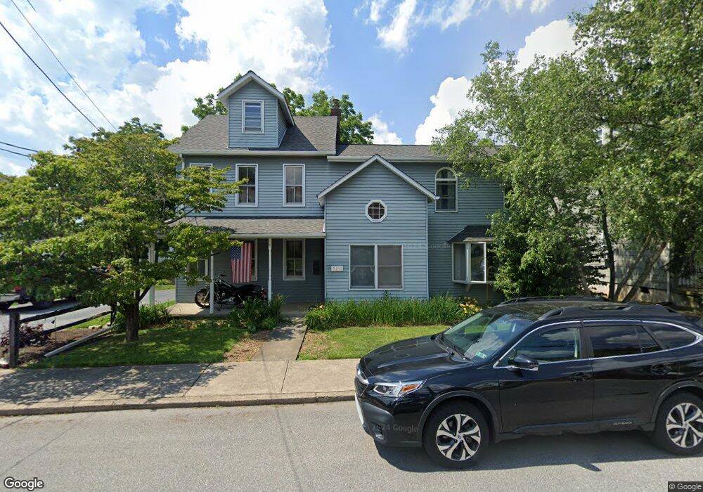
525 Euclid St Unit 529 Allentown, PA 18103
Southside NeighborhoodEstimated Value: $331,000 - $403,000
4
Beds
2
Baths
2,284
Sq Ft
$160/Sq Ft
Est. Value
About This Home
This home is located at 525 Euclid St Unit 529, Allentown, PA 18103 and is currently estimated at $364,901, approximately $159 per square foot. 525 Euclid St Unit 529 is a home located in Lehigh County with nearby schools including Hiram W Dodd Elementary School, South Mountain Middle School, and Louis E. Dieruff High School.
Ownership History
Date
Name
Owned For
Owner Type
Purchase Details
Closed on
Feb 24, 1996
Sold by
Jacobs Iii Carl R and Jacobs Penny L
Bought by
Levan Keith W
Current Estimated Value
Purchase Details
Closed on
Nov 30, 1989
Sold by
Jacobs Iii Carl R
Bought by
Jacobs Carl R and Jacobs Penny L
Purchase Details
Closed on
Apr 23, 1981
Bought by
Jacobs Carl R
Create a Home Valuation Report for This Property
The Home Valuation Report is an in-depth analysis detailing your home's value as well as a comparison with similar homes in the area
Home Values in the Area
Average Home Value in this Area
Purchase History
| Date | Buyer | Sale Price | Title Company |
|---|---|---|---|
| Levan Keith W | $90,000 | -- | |
| Jacobs Carl R | -- | -- | |
| Jacobs Carl R | $33,100 | -- |
Source: Public Records
Tax History Compared to Growth
Tax History
| Year | Tax Paid | Tax Assessment Tax Assessment Total Assessment is a certain percentage of the fair market value that is determined by local assessors to be the total taxable value of land and additions on the property. | Land | Improvement |
|---|---|---|---|---|
| 2025 | $5,846 | $170,300 | $30,800 | $139,500 |
| 2024 | $5,846 | $170,300 | $30,800 | $139,500 |
| 2023 | $5,846 | $170,300 | $30,800 | $139,500 |
| 2022 | $5,652 | $170,300 | $139,500 | $30,800 |
| 2021 | $5,545 | $170,300 | $30,800 | $139,500 |
| 2020 | $5,409 | $170,300 | $30,800 | $139,500 |
| 2019 | $5,326 | $170,300 | $30,800 | $139,500 |
| 2018 | $4,927 | $170,300 | $30,800 | $139,500 |
| 2017 | $4,808 | $170,300 | $30,800 | $139,500 |
| 2016 | -- | $170,300 | $30,800 | $139,500 |
| 2015 | -- | $170,300 | $30,800 | $139,500 |
| 2014 | -- | $170,300 | $30,800 | $139,500 |
Source: Public Records
Map
Nearby Homes
- 2347 S Law St Unit 2349
- 2416 S Alice St Unit 2418
- 566 W Emaus Ave
- 566 588 W Emaus Ave
- 2401 S Church St
- 2413 S Church St
- 2441 S 4th St
- 642 W Emaus Ave
- 206 208 W Emaus Ave
- 316 W Mountain Rd
- 618 Clifford St
- 2429 S Front St
- 2421 S Wood St
- 1852 S 2nd St
- 121 Woodcrest Cir
- 148 W Brookdale St
- 203 W Brookdale St
- 2531 S Carbon St
- 1831 S Church St
- 102 W Brookdale St
- 517 Euclid St Unit 523
- 531 Euclid St Unit 535
- 2320 S East St
- 526 Euclid St Unit 530
- 520 Euclid St Unit 524
- 2342 S Alice St
- 2344 S Alice St
- 532 Euclid St Unit 534
- 522 Euclid St
- 2338 S Alice St Unit 2340
- 2330 S Alice St Unit 2332
- 2324 S Alice St Unit 2328
- 2354 S Alice St
- 2322 S 5th St
- 2326 S 5th St
- 2324 S 5th St
- 2352 S Alice St Unit 2356
- 2320 S 5th St
- 2328 S 5th St
- 2330 S 5th St