Estimated Value: $307,000 - $385,000
4
Beds
3
Baths
2,700
Sq Ft
$126/Sq Ft
Est. Value
About This Home
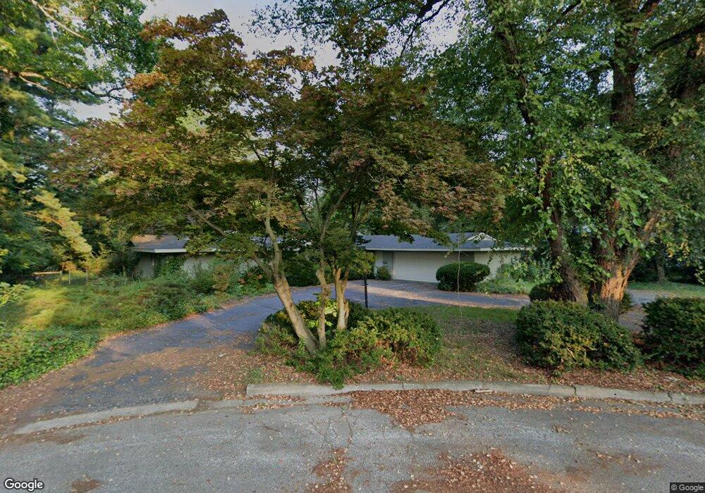
This home is located at 525 Laurel Dr, Niles, MI 49120 and is currently estimated at $341,329, approximately $126 per square foot. 525 Laurel Dr is a home located in Berrien County with nearby schools including Ballard Elementary School, Oak Manor Sixth Grade Center, and Ring Lardner Middle School.
Ownership History
Date
Name
Owned For
Owner Type
Purchase Details
Closed on
Feb 27, 2013
Sold by
Landgraf Robert L
Bought by
Hadsell Matthew H
Current Estimated Value
Purchase Details
Closed on
Oct 14, 2010
Sold by
Hadsell Marcella A
Bought by
Landgraf Robert L and Marcella A Hadsell Trust
Purchase Details
Closed on
Mar 18, 1999
Purchase Details
Closed on
Oct 8, 1993
Purchase Details
Closed on
Sep 5, 1989
Purchase Details
Closed on
Nov 2, 1987
Create a Home Valuation Report for This Property
The Home Valuation Report is an in-depth analysis detailing your home's value as well as a comparison with similar homes in the area
Home Values in the Area
Average Home Value in this Area
Purchase History
| Date | Buyer | Sale Price | Title Company |
|---|---|---|---|
| Hadsell Matthew H | -- | None Available | |
| Landgraf Robert L | -- | None Available | |
| -- | $175,000 | -- | |
| -- | $122,000 | -- | |
| -- | -- | -- | |
| -- | $95,000 | -- |
Source: Public Records
Tax History Compared to Growth
Tax History
| Year | Tax Paid | Tax Assessment Tax Assessment Total Assessment is a certain percentage of the fair market value that is determined by local assessors to be the total taxable value of land and additions on the property. | Land | Improvement |
|---|---|---|---|---|
| 2025 | $2,471 | $166,700 | $0 | $0 |
| 2024 | $1,956 | $154,800 | $0 | $0 |
| 2023 | $1,875 | $111,500 | $0 | $0 |
| 2022 | $1,786 | $99,700 | $0 | $0 |
| 2021 | $2,185 | $92,700 | $8,900 | $83,800 |
| 2020 | $2,161 | $89,000 | $0 | $0 |
| 2019 | $2,131 | $62,500 | $4,100 | $58,400 |
| 2018 | $2,061 | $62,500 | $0 | $0 |
| 2017 | $2,027 | $53,400 | $0 | $0 |
| 2016 | $2,038 | $54,400 | $0 | $0 |
| 2015 | $2,212 | $59,200 | $0 | $0 |
| 2014 | $1,851 | $62,000 | $0 | $0 |
Source: Public Records
Map
Nearby Homes
- V/L Wesaw Rd
- 1010 Tomahawk Ln
- 0 Bond St
- 413 S Street Joseph Ave
- 314 S Saint Joseph Ave
- 1551 Cedar Point Dr
- 124 S State St
- 115 S State St
- 300 Carefree Ct
- Integrity 1605 Plan at Carefree Villas
- Integrity 1530 Plan at Carefree Villas
- Integrity 1250 Plan at Carefree Villas
- Integrity 1610 Plan at Carefree Villas
- 23 Market St
- 0 Cedar Point Dr
- 121 Michigan St
- 537 Grant St
- 450 Carefree Ct
- 1604 Orchard Ln
- 1695 Signal Point Dr
- 526 Hawthorne Ln
- 71293 Laurel Dr
- 516 Hawthorne Ln
- 511 Laurel Dr
- 526 Laurel Dr
- 532 Hawthorne Ln
- 1101 Topinabee Rd
- 514 Laurel Dr
- 0 Hawthorne Ln
- 500 Hawthorne Ln
- 500 Laurel Dr
- 1029 Topinabee Rd
- 515 Hawthorne Ln
- 525 Hawthorne Ln
- 1035 S Lincoln Ave
- 505 Hawthorne Ln
- 1029 S Lincoln Ave
- 1011 Topinabee Rd
- 1201 Topinabee Rd
- 1111 S Lincoln Ave