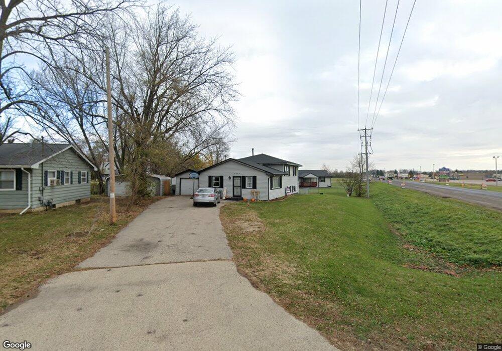
525 Ravine St South Beloit, IL 61080
Estimated Value: $98,000 - $149,394
3
Beds
1
Bath
1,384
Sq Ft
$89/Sq Ft
Est. Value
About This Home
This home is located at 525 Ravine St, South Beloit, IL 61080 and is currently estimated at $123,099, approximately $88 per square foot. 525 Ravine St is a home located in Winnebago County with nearby schools including Clark Elementary School, Riverview Elementary School, and South Beloit Junior High School.
Ownership History
Date
Name
Owned For
Owner Type
Purchase Details
Closed on
Dec 4, 2019
Sold by
Crouch Julie L
Bought by
Reed Adam C and Reed Lindsay M
Current Estimated Value
Home Financials for this Owner
Home Financials are based on the most recent Mortgage that was taken out on this home.
Original Mortgage
$51,362
Outstanding Balance
$45,371
Interest Rate
3.7%
Mortgage Type
VA
Estimated Equity
$77,728
Purchase Details
Closed on
Sep 16, 2011
Bought by
Saxton Julie
Create a Home Valuation Report for This Property
The Home Valuation Report is an in-depth analysis detailing your home's value as well as a comparison with similar homes in the area
Home Values in the Area
Average Home Value in this Area
Purchase History
| Date | Buyer | Sale Price | Title Company |
|---|---|---|---|
| Reed Adam C | $55,500 | New Title Company Name | |
| Saxton Julie | $49,500 | -- |
Source: Public Records
Mortgage History
| Date | Status | Borrower | Loan Amount |
|---|---|---|---|
| Open | Reed Adam C | $51,362 |
Source: Public Records
Tax History Compared to Growth
Tax History
| Year | Tax Paid | Tax Assessment Tax Assessment Total Assessment is a certain percentage of the fair market value that is determined by local assessors to be the total taxable value of land and additions on the property. | Land | Improvement |
|---|---|---|---|---|
| 2024 | $1,497 | $25,806 | $3,177 | $22,629 |
| 2023 | $1,411 | $23,010 | $2,833 | $20,177 |
| 2022 | $1,299 | $21,021 | $2,588 | $18,433 |
| 2021 | $1,222 | $19,672 | $2,422 | $17,250 |
| 2020 | $1,180 | $19,047 | $2,345 | $16,702 |
| 2019 | $1,725 | $18,348 | $2,259 | $16,089 |
| 2018 | $1,704 | $17,488 | $2,153 | $15,335 |
| 2017 | $1,715 | $16,763 | $2,064 | $14,699 |
| 2016 | $1,689 | $16,213 | $1,996 | $14,217 |
| 2015 | $1,680 | $15,842 | $1,950 | $13,892 |
| 2014 | $1,670 | $15,842 | $1,950 | $13,892 |
Source: Public Records
Map
Nearby Homes
- 1912 Blackhawk Blvd
- 14142 Surf Ct
- 14126 Kirane Ct
- 654 Winfield Dr
- 14069 Hanna Way
- 634 Cassandra Way
- 214 Sauk Ridge Dr Unit 1
- 214 Sauk Ridge Dr Unit 18214
- 0000-04 Nautical Ct
- 0000-03 Nautical Ct
- 110 Smith Ln
- 314 Liston Ave
- 320 Liston Ave
- 14242 Talcott Dr
- 13748 Cassidy Dr
- 15361 S Bluff Rd
- 1996 Broadmoor Rd
- 706 Pin Oak Rd
- xxx Perry Ave
- 317 Burr Oak Ave
- 521 Ravine St
- 526 Whittemore Dr
- 530 Whittemore Dr
- 522 Whittemore Dr
- 519 Ravine St
- 515 Ravine St
- 514 Whittemore Dr
- 514 Ravine St
- 511 Ravine St
- 510 Whittemore Dr
- 521 Whittemore Dr
- 507 Ravine St
- 511 Collins Dr
- 506 Ravine St
- 506 Whittemore Dr
- 1911 Barbara Ln
- 502 Whittemore Dr
- 507 Collins Dr
- 513 Whittemore Dr
- 505 Collins Dr