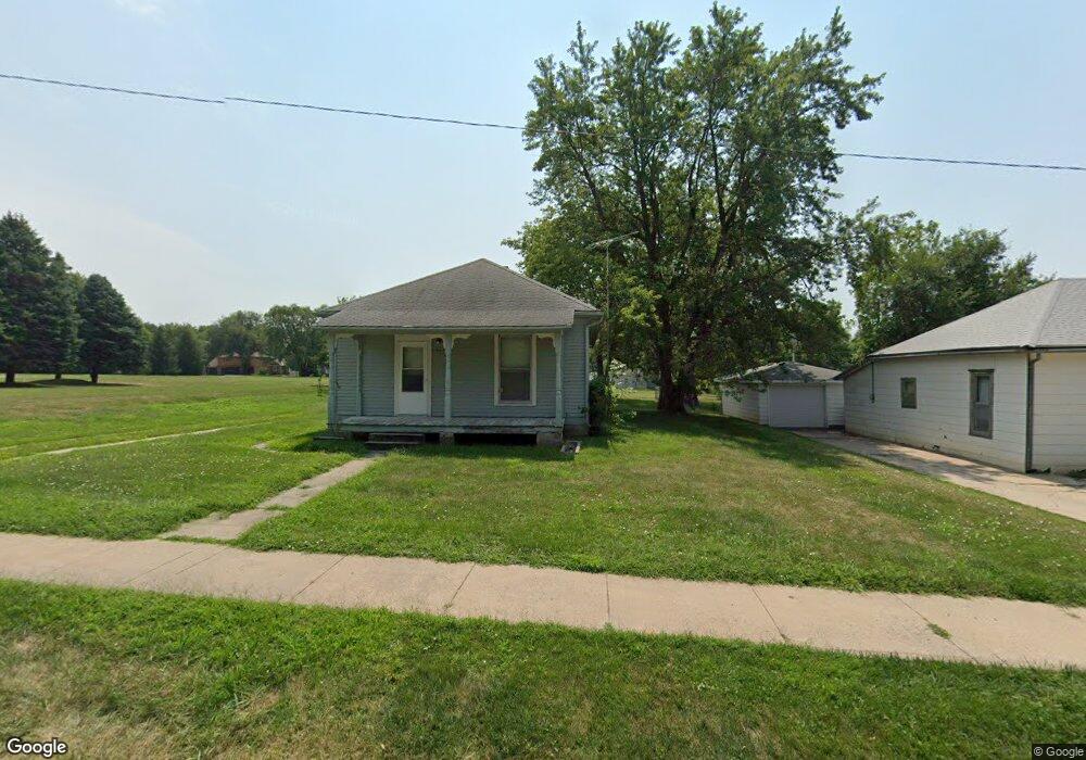
525 W Angus St Gretna, NE 68028
Estimated Value: $158,000 - $213,000
2
Beds
1
Bath
960
Sq Ft
$192/Sq Ft
Est. Value
About This Home
This home is located at 525 W Angus St, Gretna, NE 68028 and is currently estimated at $184,679, approximately $192 per square foot. 525 W Angus St is a home located in Sarpy County with nearby schools including Gretna Elementary School, Gretna Middle School, and Gretna High School.
Ownership History
Date
Name
Owned For
Owner Type
Purchase Details
Closed on
Jun 23, 2021
Sold by
Graham Patricia L
Bought by
St Patricks Church Of Gretna
Current Estimated Value
Purchase Details
Closed on
Mar 16, 2001
Sold by
Frederick Leo J and Frederick Janet D
Bought by
Graham Patricia L
Home Financials for this Owner
Home Financials are based on the most recent Mortgage that was taken out on this home.
Original Mortgage
$12,295
Interest Rate
6.95%
Create a Home Valuation Report for This Property
The Home Valuation Report is an in-depth analysis detailing your home's value as well as a comparison with similar homes in the area
Home Values in the Area
Average Home Value in this Area
Purchase History
| Date | Buyer | Sale Price | Title Company |
|---|---|---|---|
| St Patricks Church Of Gretna | $129,000 | Omaha National Title & Escrow | |
| Graham Patricia L | $60,000 | -- |
Source: Public Records
Mortgage History
| Date | Status | Borrower | Loan Amount |
|---|---|---|---|
| Previous Owner | Graham Patricia L | $12,295 |
Source: Public Records
Tax History Compared to Growth
Tax History
| Year | Tax Paid | Tax Assessment Tax Assessment Total Assessment is a certain percentage of the fair market value that is determined by local assessors to be the total taxable value of land and additions on the property. | Land | Improvement |
|---|---|---|---|---|
| 2025 | $1,988 | $123,753 | $45,000 | $78,753 |
| 2024 | $2,310 | $111,842 | $45,000 | $66,842 |
| 2023 | $2,310 | $107,479 | $45,000 | $62,479 |
| 2022 | $2,272 | $99,562 | $45,000 | $54,562 |
| 2021 | $2,106 | $93,337 | $45,000 | $48,337 |
| 2020 | $0 | $79,670 | $30,000 | $49,670 |
| 2019 | $0 | $74,124 | $30,000 | $44,124 |
| 2018 | $0 | $65,276 | $19,000 | $46,276 |
| 2017 | $0 | $62,876 | $19,000 | $43,876 |
| 2016 | -- | $73,037 | $19,000 | $54,037 |
| 2015 | -- | $69,313 | $19,000 | $50,313 |
| 2014 | -- | $68,161 | $19,000 | $49,161 |
| 2012 | -- | $66,184 | $19,000 | $47,184 |
Source: Public Records
Map
Nearby Homes
- 347 Michael Dr
- 213 Highland Dr
- 11647 Willow Park Dr
- 710 Pawnee Dr
- 20717 Frances St
- 11303 S 210th Ave
- 20919 Birch St
- 20926 Oak St
- 206 E Westplains Rd
- 21605 Hackberry Dr
- 21733 Parkview Dr
- 21710 Parkview Dr
- 21603 Parkview Dr
- Lot 127 W Gruenther Rd
- Lot 111 W Gruenther Rd
- TBD Lot 64 W Gruenther Rd
- Lot 136 W Gruenther Rd
- Lot 80 W Gruenther Rd
- Lot 71 W Gruenther Rd
- 11808 S 213th St
- 529 W Angus St
- 533 W Angus St
- 545 W Angus St
- 524 Langdon Ave
- 532 Langdon Ave
- 528 Langdon Ave
- 536 Langdon Ave
- 120 Aberdeen St
- 530 W Angus St
- 516 W Angus St
- 540 W Angus St
- 542 Langdon Ave
- 544 W Angus St
- 111 Bryan St
- 105 Bryan St
- 117 Bryan St
- 123 Bryan St
- 525 Langdon Ave
- 117 Aberdeen St
- 533 Langdon Ave