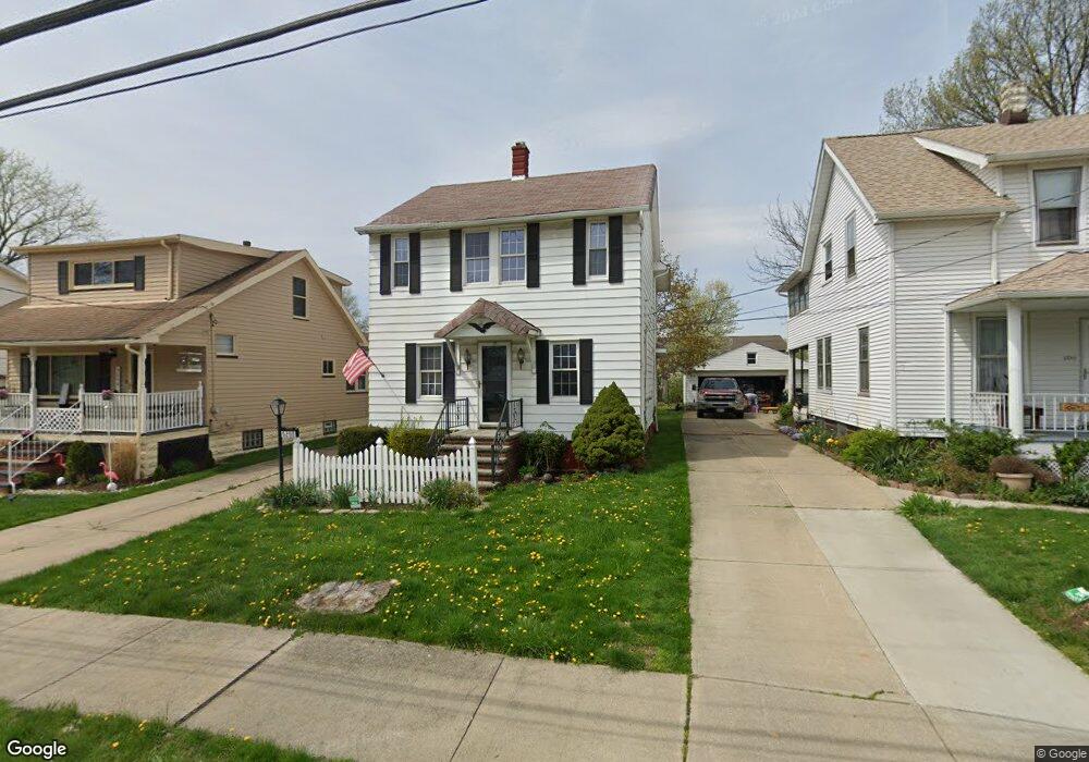
5250 Milo Ave Maple Heights, OH 44137
Estimated Value: $81,000 - $108,620
3
Beds
2
Baths
1,432
Sq Ft
$67/Sq Ft
Est. Value
About This Home
This home is located at 5250 Milo Ave, Maple Heights, OH 44137 and is currently estimated at $96,655, approximately $67 per square foot. 5250 Milo Ave is a home located in Cuyahoga County with nearby schools including Abraham Lincoln Elementary School, Rockside/ J.F. Kennedy School, and Barack Obama School.
Ownership History
Date
Name
Owned For
Owner Type
Purchase Details
Closed on
Mar 25, 2021
Sold by
Shott Dale F and Shott Dawn
Bought by
Beer Joseph and Beer Jodi
Current Estimated Value
Purchase Details
Closed on
Jul 13, 2005
Sold by
Shott Emil and Shott Mary Louise
Bought by
Shott Dale F and Shott Michael W
Purchase Details
Closed on
Apr 2, 1985
Sold by
Shott Emil
Bought by
Shott Emil and Mary Louise
Purchase Details
Closed on
Jan 1, 1975
Bought by
Shott Emil
Create a Home Valuation Report for This Property
The Home Valuation Report is an in-depth analysis detailing your home's value as well as a comparison with similar homes in the area
Home Values in the Area
Average Home Value in this Area
Purchase History
| Date | Buyer | Sale Price | Title Company |
|---|---|---|---|
| Beer Joseph | $60,000 | None Available | |
| Shott Dale F | -- | -- | |
| Shott Emil | -- | -- | |
| Shott Emil | -- | -- |
Source: Public Records
Tax History
| Year | Tax Paid | Tax Assessment Tax Assessment Total Assessment is a certain percentage of the fair market value that is determined by local assessors to be the total taxable value of land and additions on the property. | Land | Improvement |
|---|---|---|---|---|
| 2025 | $1,898 | $21,000 | $7,140 | $13,860 |
| 2024 | $2,092 | $21,000 | $7,140 | $13,860 |
| 2023 | $2,981 | $29,470 | $3,780 | $25,690 |
| 2022 | $2,970 | $29,470 | $3,780 | $25,690 |
| 2021 | $2,261 | $29,470 | $3,780 | $25,690 |
| 2020 | $1,694 | $22,330 | $2,870 | $19,460 |
| 2019 | $1,683 | $63,800 | $8,200 | $55,600 |
| 2018 | $1,673 | $22,330 | $2,870 | $19,460 |
| 2017 | $1,735 | $22,610 | $3,640 | $18,970 |
| 2016 | $1,675 | $22,610 | $3,640 | $18,970 |
| 2015 | $1,627 | $22,610 | $3,640 | $18,970 |
| 2014 | $1,627 | $23,320 | $3,750 | $19,570 |
Source: Public Records
Map
Nearby Homes
- 5197 Milo Ave
- 14510 Granger Rd
- 14512 Granger Rd
- 13600 Royal Blvd
- 5270 E 135th St
- 13801 Bangor Ave
- 5408 Roland Dr
- 15264 Broadway Ave
- 5365 E 131st St
- 5380 E 131st St
- 4955 E 141st St
- 13009 Willard Ave
- 5137 Miller Ave
- 13019 Darlington Ave
- 12913 Darlington Ave
- 13116 Oak Park Blvd
- 13206 Shady Oak Blvd
- 12328 Granger Rd
- 16029 Friend Ave
- 13616 Oakview Blvd
Your Personal Tour Guide
Ask me questions while you tour the home.