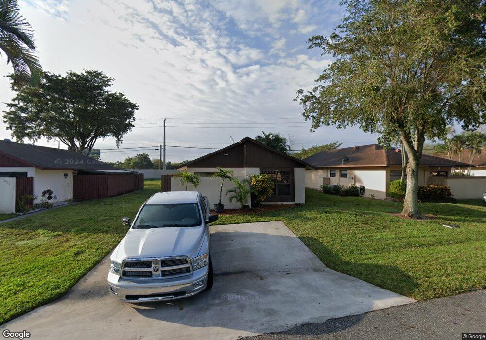
5250 Robbie Ct Unit 1B West Palm Beach, FL 33415
Kenwood Estates NeighborhoodEstimated Value: $231,000 - $286,000
2
Beds
1
Bath
936
Sq Ft
$280/Sq Ft
Est. Value
About This Home
This home is located at 5250 Robbie Ct Unit 1B, West Palm Beach, FL 33415 and is currently estimated at $261,888, approximately $279 per square foot. 5250 Robbie Ct Unit 1B is a home located in Palm Beach County with nearby schools including John I. Leonard High School, Pine Jog Elementary School, and Palm Springs Middle School.
Ownership History
Date
Name
Owned For
Owner Type
Purchase Details
Closed on
Sep 23, 2010
Sold by
Peluso Anthony
Bought by
Sears George Guy
Current Estimated Value
Home Financials for this Owner
Home Financials are based on the most recent Mortgage that was taken out on this home.
Original Mortgage
$59,202
Outstanding Balance
$41,139
Interest Rate
5.5%
Mortgage Type
FHA
Estimated Equity
$220,749
Purchase Details
Closed on
Apr 20, 2010
Sold by
The Estate Of Concetta Peluso
Bought by
Peluso Anthony
Create a Home Valuation Report for This Property
The Home Valuation Report is an in-depth analysis detailing your home's value as well as a comparison with similar homes in the area
Home Values in the Area
Average Home Value in this Area
Purchase History
| Date | Buyer | Sale Price | Title Company |
|---|---|---|---|
| Sears George Guy | $60,000 | Attorney | |
| Peluso Anthony | -- | Attorney |
Source: Public Records
Mortgage History
| Date | Status | Borrower | Loan Amount |
|---|---|---|---|
| Open | Sears George Guy | $59,202 |
Source: Public Records
Tax History Compared to Growth
Tax History
| Year | Tax Paid | Tax Assessment Tax Assessment Total Assessment is a certain percentage of the fair market value that is determined by local assessors to be the total taxable value of land and additions on the property. | Land | Improvement |
|---|---|---|---|---|
| 2024 | $989 | $57,004 | -- | -- |
| 2023 | $964 | $55,344 | $0 | $0 |
| 2022 | $961 | $53,732 | $0 | $0 |
| 2021 | $929 | $52,167 | $0 | $0 |
| 2020 | $915 | $51,447 | $0 | $0 |
| 2019 | $914 | $50,290 | $0 | $0 |
| 2018 | $854 | $49,352 | $0 | $0 |
| 2017 | $798 | $48,337 | $0 | $0 |
| 2016 | $788 | $47,343 | $0 | $0 |
| 2015 | $792 | $47,014 | $0 | $0 |
| 2014 | $793 | $46,641 | $0 | $0 |
Source: Public Records
Map
Nearby Homes
- 1838 Abbey Rd Unit 208
- 1790 Abbey Rd Unit 104B
- 1763 Abbey Rd
- 1871 Abbey Rd Unit 19A
- 5445 Mendoza St
- 5072 Pine Abbey Dr S
- 4916 Luqui Ct
- 1662 Granfern Ave
- 1442 Summit Run Cir
- 4955 Saratoga Rd
- 1970 Monks Ct
- 2084 Laura Ln
- 1891 Keenland Cir
- 1251 Summit Run Cir
- 5642 Cinnamon Dr
- 1326 Carefree Cove Dr
- 2201 W Carol Cir
- 1943 Iris Rd
- 4610 Hairland Dr
- 1160 Pitusa Ct Unit D
- 5250 Robbie Ct
- 5246 Robbie Ct
- 5262 Robbie Ct
- 5266 Robbie Ct
- 5249 Robbie Ct
- 5261 Robbie Ct
- 5245 Robbie Ct
- 5270 Robbie Ct Unit 7A
- 5273 Robbie Ct Unit 7
- 5273 Robbie Ct
- 5274 Robbie Ct Unit 3B
- 5110 Palm Hill Dr Unit K221
- 5110 Palm Hill Dr Unit K218
- 5110 Palm Hill Dr Unit K217
- 5110 Palm Hill Dr Unit K214
- 5110 Palm Hill Dr Unit K220
- 5110 Palm Hill Dr Unit K222
- 5110 Palm Hill Dr Unit K213
- 5110 Palm Hill Dr Unit K219
- 5110 Palm Hill Dr Unit K216