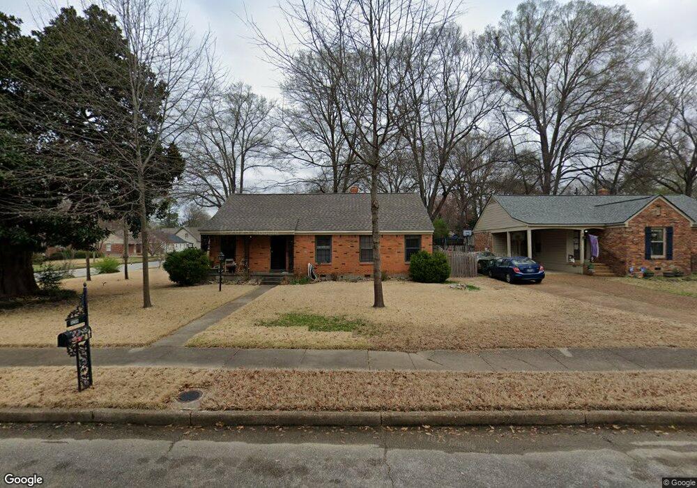
5250 Sequoia Rd Memphis, TN 38120
East Memphis NeighborhoodEstimated Value: $237,614 - $324,000
2
Beds
2
Baths
1,469
Sq Ft
$185/Sq Ft
Est. Value
About This Home
This home is located at 5250 Sequoia Rd, Memphis, TN 38120 and is currently estimated at $271,904, approximately $185 per square foot. 5250 Sequoia Rd is a home located in Shelby County with nearby schools including Richland Elementary School, White Station Middle, and White Station High.
Ownership History
Date
Name
Owned For
Owner Type
Purchase Details
Closed on
May 30, 2007
Sold by
Miller Mark H and Miller Carol G
Bought by
Chiles Timothy M and Chiles Nereida E
Current Estimated Value
Home Financials for this Owner
Home Financials are based on the most recent Mortgage that was taken out on this home.
Original Mortgage
$169,000
Outstanding Balance
$103,018
Interest Rate
6.12%
Mortgage Type
VA
Estimated Equity
$168,886
Create a Home Valuation Report for This Property
The Home Valuation Report is an in-depth analysis detailing your home's value as well as a comparison with similar homes in the area
Home Values in the Area
Average Home Value in this Area
Purchase History
| Date | Buyer | Sale Price | Title Company |
|---|---|---|---|
| Chiles Timothy M | $169,000 | Realty Title & Escrow |
Source: Public Records
Mortgage History
| Date | Status | Borrower | Loan Amount |
|---|---|---|---|
| Open | Chiles Timothy M | $169,000 |
Source: Public Records
Tax History
| Year | Tax Paid | Tax Assessment Tax Assessment Total Assessment is a certain percentage of the fair market value that is determined by local assessors to be the total taxable value of land and additions on the property. | Land | Improvement |
|---|---|---|---|---|
| 2025 | $1,706 | $55,900 | $12,000 | $43,900 |
| 2024 | $1,706 | $50,325 | $9,200 | $41,125 |
| 2023 | $3,066 | $50,325 | $9,200 | $41,125 |
| 2022 | $3,066 | $50,325 | $9,200 | $41,125 |
| 2021 | $3,102 | $50,325 | $9,200 | $41,125 |
| 2020 | $2,726 | $37,625 | $9,200 | $28,425 |
| 2019 | $2,726 | $37,625 | $9,200 | $28,425 |
| 2018 | $2,726 | $37,625 | $9,200 | $28,425 |
| 2017 | $1,546 | $37,625 | $9,200 | $28,425 |
| 2016 | $1,557 | $35,625 | $0 | $0 |
| 2014 | $1,557 | $35,625 | $0 | $0 |
Source: Public Records
Map
Nearby Homes
- 416 Rosser Rd
- 5219 Sequoia Rd
- 407 Meadvale Rd
- 446 Rosser Rd
- 448 N White Station Rd
- 379 Mcelroy Rd
- 296 N White Station Rd
- 438 Mcelroy Rd
- 529 Fleda Rd
- 5151 Tarrytown Dr
- 5126 Verosa Ave
- 5313 Chickasaw Rd
- 5110 Sequoia Rd
- 5137 Whitehall Ave
- 559 Chalmers Rd
- 5364 Wheaton Park Ct
- 226 N White Station Rd
- 421 Mcdermitt Rd
- 536 Wheaton Park Cove N
- 5194 Warfield Dr
Your Personal Tour Guide
Ask me questions while you tour the home.