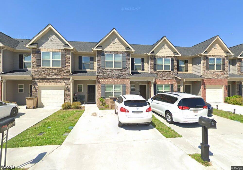
5251 Carrie Dr Morrow, GA 30260
Estimated Value: $234,000 - $312,000
4
Beds
2
Baths
1,800
Sq Ft
$146/Sq Ft
Est. Value
About This Home
This home is located at 5251 Carrie Dr, Morrow, GA 30260 and is currently estimated at $263,045, approximately $146 per square foot. 5251 Carrie Dr is a home with nearby schools including Thurgood Marshall Elementary School, Morrow Middle School, and Morrow High School.
Ownership History
Date
Name
Owned For
Owner Type
Purchase Details
Closed on
Apr 2, 2021
Sold by
Adams Homes Aec Llc
Bought by
Fergus Yorkshire Denise A
Current Estimated Value
Home Financials for this Owner
Home Financials are based on the most recent Mortgage that was taken out on this home.
Original Mortgage
$195,000
Outstanding Balance
$174,913
Interest Rate
3%
Mortgage Type
VA
Estimated Equity
$88,132
Create a Home Valuation Report for This Property
The Home Valuation Report is an in-depth analysis detailing your home's value as well as a comparison with similar homes in the area
Purchase History
| Date | Buyer | Sale Price | Title Company |
|---|---|---|---|
| Fergus Yorkshire Denise A | $197,600 | -- |
Source: Public Records
Mortgage History
| Date | Status | Borrower | Loan Amount |
|---|---|---|---|
| Open | Fergus Yorkshire Denise A | $195,000 |
Source: Public Records
Tax History
| Year | Tax Paid | Tax Assessment Tax Assessment Total Assessment is a certain percentage of the fair market value that is determined by local assessors to be the total taxable value of land and additions on the property. | Land | Improvement |
|---|---|---|---|---|
| 2025 | $3,445 | $98,960 | $5,600 | $93,360 |
| 2024 | $4,223 | $107,280 | $5,600 | $101,680 |
| 2023 | $2,916 | $80,760 | $5,600 | $75,160 |
| 2022 | $3,140 | $79,040 | $5,480 | $73,560 |
| 2021 | $2,934 | $73,320 | $5,600 | $67,720 |
| 2020 | $262 | $5,600 | $5,600 | $0 |
| 2019 | $168 | $3,200 | $3,200 | $0 |
| 2018 | $168 | $3,200 | $3,200 | $0 |
| 2017 | $168 | $3,200 | $3,200 | $0 |
| 2016 | $168 | $3,200 | $3,200 | $0 |
| 2015 | $166 | $0 | $0 | $0 |
| 2014 | $165 | $3,200 | $3,200 | $0 |
Source: Public Records
Map
Nearby Homes
- 2202 Miranda Dr
- 2183 Miranda Dr
- 2207 Miranda Dr
- 2105 Forest Pkwy
- 5356 Creekview Way
- 5372 Bryant Blvd
- 5420 Herndon Blvd
- 5521 Sapphire Cir
- LOT 39 Herndon Blvd
- LOT 26,27,28 Herndon Blvd
- 0 Herndon Blvd Unit 7730551
- 0 Herndon Blvd Unit 7686770
- 1829 Joy Lake Rd
- 3262 Anvil Block Rd
- 5651 Handley Blvd
- 0 Poplar Ave Unit 10481115
- 0 Poplar Ave Unit 7543163
- 2616 Farn Dr
- 2644 Farn Dr
- 0 Denson Blvd Unit 1527338
- 5249 Carrie Dr Unit D 8
- 5253 Carrie Dr
- 5247 Carrie Dr
- 5255 Carrie Dr Unit D 5
- 5245 Carrie Dr Unit D 10
- 5257 Carrie Dr
- 5257 Carrie Dr Unit D4
- 5243 Carrie Dr
- 5259 Carrie Dr Unit D 3
- 5241 Carrie Dr
- 5241 Carrie Dr Unit D 12
- 5261 Carrie Dr
- 5261 Carrie Dr Unit D 2
- 5239 Carrie Dr
- 5263 Carrie Dr Unit D 1
- 5237 Carrie Dr Unit E 2
- 5252 Carrie Dr
- 5248 Carrie Dr Unit G 5
- 5250 Carrie Dr Unit G 6
- 5254 Carrie Dr Unit G 8
Your Personal Tour Guide
Ask me questions while you tour the home.