Estimated Value: $1,561,000 - $2,325,000
5
Beds
7
Baths
6,000
Sq Ft
$342/Sq Ft
Est. Value
About This Home
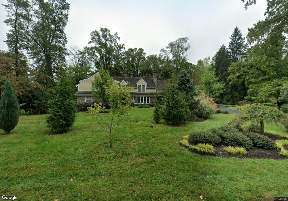
This home is located at 526 Millbrook Rd, Devon, PA 19333 and is currently estimated at $2,052,417, approximately $342 per square foot. 526 Millbrook Rd is a home located in Chester County with nearby schools including Beaumont Elementary School, Tredyffrin-Easttown Middle School, and Conestoga Senior High School.
Ownership History
Date
Name
Owned For
Owner Type
Purchase Details
Closed on
Jun 16, 2009
Sold by
Johnson Blair
Bought by
Morgan Carl G and Morgan Kathleen B
Current Estimated Value
Purchase Details
Closed on
Jun 11, 2008
Sold by
Breene Peter S and Breene Clare C
Bought by
Johnson Blair
Home Financials for this Owner
Home Financials are based on the most recent Mortgage that was taken out on this home.
Original Mortgage
$528,800
Interest Rate
5.62%
Mortgage Type
Purchase Money Mortgage
Purchase Details
Closed on
Oct 11, 1996
Sold by
Wood Adrienne R and Jones Adrienne J
Bought by
Breene Peter S and Breene Clare C
Create a Home Valuation Report for This Property
The Home Valuation Report is an in-depth analysis detailing your home's value as well as a comparison with similar homes in the area
Home Values in the Area
Average Home Value in this Area
Purchase History
| Date | Buyer | Sale Price | Title Company |
|---|---|---|---|
| Morgan Carl G | $1,349,000 | None Available | |
| Johnson Blair | $661,000 | None Available | |
| Breene Peter S | $272,500 | -- |
Source: Public Records
Mortgage History
| Date | Status | Borrower | Loan Amount |
|---|---|---|---|
| Previous Owner | Johnson Blair | $528,800 |
Source: Public Records
Tax History
| Year | Tax Paid | Tax Assessment Tax Assessment Total Assessment is a certain percentage of the fair market value that is determined by local assessors to be the total taxable value of land and additions on the property. | Land | Improvement |
|---|---|---|---|---|
| 2025 | $23,058 | $618,190 | $83,180 | $535,010 |
| 2024 | $23,058 | $618,190 | $83,180 | $535,010 |
| 2023 | $21,560 | $618,190 | $83,180 | $535,010 |
| 2022 | $20,970 | $618,190 | $83,180 | $535,010 |
| 2021 | $20,515 | $618,190 | $83,180 | $535,010 |
| 2020 | $19,944 | $618,190 | $83,180 | $535,010 |
| 2019 | $19,389 | $618,190 | $83,180 | $535,010 |
| 2018 | $19,053 | $618,190 | $83,180 | $535,010 |
| 2017 | $18,623 | $618,190 | $83,180 | $535,010 |
| 2016 | -- | $618,190 | $83,180 | $535,010 |
| 2015 | -- | $618,190 | $83,180 | $535,010 |
| 2014 | -- | $618,190 | $83,180 | $535,010 |
Source: Public Records
Map
Nearby Homes
- 3663 Wyola Dr
- 814 Newtown Rd
- 641 Andover Rd
- 1105 Waterloo Rd
- 1012 Waltham Rd
- 1108 Prescott Rd
- 600 Waynesfield Dr
- 709 Newtown Rd
- 718 S Waterloo Rd
- 837-Lot1 Nathan Hale
- 850 Farragut Rd
- 518 Newtown Rd
- 1 Dunminning Rd
- 514 Newtown Rd
- 130 Beaumont Rd
- 3716 Rose Trader Ln
- 334 Echo Valley Ln
- 846 Maplewood Rd
- 3703 Rosemont Pass
- 6 Wingstone Ln
- 532 Millbrook Rd
- 518 Millbrook Rd
- 934 Spring Ln
- 527 Millbrook Rd
- 510 Millbrook Rd
- 538 Millbrook Rd
- 1017 Newtown Rd
- 935 Spring Ln
- 533 Millbrook Rd
- 928 Spring Ln
- 504 Millbrook Rd
- 507 Millbrook Rd
- 929 Newtown Rd
- 929 Spring Ln
- 1006 Millbrook Rd
- 1005 Millbrook Rd
- 922 Spring Ln
- 499 Millbrook Rd
- 498 Millbrook Rd
- 923 Newtown Rd
Your Personal Tour Guide
Ask me questions while you tour the home.