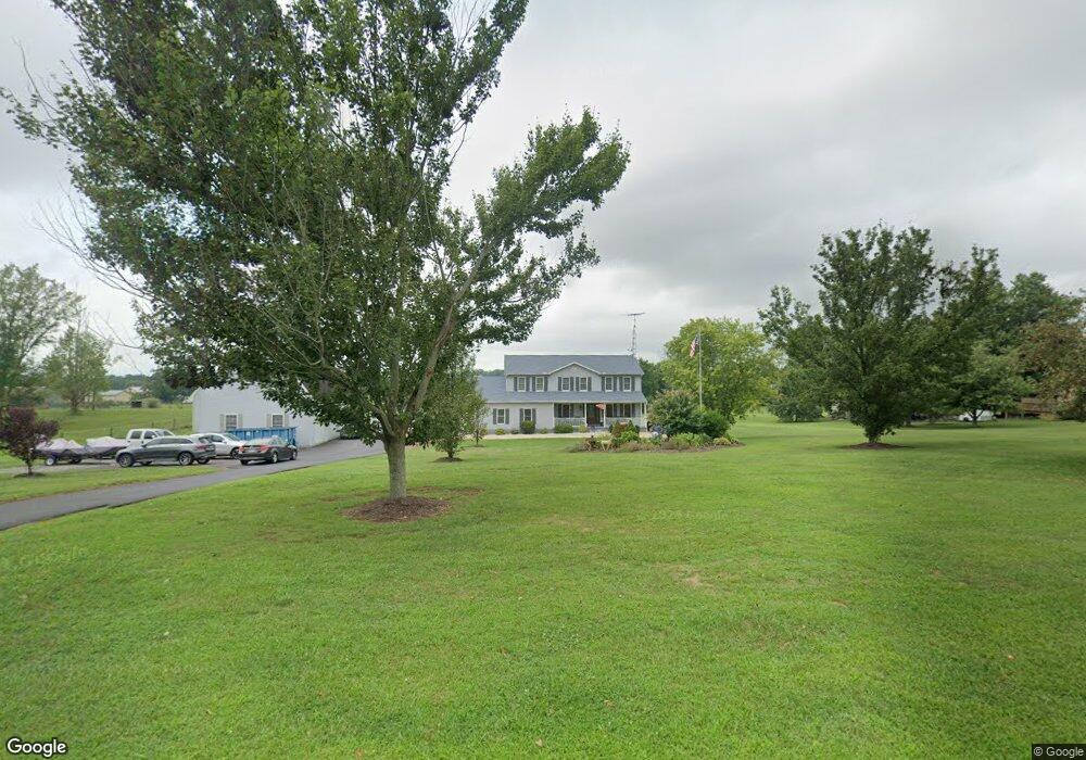
526 Teeter Rd Littlestown, PA 17340
Estimated Value: $527,162 - $627,000
4
Beds
3
Baths
2,832
Sq Ft
$202/Sq Ft
Est. Value
About This Home
This home is located at 526 Teeter Rd, Littlestown, PA 17340 and is currently estimated at $573,291, approximately $202 per square foot. 526 Teeter Rd is a home located in Adams County with nearby schools including Rolling Acres El School, Maple Avenue Middle School, and Littlestown Senior High School.
Ownership History
Date
Name
Owned For
Owner Type
Purchase Details
Closed on
Oct 18, 1990
Bought by
Reed John R and Reed Andrea J
Current Estimated Value
Create a Home Valuation Report for This Property
The Home Valuation Report is an in-depth analysis detailing your home's value as well as a comparison with similar homes in the area
Purchase History
| Date | Buyer | Sale Price | Title Company |
|---|---|---|---|
| Reed John R | $36,900 | -- |
Source: Public Records
Mortgage History
| Date | Status | Borrower | Loan Amount |
|---|---|---|---|
| Open | Reed John R | $310,400 |
Source: Public Records
Tax History
| Year | Tax Paid | Tax Assessment Tax Assessment Total Assessment is a certain percentage of the fair market value that is determined by local assessors to be the total taxable value of land and additions on the property. | Land | Improvement |
|---|---|---|---|---|
| 2025 | $6,248 | $330,100 | $119,800 | $210,300 |
| 2024 | $5,979 | $328,600 | $119,800 | $208,800 |
| 2023 | $5,828 | $328,600 | $119,800 | $208,800 |
| 2022 | $5,785 | $328,600 | $119,800 | $208,800 |
| 2021 | $5,580 | $328,600 | $119,800 | $208,800 |
| 2020 | $5,499 | $328,600 | $119,800 | $208,800 |
| 2019 | $5,381 | $328,600 | $119,800 | $208,800 |
| 2018 | $5,221 | $328,600 | $119,800 | $208,800 |
| 2017 | $5,058 | $328,600 | $119,800 | $208,800 |
| 2016 | -- | $328,600 | $119,800 | $208,800 |
| 2015 | -- | $328,600 | $119,800 | $208,800 |
| 2014 | -- | $328,600 | $119,800 | $208,800 |
Source: Public Records
Map
Nearby Homes
- 37 Amanda Dr Unit 14
- 240 Amanda Dr Unit 18
- 0 Hershey Rd Unit PALA2058618
- 1245 Harney Rd
- 2226 Harney Rd Unit 2
- 1024 Frederick Pike Unit 6
- 1002 Frederick Pike Unit 4
- 620 Saint Johns Rd
- 720 W Myrtle St Unit 14
- 14 Revere Ct Unit 71
- 153 Stoners Cir
- 20 Stedtle Ave
- 4174 Francis Scott Key Hwy
- 7 Stoners Cir
- 11 Yorktowne Ct Unit 96
- 15 Yorktowne Ct Unit 97
- 61 Stoners Cir
- 5160 Baltimore Pike Unit 3
- 311 S Columbus Ave Unit 128
- 141 W King St
- 550 Teeter Rd
- 500 Teeter Rd
- 527 Teeter Rd
- 509 Teeter Rd Unit 2
- 539 Teeter Rd Unit 4
- 555 Teeter Rd Unit 5
- 1578 Harney Rd Unit 23
- 1590 Harney Rd Unit 22
- 1550 Harney Rd Unit 24
- 576 Teeter Rd Unit 18
- 1528 Harney Rd
- 1498 Harney Rd Unit 9
- 567 Teeter Rd Unit 6
- 1606 Harney Rd
- 1514 Harney Rd Unit 26
- 585 Teeter Rd Unit 7
- 1640 Harney Rd
- 606 Teeter Rd
- 1585 Harney Rd Unit 1
- 50 Amanda Dr Unit 6
Your Personal Tour Guide
Ask me questions while you tour the home.