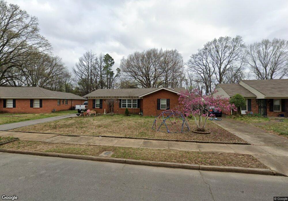
5260 Boswell Rd Memphis, TN 38120
East Memphis NeighborhoodEstimated Value: $242,000 - $265,156
3
Beds
2
Baths
1,522
Sq Ft
$166/Sq Ft
Est. Value
About This Home
This home is located at 5260 Boswell Rd, Memphis, TN 38120 and is currently estimated at $252,039, approximately $165 per square foot. 5260 Boswell Rd is a home located in Shelby County with nearby schools including Richland Elementary School, White Station Middle, and White Station High.
Ownership History
Date
Name
Owned For
Owner Type
Purchase Details
Closed on
Jan 28, 2014
Sold by
Hirsch Julian and Hirsch Celia H
Bought by
Gordon James D and Gordon Anger D
Current Estimated Value
Home Financials for this Owner
Home Financials are based on the most recent Mortgage that was taken out on this home.
Original Mortgage
$78,750
Outstanding Balance
$22,866
Interest Rate
4.51%
Mortgage Type
New Conventional
Estimated Equity
$229,173
Create a Home Valuation Report for This Property
The Home Valuation Report is an in-depth analysis detailing your home's value as well as a comparison with similar homes in the area
Home Values in the Area
Average Home Value in this Area
Purchase History
| Date | Buyer | Sale Price | Title Company |
|---|---|---|---|
| Gordon James D | $105,000 | First American Title Llc |
Source: Public Records
Mortgage History
| Date | Status | Borrower | Loan Amount |
|---|---|---|---|
| Open | Gordon James D | $78,750 |
Source: Public Records
Tax History
| Year | Tax Paid | Tax Assessment Tax Assessment Total Assessment is a certain percentage of the fair market value that is determined by local assessors to be the total taxable value of land and additions on the property. | Land | Improvement |
|---|---|---|---|---|
| 2025 | $1,871 | $68,950 | $10,800 | $58,150 |
| 2024 | $1,871 | $55,200 | $8,275 | $46,925 |
| 2023 | $3,363 | $55,200 | $8,275 | $46,925 |
| 2022 | $3,363 | $55,200 | $8,275 | $46,925 |
| 2021 | $3,402 | $55,200 | $8,275 | $46,925 |
| 2020 | $3,105 | $42,850 | $8,275 | $34,575 |
| 2019 | $3,105 | $42,850 | $8,275 | $34,575 |
| 2018 | $3,105 | $42,850 | $8,275 | $34,575 |
| 2017 | $1,761 | $42,850 | $8,275 | $34,575 |
| 2016 | $1,625 | $37,175 | $0 | $0 |
| 2014 | $1,530 | $35,000 | $0 | $0 |
Source: Public Records
Map
Nearby Homes
- 5194 Warfield Dr
- 5122 Warfield Dr
- 5137 Whitehall Ave
- 5112 White Cliff Dr
- 5167 Tarrytown Dr
- 5151 Tarrytown Dr
- 5364 Wheaton Park Ct
- 446 Rosser Rd
- 536 Wheaton Park Cove N
- 5124 Princeton Rd
- 5017 Acorn Dr
- 524 Mineral Rd
- 416 Rosser Rd
- 438 Mcelroy Rd
- 407 Meadvale Rd
- 5219 Sequoia Rd
- 5037 Henry Heights Dr
- 506 Mcdermitt Rd
- 5042 Princeton Rd
- 5045 Henry Heights Dr
- 5260 Boswell Ave
- 5264 Boswell Rd
- 5264 Boswell Ave
- 5256 Boswell Rd
- 5268 Boswell Rd
- 5254 Boswell Ave
- 5254 Boswell Rd
- 5255 Boswell Rd
- 5272 Boswell Rd
- 5272 Boswell Ave
- 5255 Boswell Ave
- 5265 Boswell Rd
- 5265 Boswell Ave
- 5250 Boswell Rd
- 5249 Boswell Ave
- 5249 Boswell Rd
- 5269 Boswell Rd
- 5274 Boswell Rd
- 5269 Boswell Ave
- 5248 Boswell Rd
Your Personal Tour Guide
Ask me questions while you tour the home.