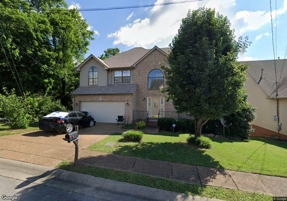
5264 Catspaw Dr Antioch, TN 37013
Oak Highlands NeighborhoodEstimated Value: $436,000 - $458,000
3
Beds
3
Baths
2,211
Sq Ft
$200/Sq Ft
Est. Value
About This Home
This home is located at 5264 Catspaw Dr, Antioch, TN 37013 and is currently estimated at $443,246, approximately $200 per square foot. 5264 Catspaw Dr is a home located in Davidson County with nearby schools including A.Z. Kelley Elementary School, Thurgood Marshall Middle School, and Cane Ridge High School.
Ownership History
Date
Name
Owned For
Owner Type
Purchase Details
Closed on
Jul 9, 2012
Sold by
Arafat Yasser Saleh
Bought by
Titi Yaseen
Current Estimated Value
Purchase Details
Closed on
Sep 27, 2011
Sold by
Federal National Mortgage Association
Bought by
Arafat Yasser Saleh
Purchase Details
Closed on
Mar 3, 2011
Sold by
Delduca Robert and Delduca Kimberly
Bought by
Federal National Mortgage Association
Purchase Details
Closed on
Aug 15, 2008
Sold by
Delduca Robert J
Bought by
Russell Kimberly Carson
Purchase Details
Closed on
Aug 31, 1998
Sold by
Yazdian Construction Inc
Bought by
Delduca Robert J and Delduca Kimberly C Russell
Home Financials for this Owner
Home Financials are based on the most recent Mortgage that was taken out on this home.
Original Mortgage
$120,000
Interest Rate
6.96%
Mortgage Type
Balloon
Create a Home Valuation Report for This Property
The Home Valuation Report is an in-depth analysis detailing your home's value as well as a comparison with similar homes in the area
Home Values in the Area
Average Home Value in this Area
Purchase History
| Date | Buyer | Sale Price | Title Company |
|---|---|---|---|
| Titi Yaseen | -- | Tennessee Title Services Llc | |
| Arafat Yasser Saleh | $165,000 | None Available | |
| Federal National Mortgage Association | $201,622 | None Available | |
| Russell Kimberly Carson | -- | None Available | |
| Delduca Robert J | $185,725 | -- |
Source: Public Records
Mortgage History
| Date | Status | Borrower | Loan Amount |
|---|---|---|---|
| Previous Owner | Delduca Robert J | $120,000 |
Source: Public Records
Tax History Compared to Growth
Tax History
| Year | Tax Paid | Tax Assessment Tax Assessment Total Assessment is a certain percentage of the fair market value that is determined by local assessors to be the total taxable value of land and additions on the property. | Land | Improvement |
|---|---|---|---|---|
| 2024 | $2,265 | $77,500 | $16,250 | $61,250 |
| 2023 | $2,265 | $77,500 | $16,250 | $61,250 |
| 2022 | $2,936 | $77,500 | $16,250 | $61,250 |
| 2021 | $2,289 | $77,500 | $16,250 | $61,250 |
| 2020 | $1,735 | $45,800 | $11,500 | $34,300 |
| 2019 | $1,262 | $45,800 | $11,500 | $34,300 |
Source: Public Records
Map
Nearby Homes
- 5917 Banning Cir
- 921 Calvin Ct
- 7309 Smokey Hill Rd
- 0 Old Hickory Blvd Unit RTC2673022
- 3629 Applewood Ln
- 508 Appleseed Ct
- 828 Lewis Way
- 824 Lewis Way
- Chandler Plan at Briarcreek - Legacy Series
- Sherwood Plan at Briarcreek - Bronze Series
- Cottonwood Plan at Briarcreek - Legacy Series
- Cottonwood Plan at Briarcreek - Bronze Series
- Johnson Plan at Briarcreek - Bronze Series
- Chandler Plan at Briarcreek - Bronze Series
- Rockwell Plan at Briarcreek - Bronze Series
- Manchester Plan at Briarcreek - Bronze Series
- Chatham Plan at Briarcreek - Legacy Series
- Sherwood Plan at Briarcreek - Legacy Series
- Manchester Plan at Briarcreek - Legacy Series
- Chatham Plan at Briarcreek - Bronze Series
- 5260 Catspaw Dr
- 5256 Catspaw Dr
- 5251 Catspaw Dr
- 5247 Catspaw Dr
- 5255 Catspaw Dr
- 5313 Kimsaw Cir
- 5252 Catspaw Dr
- 5317 Kimsaw Cir
- 5259 Catspaw Dr
- 5245 Catspaw Dr
- 5309 Kimsaw Cir
- 5263 Catspaw Dr
- 5248 Catspaw Dr
- 5321 Kimsaw Cir
- 304 Catspaw Ct
- 5305 Kimsaw Cir
- 5241 Catspaw Dr
- 5267 Catspaw Dr
- 5244 Catspaw Dr
- 308 Catspaw Ct