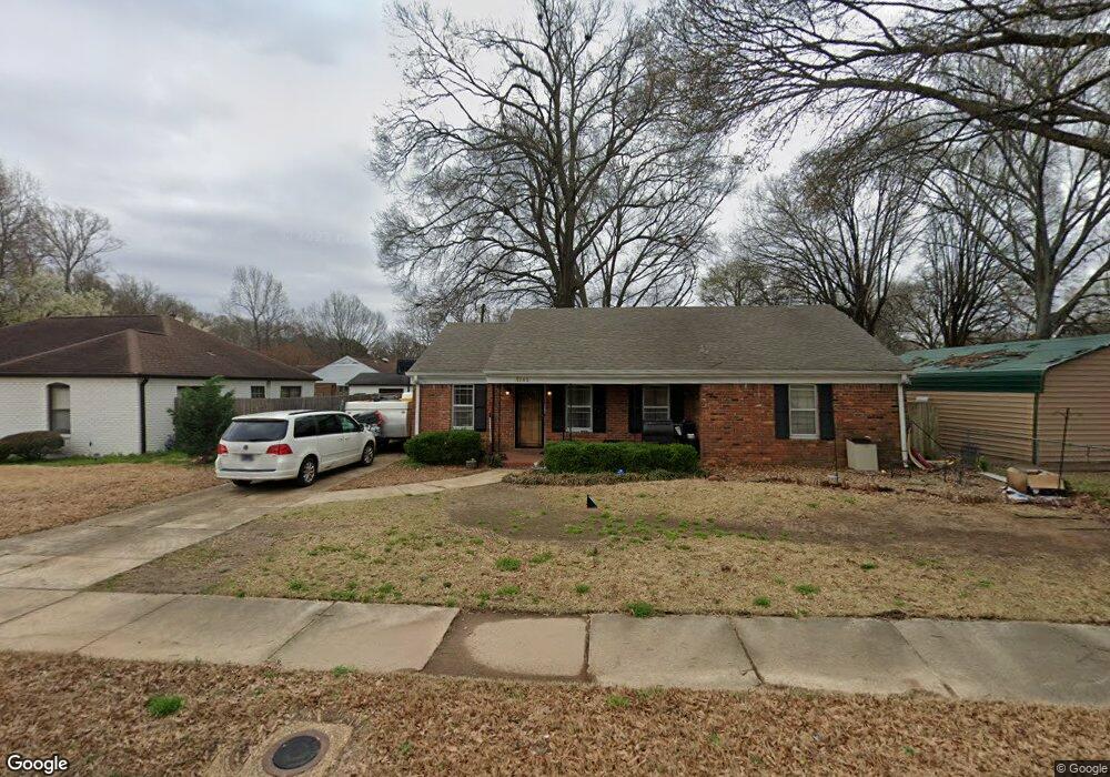
5265 Boswell Rd Memphis, TN 38120
Audubon Park NeighborhoodEstimated Value: $219,981 - $241,000
3
Beds
2
Baths
1,539
Sq Ft
$149/Sq Ft
Est. Value
About This Home
This home is located at 5265 Boswell Rd, Memphis, TN 38120 and is currently estimated at $229,995, approximately $149 per square foot. 5265 Boswell Rd is a home located in Shelby County with nearby schools including Richland Elementary School, White Station Middle, and White Station High.
Ownership History
Date
Name
Owned For
Owner Type
Purchase Details
Closed on
Jun 7, 2024
Sold by
Gary And Diane Clowers Living Trust and Clowers Gary E
Bought by
Clowers Charles and Clowers Elaine
Current Estimated Value
Purchase Details
Closed on
Sep 25, 2019
Sold by
Clowers Norma Diane and Clowers Gary E
Bought by
Clowers Norma Diane and Gary And Diane Clowers Living Trust
Purchase Details
Closed on
Nov 12, 2012
Sold by
Clowers Norma Diane and Clowers Diane
Bought by
Clowers Diane
Purchase Details
Closed on
Mar 16, 2012
Sold by
Bandy Billy Gene and Bandy Tania
Bought by
Clowers Diane and Borgognoni Sam
Purchase Details
Closed on
Aug 21, 2002
Sold by
Koonce Mae W
Bought by
Bandy Ii Billy Gene
Home Financials for this Owner
Home Financials are based on the most recent Mortgage that was taken out on this home.
Original Mortgage
$103,976
Interest Rate
6.31%
Create a Home Valuation Report for This Property
The Home Valuation Report is an in-depth analysis detailing your home's value as well as a comparison with similar homes in the area
Home Values in the Area
Average Home Value in this Area
Purchase History
| Date | Buyer | Sale Price | Title Company |
|---|---|---|---|
| Clowers Charles | -- | None Listed On Document | |
| Clowers Norma Diane | -- | None Available | |
| Clowers Diane | -- | None Available | |
| Clowers Diane | $115,000 | None Available | |
| Bandy Ii Billy Gene | $105,000 | -- |
Source: Public Records
Mortgage History
| Date | Status | Borrower | Loan Amount |
|---|---|---|---|
| Previous Owner | Bandy Ii Billy Gene | $103,976 |
Source: Public Records
Tax History Compared to Growth
Tax History
| Year | Tax Paid | Tax Assessment Tax Assessment Total Assessment is a certain percentage of the fair market value that is determined by local assessors to be the total taxable value of land and additions on the property. | Land | Improvement |
|---|---|---|---|---|
| 2025 | $1,632 | $52,300 | $12,000 | $40,300 |
| 2024 | $1,632 | $48,150 | $9,200 | $38,950 |
| 2023 | $2,933 | $48,150 | $9,200 | $38,950 |
| 2022 | $2,933 | $48,150 | $9,200 | $38,950 |
| 2021 | $2,968 | $48,150 | $9,200 | $38,950 |
| 2020 | $2,433 | $33,575 | $9,200 | $24,375 |
| 2019 | $1,073 | $33,575 | $9,200 | $24,375 |
| 2018 | $1,073 | $33,575 | $9,200 | $24,375 |
| 2017 | $1,098 | $33,575 | $9,200 | $24,375 |
| 2016 | $1,299 | $29,725 | $0 | $0 |
| 2014 | $1,299 | $29,725 | $0 | $0 |
Source: Public Records
Map
Nearby Homes
- 551 N White Station Rd
- 5176 White Cliff Dr
- 529 Fleda Rd
- 580 N Oak Grove Rd
- 5137 Whitehall Ave
- 496 Chalmers Rd
- 5119 Tarrytown Dr
- 446 Rosser Rd
- 536 Wheaton Park Cove N
- 448 N White Station Rd
- 430 Mcelroy Rd
- 4991 Shifri Ave
- 422 Mcelroy Rd
- 5033 Henry Heights Dr
- 5017 Henry Heights Dr
- 5009 Henry Heights Dr
- 557 Sabine St Unit 557
- 379 Mcelroy Rd
- 5121 Lynbar Ave
- 5238 Peg Ln
- 5265 Boswell Ave
- 5269 Boswell Ave
- 5269 Boswell Rd
- 5255 Boswell Ave
- 5255 Boswell Rd
- 5273 Dorsey Ave
- 5249 Boswell Rd
- 5249 Boswell Ave
- 5245 Boswell Rd
- 5264 Boswell Ave
- 5268 Boswell Rd
- 5264 Boswell Rd
- 5277 Dorsey Ave
- 5260 Boswell Ave
- 5260 Boswell Rd
- 5272 Boswell Ave
- 5281 Boswell Rd
- 5241 Boswell Rd
- 5281 Boswell Ave
- 5241 Boswell Ave