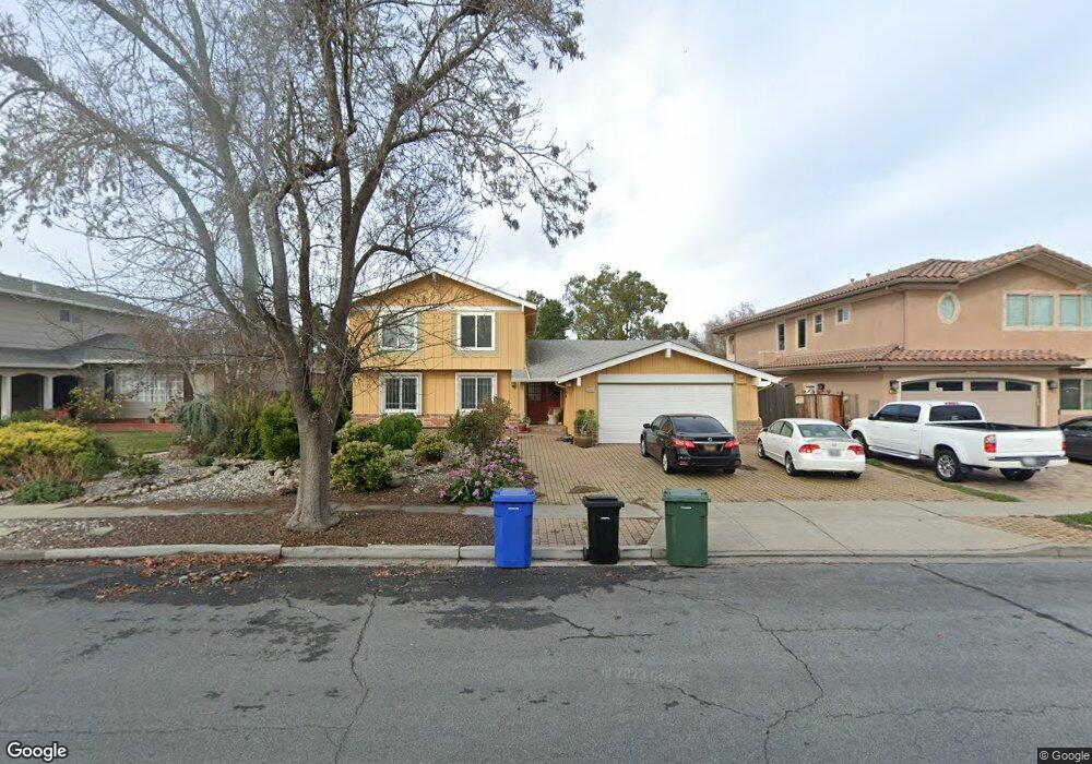
5265 Salisbury Dr Newark, CA 94560
Estimated Value: $1,803,000 - $2,031,000
5
Beds
3
Baths
2,660
Sq Ft
$712/Sq Ft
Est. Value
About This Home
This home is located at 5265 Salisbury Dr, Newark, CA 94560 and is currently estimated at $1,893,379, approximately $711 per square foot. 5265 Salisbury Dr is a home located in Alameda County with nearby schools including John F. Kennedy Elementary School, Newark Junior High School, and Newark Memorial High School.
Ownership History
Date
Name
Owned For
Owner Type
Purchase Details
Closed on
Aug 5, 2025
Sold by
Jarin Jessica
Bought by
Jessica A Jarin Trust and Jarin
Current Estimated Value
Purchase Details
Closed on
Mar 12, 2018
Sold by
Jarin Gia
Bought by
Jarin Gia T and Gia T Jarin 2018 Trust
Purchase Details
Closed on
Mar 22, 2016
Sold by
Martocci Victoria and Martocci Alejandro Jarin
Bought by
Martocci Victoria Jeannine and Jarin Jessica
Purchase Details
Closed on
Nov 29, 2004
Sold by
Jarin Alejandro and Jarin Victoria
Bought by
Jarin Alejandro and Jarin Victoria I
Create a Home Valuation Report for This Property
The Home Valuation Report is an in-depth analysis detailing your home's value as well as a comparison with similar homes in the area
Home Values in the Area
Average Home Value in this Area
Purchase History
| Date | Buyer | Sale Price | Title Company |
|---|---|---|---|
| Jessica A Jarin Trust | -- | None Listed On Document | |
| Jarin Gia T | -- | None Available | |
| Martocci Victoria Jeannine | -- | None Available | |
| Jarin Alejandro | -- | -- |
Source: Public Records
Tax History Compared to Growth
Tax History
| Year | Tax Paid | Tax Assessment Tax Assessment Total Assessment is a certain percentage of the fair market value that is determined by local assessors to be the total taxable value of land and additions on the property. | Land | Improvement |
|---|---|---|---|---|
| 2025 | $2,678 | $167,892 | $57,989 | $116,903 |
| 2024 | $2,678 | $164,463 | $56,852 | $114,611 |
| 2023 | $2,587 | $168,102 | $55,738 | $112,364 |
| 2022 | $2,525 | $157,806 | $54,645 | $110,161 |
| 2021 | $2,467 | $154,574 | $53,573 | $108,001 |
| 2020 | $2,362 | $159,918 | $53,024 | $106,894 |
| 2019 | $2,333 | $156,784 | $51,985 | $104,799 |
| 2018 | $2,291 | $153,710 | $50,966 | $102,744 |
| 2017 | $2,232 | $150,695 | $49,966 | $100,729 |
| 2016 | $2,192 | $147,741 | $48,987 | $98,754 |
| 2015 | $2,183 | $145,522 | $48,251 | $97,271 |
| 2014 | $2,118 | $142,672 | $47,306 | $95,366 |
Source: Public Records
Map
Nearby Homes
- 5139 Dryden Ct
- 5093 Dorking Ct
- 4987 Winchester Place
- 35605 Scarborough Dr
- 36202 Worthing Dr
- 36288 Saxon Ct
- 4955 Swindon Place
- 5303 Stirling Ct
- 36139 San Pedro Dr
- 35936 Magellan Dr
- 36109 Dalewood Dr
- 5113 Dupont Ave
- 35794 Cabral Dr
- 35220 Cornwall Place
- 35978 Magellan Dr
- 35856 Adobe Dr
- 5879 Caleb Ct
- 36686 Charles St
- 36347 Magellan Dr
- 36720 Charles St
- 5279 Salisbury Dr
- 5253 Salisbury Dr
- 5239 Salisbury Dr
- 5291 Salisbury Dr
- 5264 Salisbury Dr
- 5252 Salisbury Dr
- 5278 Salisbury Dr
- 5227 Salisbury Dr
- 5238 Salisbury Dr
- 5290 Salisbury Dr
- 5226 Salisbury Dr
- 5269 Bristol Place
- 5283 Bristol Place
- 5257 Bristol Place
- 5213 Salisbury Dr
- 5242 Hebrides Ct
- 5311 Cambridge Ct
- 5243 Bristol Place
- 5304 Rockport Ct
- 5295 Bristol Place