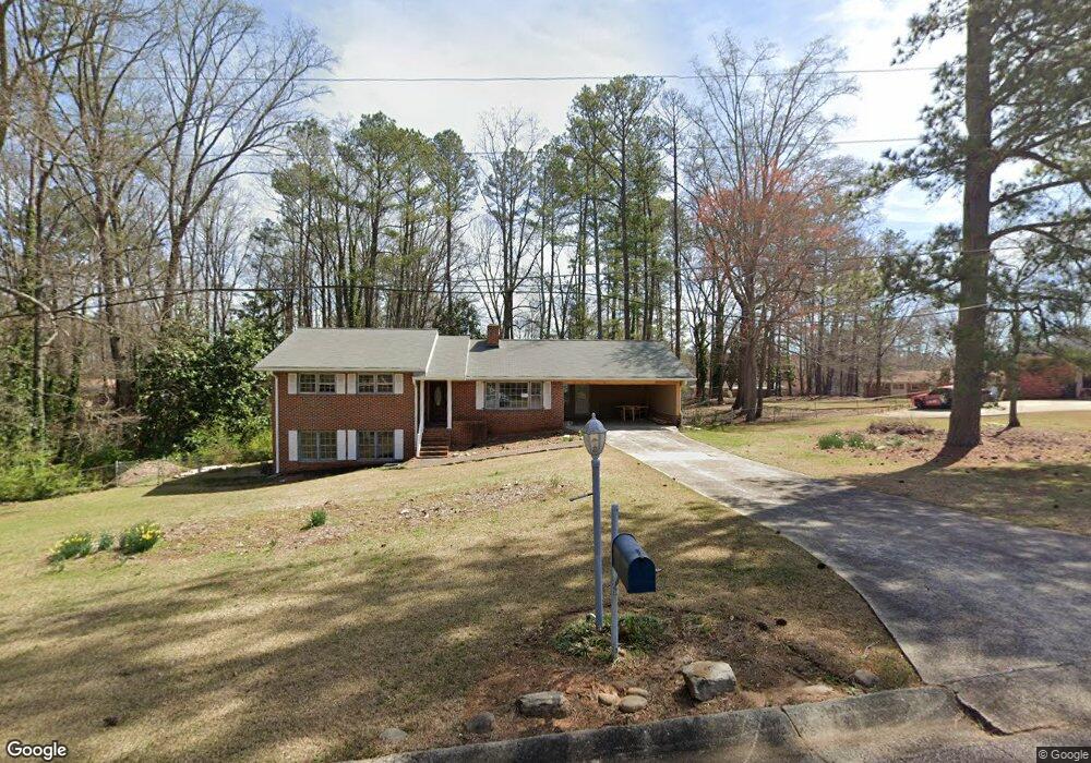
5267 Bullard Ln Austell, GA 30106
Estimated Value: $167,000 - $315,000
3
Beds
2
Baths
1,520
Sq Ft
$178/Sq Ft
Est. Value
About This Home
This home is located at 5267 Bullard Ln, Austell, GA 30106 and is currently estimated at $271,063, approximately $178 per square foot. 5267 Bullard Ln is a home located in Cobb County with nearby schools including Deerwood Elementary School, Austell Elementary School, and Garrett Middle School.
Ownership History
Date
Name
Owned For
Owner Type
Purchase Details
Closed on
Aug 15, 2025
Sold by
Carroll David Jeffrey
Bought by
Boomer Theodore S and Carder Roger L
Current Estimated Value
Home Financials for this Owner
Home Financials are based on the most recent Mortgage that was taken out on this home.
Original Mortgage
$150,000
Outstanding Balance
$128,929
Interest Rate
6.72%
Mortgage Type
Construction
Estimated Equity
$142,134
Purchase Details
Closed on
Jul 1, 2024
Sold by
Boomer Theodore S and Carroll David J
Bought by
Boomer Theodore S and Carder Roger L
Purchase Details
Closed on
Feb 21, 2023
Sold by
Carroll Donald Franklin
Bought by
Carroll David Jeffrey
Purchase Details
Closed on
Jul 8, 2016
Sold by
Sandra A Hughes
Bought by
Carroll Donald and Carroll Betty
Home Financials for this Owner
Home Financials are based on the most recent Mortgage that was taken out on this home.
Original Mortgage
$69,900
Interest Rate
3.41%
Create a Home Valuation Report for This Property
The Home Valuation Report is an in-depth analysis detailing your home's value as well as a comparison with similar homes in the area
Home Values in the Area
Average Home Value in this Area
Purchase History
| Date | Buyer | Sale Price | Title Company |
|---|---|---|---|
| Boomer Theodore S | -- | None Listed On Document | |
| Creative Housing Duo Llc | $168,000 | None Listed On Document | |
| Boomer Theodore S | -- | None Listed On Document | |
| Carroll David Jeffrey | -- | -- | |
| Carroll David Jeffrey | -- | -- | |
| Carroll Donald | -- | -- |
Source: Public Records
Mortgage History
| Date | Status | Borrower | Loan Amount |
|---|---|---|---|
| Open | Creative Housing Duo Llc | $150,000 | |
| Previous Owner | Carroll Donald | $69,900 | |
| Previous Owner | Carroll Donald | -- |
Source: Public Records
Tax History Compared to Growth
Tax History
| Year | Tax Paid | Tax Assessment Tax Assessment Total Assessment is a certain percentage of the fair market value that is determined by local assessors to be the total taxable value of land and additions on the property. | Land | Improvement |
|---|---|---|---|---|
| 2025 | $3,850 | $127,768 | $26,000 | $101,768 |
| 2024 | $3,370 | $111,784 | $24,000 | $87,784 |
| 2023 | $3,444 | $114,244 | $18,000 | $96,244 |
| 2022 | $298 | $63,120 | $10,000 | $53,120 |
| 2021 | $298 | $63,120 | $10,000 | $53,120 |
| 2020 | $276 | $55,544 | $10,000 | $45,544 |
| 2019 | $302 | $64,420 | $10,000 | $54,420 |
| 2018 | $199 | $39,392 | $7,200 | $32,192 |
| 2017 | $141 | $36,320 | $6,000 | $30,320 |
| 2016 | $111 | $33,248 | $5,600 | $27,648 |
| 2015 | $68 | $28,464 | $8,000 | $20,464 |
| 2014 | $69 | $28,464 | $0 | $0 |
Source: Public Records
Map
Nearby Homes
- 1943 Arnold Dr
- 1971 Annette Ln
- 1803 Gherry Dr
- Laurel Plan at Avenbrook
- Rosedale Plan at Avenbrook
- Fulmont at Avenbrook Plan at Avenbrook
- Addison Plan at Avenbrook
- Conley Plan at Avenbrook
- Bayberry Plan at Sawmill Creek - Bungalow Series
- Wisteria Plan at Sawmill Creek - Bungalow Series
- Redbud Plan at Sawmill Creek - Bungalow Series
- 1645 Fulmont Cir
- 5410 Beth Dr
- 0 Harris St Unit 7661273
- 5466 Davis Dr
- 5320 Beth Dr
- 1841 Mobley St
- 5393 Janet Ln
- 1 Perkerson Mill Rd SW
- 1675 Huntcrest Park SW
- 5279 Bullard Ln
- 0 Bullard Ln
- 1898 Annette Ln Unit 2
- 1564 Brannon Cir
- 1881 Arnold Dr
- 1867 Arnold Dr
- 1860 Gherry Dr
- 1846 Gherry Dr Unit 2
- 1897 Annette Ln
- 1870 Gherry Dr
- 1843 Arnold Dr
- 1910 Annette Ln
- 1910 Annette Ln SW
- 1563 Brannon Cir
- 1901 Arnold Dr
- 1911 Arnold Dr
- 1917 Annette Ln SW
- 1884 Gherry Dr
- 1884 Gherry Dr Unit 51
- 0 Brannon Cir Unit 8150837