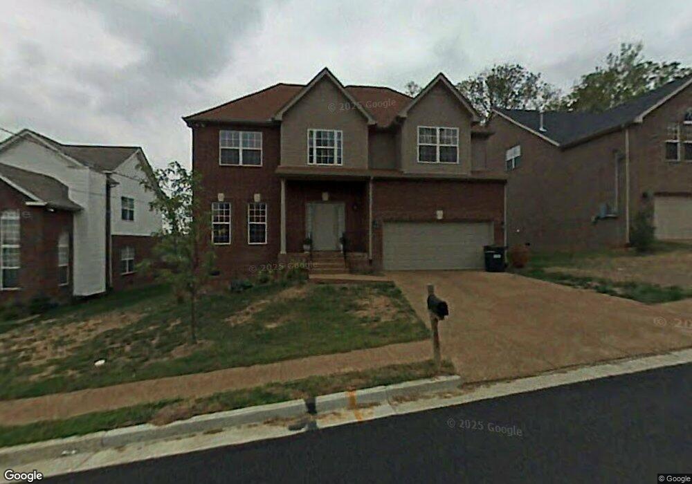
5267 Catspaw Dr Antioch, TN 37013
Oak Highlands NeighborhoodEstimated Value: $472,000 - $498,000
4
Beds
3
Baths
2,688
Sq Ft
$180/Sq Ft
Est. Value
About This Home
This home is located at 5267 Catspaw Dr, Antioch, TN 37013 and is currently estimated at $484,816, approximately $180 per square foot. 5267 Catspaw Dr is a home located in Davidson County with nearby schools including A.Z. Kelley Elementary School, Thurgood Marshall Middle School, and Cane Ridge High School.
Ownership History
Date
Name
Owned For
Owner Type
Purchase Details
Closed on
Sep 12, 2005
Sold by
Tr & D Homes Inc
Bought by
Gilbert Aaron and Gilbert Lenore
Current Estimated Value
Home Financials for this Owner
Home Financials are based on the most recent Mortgage that was taken out on this home.
Original Mortgage
$219,520
Outstanding Balance
$116,853
Interest Rate
5.77%
Mortgage Type
VA
Estimated Equity
$367,963
Purchase Details
Closed on
Mar 31, 2005
Sold by
Gp October Woods
Bought by
Tr & D Inc
Home Financials for this Owner
Home Financials are based on the most recent Mortgage that was taken out on this home.
Original Mortgage
$400,000
Interest Rate
5.57%
Mortgage Type
Construction
Create a Home Valuation Report for This Property
The Home Valuation Report is an in-depth analysis detailing your home's value as well as a comparison with similar homes in the area
Home Values in the Area
Average Home Value in this Area
Purchase History
| Date | Buyer | Sale Price | Title Company |
|---|---|---|---|
| Gilbert Aaron | $214,900 | Realty Title | |
| Tr & D Inc | $76,000 | -- |
Source: Public Records
Mortgage History
| Date | Status | Borrower | Loan Amount |
|---|---|---|---|
| Open | Gilbert Aaron | $219,520 | |
| Previous Owner | Tr & D Inc | $400,000 |
Source: Public Records
Tax History Compared to Growth
Tax History
| Year | Tax Paid | Tax Assessment Tax Assessment Total Assessment is a certain percentage of the fair market value that is determined by local assessors to be the total taxable value of land and additions on the property. | Land | Improvement |
|---|---|---|---|---|
| 2024 | $2,514 | $86,050 | $16,250 | $69,800 |
| 2023 | $2,514 | $86,050 | $16,250 | $69,800 |
| 2022 | $3,260 | $86,050 | $16,250 | $69,800 |
| 2021 | $2,541 | $86,050 | $16,250 | $69,800 |
| 2020 | $1,915 | $50,550 | $11,500 | $39,050 |
| 2019 | $1,393 | $50,550 | $11,500 | $39,050 |
Source: Public Records
Map
Nearby Homes
- 5917 Banning Cir
- 921 Calvin Ct
- 7309 Smokey Hill Rd
- 0 Old Hickory Blvd Unit RTC2673022
- 828 Lewis Way
- 824 Lewis Way
- Chandler Plan at Briarcreek - Legacy Series
- Sherwood Plan at Briarcreek - Bronze Series
- Cottonwood Plan at Briarcreek - Legacy Series
- Cottonwood Plan at Briarcreek - Bronze Series
- Johnson Plan at Briarcreek - Bronze Series
- Chandler Plan at Briarcreek - Bronze Series
- Rockwell Plan at Briarcreek - Bronze Series
- Manchester Plan at Briarcreek - Bronze Series
- Chatham Plan at Briarcreek - Legacy Series
- Sherwood Plan at Briarcreek - Legacy Series
- Manchester Plan at Briarcreek - Legacy Series
- Chatham Plan at Briarcreek - Bronze Series
- Johnson Plan at Briarcreek - Legacy Series
- Newport Plan at Briarcreek - Legacy Series
- 5271 Catspaw Dr
- 5263 Catspaw Dr
- 5259 Catspaw Dr
- 5275 Catspaw Dr
- 5255 Catspaw Dr
- 5279 Catspaw Dr
- 5292 Catspaw Dr
- 5251 Catspaw Dr
- 5283 Catspaw Dr
- 4560 Red Bark Ct
- 4561 Red Bark Ct
- 5264 Catspaw Dr
- 5247 Catspaw Dr
- 5296 Catspaw Dr
- 5287 Catspaw Dr
- 4556 Red Bark Ct
- 5260 Catspaw Dr
- 304 Catspaw Ct
- 4557 Red Bark Ct
- 5245 Catspaw Dr