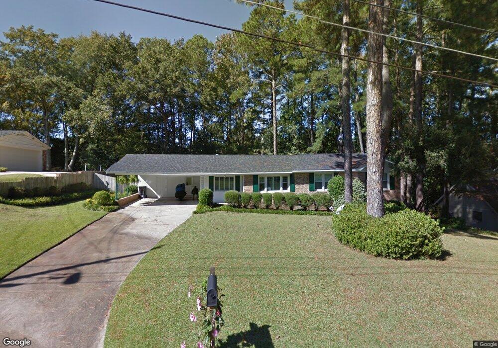
527 Ashland Dr Augusta, GA 30909
West Augusta NeighborhoodEstimated Value: $242,990 - $301,000
3
Beds
2
Baths
1,669
Sq Ft
$168/Sq Ft
Est. Value
About This Home
This home is located at 527 Ashland Dr, Augusta, GA 30909 and is currently estimated at $280,998, approximately $168 per square foot. 527 Ashland Dr is a home located in Richmond County with nearby schools including First Coast Technical Institute, R.B. Hunt Elementary School, and A. Brian Merry Elementary School.
Ownership History
Date
Name
Owned For
Owner Type
Purchase Details
Closed on
Jun 2, 1994
Sold by
Dominy Wilburn T Jr Dominy Claudia S
Bought by
James Dwight D James Lynne Wray
Current Estimated Value
Purchase Details
Closed on
May 31, 1994
Sold by
Dominy Wilburn T
Bought by
James Dwight D
Purchase Details
Closed on
Sep 8, 1992
Sold by
Ligon Sybil W
Bought by
Dominy Wilburn T Jr Dominy Claudia
Purchase Details
Closed on
Aug 17, 1992
Sold by
Ligon Sybil W
Bought by
Dominy Wilburn T
Purchase Details
Closed on
Sep 16, 1986
Sold by
Ligon Fred H
Bought by
Ligon Sybil W
Create a Home Valuation Report for This Property
The Home Valuation Report is an in-depth analysis detailing your home's value as well as a comparison with similar homes in the area
Home Values in the Area
Average Home Value in this Area
Purchase History
| Date | Buyer | Sale Price | Title Company |
|---|---|---|---|
| James Dwight D James Lynne Wray | $100 | -- | |
| James Dwight D | $91,000 | -- | |
| Dominy Wilburn T Jr Dominy Claudia | -- | -- | |
| Dominy Wilburn T | $85,000 | -- | |
| Ligon Sybil W | -- | -- |
Source: Public Records
Tax History Compared to Growth
Tax History
| Year | Tax Paid | Tax Assessment Tax Assessment Total Assessment is a certain percentage of the fair market value that is determined by local assessors to be the total taxable value of land and additions on the property. | Land | Improvement |
|---|---|---|---|---|
| 2025 | $1,103 | $82,872 | $15,200 | $67,672 |
| 2024 | $1,103 | $82,960 | $15,200 | $67,760 |
| 2023 | $1,059 | $82,288 | $15,200 | $67,088 |
| 2022 | $1,216 | $84,214 | $15,200 | $69,014 |
| 2021 | $1,117 | $66,464 | $15,200 | $51,264 |
| 2020 | $1,938 | $56,167 | $13,320 | $42,847 |
| 2019 | $2,051 | $56,167 | $13,320 | $42,847 |
| 2018 | $2,065 | $56,167 | $13,320 | $42,847 |
| 2017 | $2,011 | $56,167 | $13,320 | $42,847 |
| 2016 | $2,013 | $56,167 | $13,320 | $42,847 |
| 2015 | $2,027 | $56,167 | $13,320 | $42,847 |
| 2014 | $2,029 | $56,167 | $13,320 | $42,847 |
Source: Public Records
Map
Nearby Homes
- 525 Henderson Dr
- 12 Shadowbrook Cir
- 2823 Walters Ct
- 533 Basin St
- 2711 Wellington Dr
- 542 Basin St
- 543 Basin St
- 552 Whitehead Dr
- 427 Aumond Rd
- 565 Martin Ln
- 2924 Mayfair Ct
- 2816 Royal St
- 441 Aumond Rd
- 3101 Trafalgar Dr
- 2818 Hazel St
- 503 Sheffield Dr
- 505 Stratford Dr
- 2920 Sussex Rd
- 2716 Hazel St
- 2923 Henry St
- 529 Ashland Dr
- 525 Ashland Dr
- 520 Ashland Dr
- 523 Ashland Dr
- 531 Ashland Dr
- 487 Boy Scout Rd
- 489 Boy Scout Rd
- 518 Ashland Dr
- 531 Henderson Dr
- 485 Boy Scout Rd
- 491 Boy Scout Rd
- 493 Boy Scout Rd
- 529 Henderson Dr
- 521 Ashland Dr
- 533 Ashland Dr
- 2814 Palmer Place
- 479 Boy Scout Rd
- 494 Harlem Ave
- 527 Henderson Dr
- 492 Harlem Ave