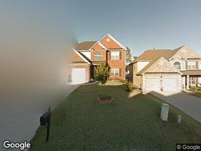
527 Moulton Way West Columbia, SC 29170
Edmund NeighborhoodEstimated Value: $310,000 - $327,000
4
Beds
3
Baths
2,358
Sq Ft
$135/Sq Ft
Est. Value
About This Home
This home is located at 527 Moulton Way, West Columbia, SC 29170 and is currently estimated at $318,234, approximately $134 per square foot. 527 Moulton Way is a home located in Lexington County with nearby schools including Saxe Gotha Elementary School, White Knoll Middle School, and White Knoll High School.
Ownership History
Date
Name
Owned For
Owner Type
Purchase Details
Closed on
Jul 1, 2016
Sold by
Lc Green & Felicaine
Bought by
Deas Matthew and Deas Katherine
Current Estimated Value
Home Financials for this Owner
Home Financials are based on the most recent Mortgage that was taken out on this home.
Original Mortgage
$180,405
Interest Rate
3.48%
Purchase Details
Closed on
Jan 14, 2011
Sold by
Sc Pillon Homes Inc
Bought by
Greene L C and Green Feliciane
Home Financials for this Owner
Home Financials are based on the most recent Mortgage that was taken out on this home.
Original Mortgage
$177,000
Interest Rate
4.82%
Mortgage Type
VA
Create a Home Valuation Report for This Property
The Home Valuation Report is an in-depth analysis detailing your home's value as well as a comparison with similar homes in the area
Home Values in the Area
Average Home Value in this Area
Purchase History
| Date | Buyer | Sale Price | Title Company |
|---|---|---|---|
| Deas Matthew | -- | -- | |
| Greene L C | $178,125 | -- |
Source: Public Records
Mortgage History
| Date | Status | Borrower | Loan Amount |
|---|---|---|---|
| Open | Deas Matthew W | $169,000 | |
| Closed | Deas Matthew | $180,405 | |
| Closed | Deas Matthew | -- | |
| Closed | Deas Matthew W | $180,405 | |
| Previous Owner | Greene L C | $177,000 |
Source: Public Records
Tax History Compared to Growth
Tax History
| Year | Tax Paid | Tax Assessment Tax Assessment Total Assessment is a certain percentage of the fair market value that is determined by local assessors to be the total taxable value of land and additions on the property. | Land | Improvement |
|---|---|---|---|---|
| 2024 | $1,157 | $7,749 | $1,440 | $6,309 |
| 2023 | $1,157 | $7,749 | $1,440 | $6,309 |
| 2022 | $1,154 | $7,749 | $1,440 | $6,309 |
| 2020 | $1,184 | $7,749 | $1,440 | $6,309 |
| 2019 | $1,182 | $7,596 | $1,440 | $6,156 |
| 2018 | $1,160 | $7,596 | $1,440 | $6,156 |
| 2017 | $1,125 | $7,596 | $1,440 | $6,156 |
| 2016 | $711 | $7,516 | $1,440 | $6,076 |
| 2014 | $1,000 | $7,123 | $1,400 | $5,723 |
| 2013 | -- | $7,120 | $1,400 | $5,720 |
Source: Public Records
Map
Nearby Homes
- 271 Lake Frances Dr
- 465 Henslowe Ln
- 427 Laurel Mist Ln
- 113 Laurel Hill Dr
- 241 Highgrove Cir
- 123 Turnfield Dr
- 272 Winchester Ct
- 171 Turnfield Dr
- 104 Candlelight Dr
- 190 Turnfield Dr
- 420 Congaree Ridge Ct
- 1425 Hammerwood Ln
- 1412 Hammerwood Ln
- 4383 Platt Springs Rd
- 249 Loop Rd
- 221 Isom Ln
- 4974 Platt Springs Rd
- 5119 Backman Ave
- 1056 Lindler Dr
- 2715 Roman Way
- 527 Moulton Way
- 531 Moulton Way
- 523 Moulton Way
- 519 Moulton Way
- 311 Ashburton Ln
- 307 Ashburton Ln
- 315 Ashburton Ln
- 414 Henslowe Ln
- 418 Henslowe Ln
- 515 Moulton Way
- 406 Henslowe Ln
- 327 Ashburton Ln
- 426 Henslowe Ln
- 522 Moulton Way
- 402 Henslowe Ln
- 518 Moulton Way
- 503 Moulton Ln
- 430 Henslowe Ln
- 514 Moulton Way
- 000 Ashburton Ln