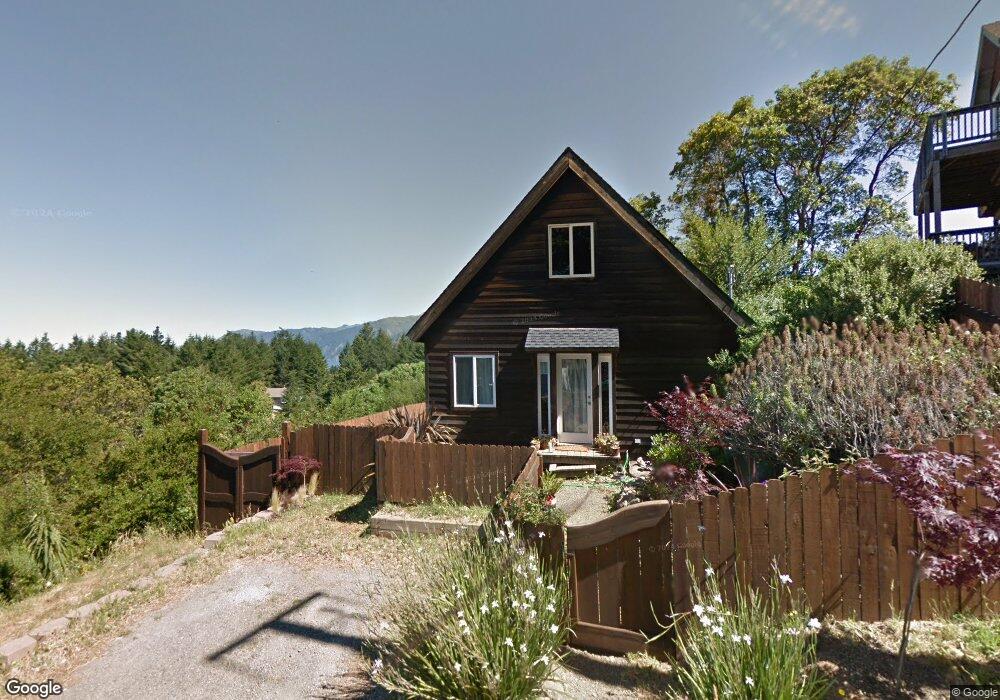
527 Seafoam Rd Whitethorn, CA 95589
Shelter Cove NeighborhoodEstimated Value: $370,000 - $712,000
2
Beds
1
Bath
1,100
Sq Ft
$423/Sq Ft
Est. Value
About This Home
This home is located at 527 Seafoam Rd, Whitethorn, CA 95589 and is currently estimated at $465,381, approximately $423 per square foot. 527 Seafoam Rd is a home located in Humboldt County.
Ownership History
Date
Name
Owned For
Owner Type
Purchase Details
Closed on
Jan 26, 2017
Sold by
Bryant Mark and Bryant Carol
Bought by
Bryant Mark and Bryant Carol
Current Estimated Value
Purchase Details
Closed on
Nov 16, 2016
Sold by
Bryant Mark and Bryant Carol
Bought by
Bryant Mark and Bryant Carol
Purchase Details
Closed on
Oct 28, 2008
Sold by
Wells Fargo Bank Na
Bought by
Bryant Mark and Bryant Carol
Purchase Details
Closed on
Jul 7, 2008
Sold by
Sherry Michael Reed
Bought by
Wells Fargo Bank Na and Abfc 2006-Opt3 Trust Abfc Asset Backed C
Purchase Details
Closed on
May 13, 2008
Sold by
Sherry Michael Reed
Bought by
Emerald Coast Homes Inc
Purchase Details
Closed on
May 22, 2006
Sold by
Island Jason G
Bought by
Sherry Michael Reed
Home Financials for this Owner
Home Financials are based on the most recent Mortgage that was taken out on this home.
Original Mortgage
$425,000
Interest Rate
9.2%
Mortgage Type
Purchase Money Mortgage
Purchase Details
Closed on
Jun 8, 2000
Sold by
Arnds Karl A
Bought by
Island Jason G
Create a Home Valuation Report for This Property
The Home Valuation Report is an in-depth analysis detailing your home's value as well as a comparison with similar homes in the area
Home Values in the Area
Average Home Value in this Area
Purchase History
| Date | Buyer | Sale Price | Title Company |
|---|---|---|---|
| Bryant Mark | -- | None Available | |
| Bryant Mark | -- | None Available | |
| Bryant Mark | $280,000 | First American Title Company | |
| Wells Fargo Bank Na | $318,750 | None Available | |
| Emerald Coast Homes Inc | -- | None Available | |
| Sherry Michael Reed | $425,000 | Humboldt Land Title Company | |
| Island Jason G | $20,000 | Humboldt Land Title Company |
Source: Public Records
Mortgage History
| Date | Status | Borrower | Loan Amount |
|---|---|---|---|
| Previous Owner | Sherry Michael Reed | $425,000 |
Source: Public Records
Tax History Compared to Growth
Tax History
| Year | Tax Paid | Tax Assessment Tax Assessment Total Assessment is a certain percentage of the fair market value that is determined by local assessors to be the total taxable value of land and additions on the property. | Land | Improvement |
|---|---|---|---|---|
| 2025 | $4,112 | $360,555 | $109,450 | $251,105 |
| 2024 | $4,112 | $353,486 | $107,304 | $246,182 |
| 2023 | $4,128 | $346,555 | $105,200 | $241,355 |
| 2022 | $4,067 | $339,761 | $103,138 | $236,623 |
| 2021 | $3,921 | $333,100 | $101,116 | $231,984 |
| 2020 | $3,943 | $329,686 | $100,080 | $229,606 |
| 2019 | $3,850 | $323,222 | $98,118 | $225,104 |
| 2018 | $3,787 | $316,886 | $96,195 | $220,691 |
| 2017 | $3,619 | $310,673 | $94,309 | $216,364 |
| 2016 | $3,599 | $304,582 | $92,460 | $212,122 |
| 2015 | $3,581 | $300,008 | $91,072 | $208,936 |
| 2014 | $3,446 | $294,133 | $89,289 | $204,844 |
Source: Public Records
Map
Nearby Homes
- 189 & 177 Hickory Rd
- 30 Fir Ct
- 37 Spur Ct
- 680 Redwood Rd
- 48 Cinch Ct
- 825 Upper Pacific Dr
- 865 Upper Pacific Dr
- 541 Redwood Rd
- 529 Redwood Rd
- 245 Albatross Rd
- 26 Rd
- 797 Redwood Rd
- 566 Redwood Rd
- 776 Upper Pacific Dr
- 299 Vista Rd
- 60 Spring Rd
- 76 Lower Pacific Dr
- 88 Shaker Rd
- 87 Tern Rd
- 489 & 508 Humboldt Loop Rd