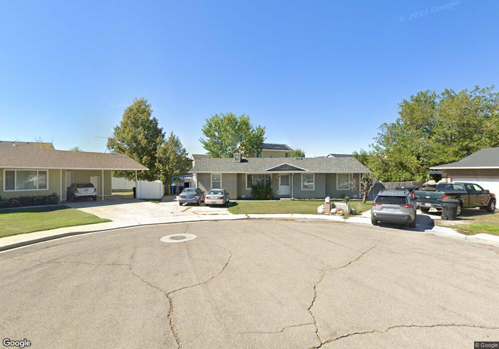
527 W 1670 S Provo, UT 84601
Franklin NeighborhoodEstimated Value: $441,000 - $502,000
3
Beds
2
Baths
1,426
Sq Ft
$331/Sq Ft
Est. Value
About This Home
This home is located at 527 W 1670 S, Provo, UT 84601 and is currently estimated at $471,828, approximately $330 per square foot. 527 W 1670 S is a home located in Utah County with nearby schools including Franklin Elementary School, Dixon Middle School, and Provo High School.
Ownership History
Date
Name
Owned For
Owner Type
Purchase Details
Closed on
May 15, 2015
Sold by
Pedraza Leo and Alvarado Isabel
Bought by
Pedraza Leo and Alvarado Isabel
Current Estimated Value
Purchase Details
Closed on
Feb 26, 2002
Sold by
Pedraza Leo and Alvarado Isabel
Bought by
Pedraza Leo and Alvarado Isabel
Home Financials for this Owner
Home Financials are based on the most recent Mortgage that was taken out on this home.
Original Mortgage
$102,000
Outstanding Balance
$41,828
Interest Rate
6.8%
Estimated Equity
$430,000
Purchase Details
Closed on
Mar 23, 1999
Sold by
Pedraza Maria Isabel
Bought by
Pedraza Leo and Alvarado Isabel
Purchase Details
Closed on
Jun 28, 1996
Sold by
Howell David N and Howell Karina S
Bought by
Pedraza Maria Isabel
Home Financials for this Owner
Home Financials are based on the most recent Mortgage that was taken out on this home.
Original Mortgage
$98,723
Interest Rate
6.79%
Create a Home Valuation Report for This Property
The Home Valuation Report is an in-depth analysis detailing your home's value as well as a comparison with similar homes in the area
Home Values in the Area
Average Home Value in this Area
Purchase History
| Date | Buyer | Sale Price | Title Company |
|---|---|---|---|
| Pedraza Leo | -- | Accommodation | |
| Pedraza Leo | -- | Inwest Title Services Inc | |
| Pedraza Leo | -- | Action Title Company | |
| Pedraza Maria Isabel | -- | Action Title Company |
Source: Public Records
Mortgage History
| Date | Status | Borrower | Loan Amount |
|---|---|---|---|
| Open | Pedraza Leo | $102,000 | |
| Previous Owner | Pedraza Maria Isabel | $98,723 |
Source: Public Records
Tax History Compared to Growth
Tax History
| Year | Tax Paid | Tax Assessment Tax Assessment Total Assessment is a certain percentage of the fair market value that is determined by local assessors to be the total taxable value of land and additions on the property. | Land | Improvement |
|---|---|---|---|---|
| 2025 | $2,153 | $224,180 | $180,400 | $227,200 |
| 2024 | $2,153 | $211,915 | $0 | $0 |
| 2023 | $2,076 | $201,465 | $0 | $0 |
| 2022 | $2,176 | $212,960 | $0 | $0 |
| 2021 | $1,647 | $281,100 | $99,000 | $182,100 |
| 2020 | $1,597 | $255,500 | $90,000 | $165,500 |
| 2019 | $1,480 | $246,200 | $90,000 | $156,200 |
| 2018 | $1,294 | $218,300 | $82,500 | $135,800 |
| 2017 | $1,119 | $103,785 | $0 | $0 |
| 2016 | $1,079 | $93,225 | $0 | $0 |
| 2015 | $955 | $83,380 | $0 | $0 |
| 2014 | -- | $79,585 | $0 | $0 |
Source: Public Records
Map
Nearby Homes
- 588 W 1720 S
- 311 W 1610 S
- 642 W 1870 S Unit 1046
- 1895 S 530 W Unit 1191
- Oakridge (Crawl) Plan at Osprey Towns
- 686 W 1920 S Unit 1024
- Dalton Plan at Osprey Towns
- Dumont Plan at Osprey Towns
- Millbrook (Crawl) Plan at Osprey Towns
- 661 W 1920 S Unit 1072
- 655 W 1280 S
- 1095 S 500 W Unit 11
- 985 S 600 W
- 272 W 1020 S Unit B
- 914 W 1150 S Unit 2
- 908 W 1150 S Unit 3
- 966 S Freedom Blvd Unit 1
- 933 S Blvd W
- 131 S Meadow Dr Unit 20
- 169 S Meadow Dr Unit 18
- 514 W 1670 S
- 545 W 1670 S
- 1673 S 570 W Unit LOT106
- 1651 S 570 W Unit LOT105
- 517 W 1670 S
- 519 W 1610 S
- 547 W 1610 S
- 1691 S 570 W Unit LOT107
- 1635 S 570 W
- 546 W 1720 S
- 1645 S 500 W
- 1671 S 500 W
- 528 W 1720 S
- 1711 S 570 W
- 1631 S 500 W
- 1617 S 570 W Unit LOT103
- 1679 S 500 W
- 1648 S 570 W
- 1688 S 570 W
- 587 W 1660 S Unit 123