G
Seller's Agent in 2017
Gary Tingey
Alpine Real Estate
Estimated Value: $536,000 - $610,000
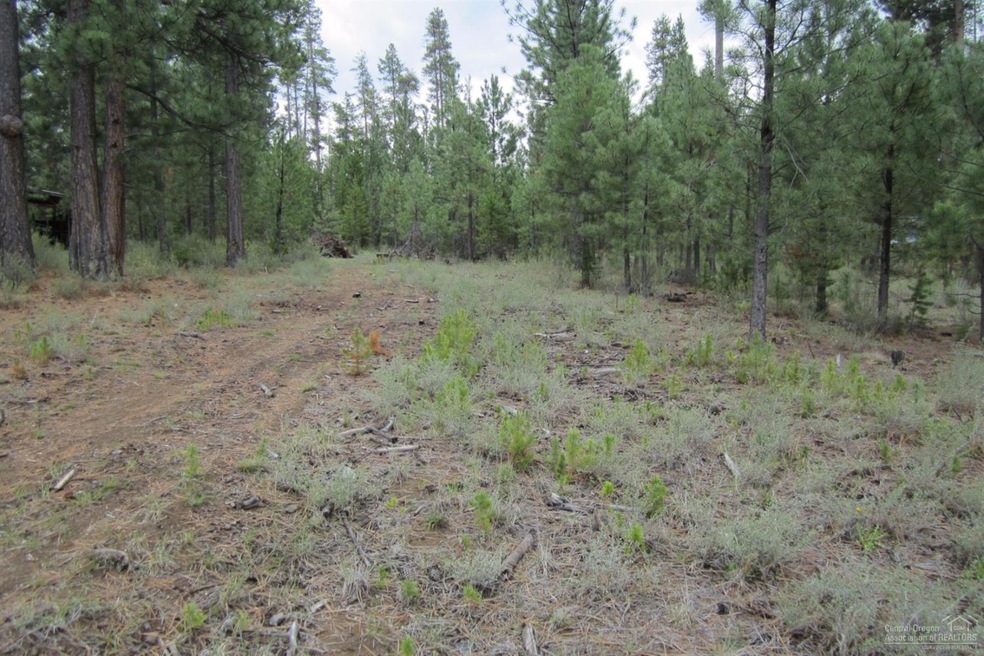
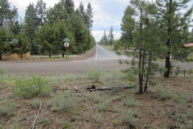
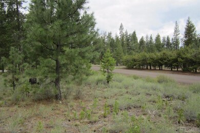
Only once in a while is there a opportunity to purchase a buildable lot in the Newberry Subdivision. Here it is just over a acre and right across the street from the paved Newberry Rd. These lots will typically only need a standard septic system without a nitrate reducing system. Check with Deschutes county. Great building lot in a private location with lots of public lands surrounding the subdivision.
Last Agent to Sell the Property
Gary Tingey
Alpine Real Estate License #200802192 Listed on: 04/06/2016
Last Buyer's Agent
Chelsey Hadley
Lifestyles Realty Group License #201214137
| Date | Buyer | Sale Price | Title Company |
|---|---|---|---|
| Newidouski Thomas R | -- | Old Republic Title Company | |
| Newidouski Thomas | $46,000 | Amerititle |
| Date | Status | Borrower | Loan Amount |
|---|---|---|---|
| Open | Newidouski Thomas R | $241,000 |
| Date | Event | Price | List to Sale | Price per Sq Ft |
|---|---|---|---|---|
| 03/09/2017 03/09/17 | Sold | $46,000 | 0.0% | -- |
| 02/21/2017 02/21/17 | Pending | -- | -- | -- |
| 04/06/2016 04/06/16 | For Sale | $46,000 | -- | -- |
| Year | Tax Paid | Tax Assessment Tax Assessment Total Assessment is a certain percentage of the fair market value that is determined by local assessors to be the total taxable value of land and additions on the property. | Land | Improvement |
|---|---|---|---|---|
| 2025 | $4,375 | $245,990 | -- | -- |
| 2024 | $4,197 | $238,830 | -- | -- |
| 2023 | $4,055 | $231,880 | $0 | $0 |
| 2022 | $3,616 | $199,300 | $0 | $0 |
| 2021 | $3,322 | $193,500 | $0 | $0 |
| 2020 | $3,153 | $193,500 | $0 | $0 |
| 2019 | $3,065 | $187,870 | $0 | $0 |
| 2018 | $2,978 | $182,400 | $0 | $0 |
| 2017 | $227 | $15,330 | $0 | $0 |
| 2016 | $217 | $14,890 | $0 | $0 |
| 2015 | $211 | $14,460 | $0 | $0 |
| 2014 | $199 | $14,040 | $0 | $0 |
G
Seller's Agent in 2017
Gary Tingey
Alpine Real Estate
C
Buyer's Agent in 2017
Chelsey Hadley
Lifestyles Realty Group

Buyer Co-Listing Agent in 2017
Holly Cole
Keller Williams Realty Central Oregon
(541) 480-4208
36 in this area
576 Total Sales
Source: Oregon Datashare
MLS Number: 201602950
APN: 145980
Disclaimer: Certain information contained herein is derived from information provided by parties other than Homes.com. All information provided is deemed reliable, but is not guaranteed to be accurate and should be independently verified.
![]() © 2025 Oregon Datashare (KCAR | MLSCO | SOMLS). All rights reserved. The data relating to real estate for sale on this web site comes in part from the Internet Data Exchange Program of the Oregon Datashare. Real estate listings held by IDX Brokerage firms other than Ten-X are marked with the Internet Data Exchange logo or the Internet Data Exchange thumbnail logo and detailed information about them includes the name of the listing Brokers. Information provided is for consumers' personal, non-commercial use and may not be used for any purpose other than to identify prospective properties the viewer may be interested in purchasing. The consumer will not copy, retransmit nor redistribute any of the content from this website. Information provided is deemed reliable, but not guaranteed.
© 2025 Oregon Datashare (KCAR | MLSCO | SOMLS). All rights reserved. The data relating to real estate for sale on this web site comes in part from the Internet Data Exchange Program of the Oregon Datashare. Real estate listings held by IDX Brokerage firms other than Ten-X are marked with the Internet Data Exchange logo or the Internet Data Exchange thumbnail logo and detailed information about them includes the name of the listing Brokers. Information provided is for consumers' personal, non-commercial use and may not be used for any purpose other than to identify prospective properties the viewer may be interested in purchasing. The consumer will not copy, retransmit nor redistribute any of the content from this website. Information provided is deemed reliable, but not guaranteed.