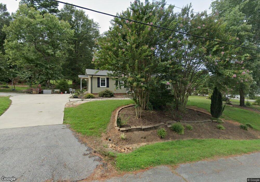
528 Woodland Cir Pendleton, SC 29670
Estimated Value: $254,000 - $271,000
3
Beds
2
Baths
1,374
Sq Ft
$188/Sq Ft
Est. Value
About This Home
This home is located at 528 Woodland Cir, Pendleton, SC 29670 and is currently estimated at $258,972, approximately $188 per square foot. 528 Woodland Cir is a home located in Anderson County with nearby schools including Pendleton High School.
Ownership History
Date
Name
Owned For
Owner Type
Purchase Details
Closed on
Sep 23, 2016
Sold by
Walker Karry D
Bought by
Simpson Richard S and Simpson Deborah E
Current Estimated Value
Purchase Details
Closed on
May 28, 2010
Sold by
Duncan Ruel L and Duncan Patricia C
Bought by
Walker Karry Diane
Home Financials for this Owner
Home Financials are based on the most recent Mortgage that was taken out on this home.
Original Mortgage
$120,143
Interest Rate
4.75%
Mortgage Type
FHA
Purchase Details
Closed on
Jul 9, 2007
Sold by
Slann Tal
Bought by
Duncan Ruel L and Duncan Patricia C
Purchase Details
Closed on
Aug 2, 2006
Sold by
Goldie Steve R and Davis James R
Bought by
Slann Tal
Create a Home Valuation Report for This Property
The Home Valuation Report is an in-depth analysis detailing your home's value as well as a comparison with similar homes in the area
Home Values in the Area
Average Home Value in this Area
Purchase History
We collect this data history from publicly available records. To have your information removed, we recommend requesting removal directly through your county’s website.
| Date | Buyer | Sale Price | Title Company |
|---|---|---|---|
| Simpson Richard S | $145,000 | None Available | |
| Walker Karry Diane | $121,800 | -- | |
| Duncan Ruel L | $126,500 | Attorney | |
| Slann Tal | $81,250 | None Available |
Source: Public Records
Mortgage History
We collect this data history from publicly available records. To have your information removed, we recommend requesting removal directly through your county’s website.
| Date | Status | Borrower | Loan Amount |
|---|---|---|---|
| Previous Owner | Walker Karry Diane | $120,143 |
Source: Public Records
Tax History
| Year | Tax Paid | Tax Assessment Tax Assessment Total Assessment is a certain percentage of the fair market value that is determined by local assessors to be the total taxable value of land and additions on the property. | Land | Improvement |
|---|---|---|---|---|
| 2025 | $1,170 | $7,010 | $1,160 | $5,850 |
| 2024 | $1,170 | $7,010 | $1,160 | $5,850 |
| 2023 | $1,168 | $7,010 | $1,160 | $5,850 |
| 2022 | $1,101 | $7,010 | $1,160 | $5,850 |
| 2021 | $892 | $5,320 | $460 | $4,860 |
| 2020 | $886 | $5,320 | $460 | $4,860 |
| 2019 | $886 | $5,320 | $460 | $4,860 |
| 2018 | $890 | $5,320 | $460 | $4,860 |
| 2017 | -- | $5,320 | $460 | $4,860 |
| 2016 | $1,248 | $4,550 | $320 | $4,230 |
| 2015 | $1,251 | $4,550 | $320 | $4,230 |
| 2014 | $1,269 | $4,550 | $320 | $4,230 |
Source: Public Records
Map
Nearby Homes
- 103 Stephens Rd
- 104 Leah Dr
- Lot 3 Crenshaw St
- Lot 1 Crenshaw St
- 00 Spake Rd Unit Lot C
- 00 Spake Rd Unit Lot D
- 501 Westminster Dr
- 160 Burdette Cir
- 125 Cambridge Ln
- 216 N Mechanic St
- 335 Winston St
- 340 Allingham Rd
- 826 Greenville St
- 171 E Main St
- 99 Issaqueena Trail
- 156 Grand Oak Cir
- 158 Grand Oak Cir
- 936 Chester Cir Unit Hopkins
- 130 S Mechanic St
- 215 Royal Way
- 526 Woodland Cir
- 535 Woodland Cir
- 104 Poplar St
- 601 Woodland Cir
- 103 Poplar St
- 527 Woodland Cir
- 531 Woodland Cir
- 405 Brown Rd Unit 405 Brown Road
- 405 Brown Rd
- 405 Brown Rd Unit 3
- 405 Brown Rd
- 405 Brown Rd Unit 1
- 405 Brown Rd Unit 2
- 524 Woodland Cir
- 525 Woodland Cir
- 300 Woodland Cir
- 112 Maple St
- 104 Maple St
- 104 Maple St
- 109 Crawford Cir
Your Personal Tour Guide
Ask me questions while you tour the home.