Estimated Value: $722,000
4
Beds
3
Baths
4,209
Sq Ft
$172/Sq Ft
Est. Value
About This Home
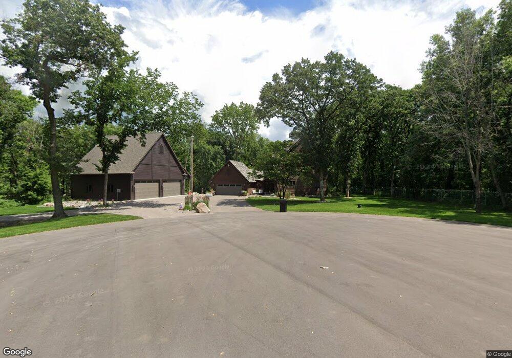
This home is located at 5280 161st Ave NW, Anoka, MN 55303 and is currently priced at $722,000, approximately $171 per square foot. 5280 161st Ave NW is a home located in Anoka County with nearby schools including Brookside Elementary School, Anoka Middle School for the Arts - Fred Moor Campus, and Anoka Senior High School.
Ownership History
Date
Name
Owned For
Owner Type
Purchase Details
Closed on
Sep 9, 2020
Sold by
Briggs Michael J
Bought by
Rice Mark E and Rice Bethany J
Current Estimated Value
Home Financials for this Owner
Home Financials are based on the most recent Mortgage that was taken out on this home.
Original Mortgage
$510,235
Interest Rate
2.9%
Mortgage Type
New Conventional
Purchase Details
Closed on
Dec 3, 2018
Sold by
Ingenito Allan P and Mccrossen Jane
Bought by
Briggs Michael J
Home Financials for this Owner
Home Financials are based on the most recent Mortgage that was taken out on this home.
Original Mortgage
$280,000
Interest Rate
4%
Mortgage Type
Adjustable Rate Mortgage/ARM
Create a Home Valuation Report for This Property
The Home Valuation Report is an in-depth analysis detailing your home's value as well as a comparison with similar homes in the area
Home Values in the Area
Average Home Value in this Area
Purchase History
| Date | Buyer | Sale Price | Title Company |
|---|---|---|---|
| Rice Mark E | -- | Titlesmart Inc | |
| Rice Mark E | $599,900 | Titlesmart Inc | |
| Briggs Michael J | $515,000 | Results Title | |
| Rice Mark Mark | $599,900 | -- |
Source: Public Records
Mortgage History
| Date | Status | Borrower | Loan Amount |
|---|---|---|---|
| Previous Owner | Rice Mark E | $510,235 | |
| Previous Owner | Briggs Michael J | $280,000 | |
| Closed | Rice Mark Mark | $510,235 |
Source: Public Records
Tax History Compared to Growth
Tax History
| Year | Tax Paid | Tax Assessment Tax Assessment Total Assessment is a certain percentage of the fair market value that is determined by local assessors to be the total taxable value of land and additions on the property. | Land | Improvement |
|---|---|---|---|---|
| 2022 | $6,334 | $668,600 | $202,600 | $466,000 |
| 2021 | $5,911 | $540,600 | $123,700 | $416,900 |
| 2020 | $6,102 | $485,200 | $107,000 | $378,200 |
| 2019 | $6,142 | $509,900 | $139,100 | $370,800 |
| 2018 | $3,122 | $500,400 | $0 | $0 |
| 2017 | $5,647 | $490,900 | $0 | $0 |
| 2016 | $5,488 | $416,800 | $0 | $0 |
| 2015 | -- | $416,800 | $116,900 | $299,900 |
| 2014 | -- | $363,900 | $97,000 | $266,900 |
Source: Public Records
Map
Nearby Homes
- 16042 Iodine St NW
- 5695 160th Ln NW
- 15661 Juniper Ridge Dr NW
- 4584 162nd Ln NW
- 16200 Makah St NW
- 5696 154th Cove NW
- 4572 166th Ave NW
- 4907 170th Ave NW
- 4473 166th Ave NW
- 5658 152nd Ln NW
- 16658 Inca St NW
- 15495 Sodium St NW
- 16000 Dakota St NW
- 4680 152nd Ct NW
- 15108 Ute St NW
- 5901 151st Ln NW
- 5803 151st Ln NW
- 15363 Radium St NW
- 5817 151st Ln NW
- 5845 151st Ln NW
- 0 161st Ave Unit 6073045
- 5351 161st Ave NW
- 16137 Dysprosium St NW
- 16100 Dysprosium St NW
- 16201 Dysprosium St NW
- 5115 159th Ave NW
- 16207 Dysprosium St NW
- 5151 159th Ave NW
- 16150 Dysprosium St NW
- 16260 Ventre St NW
- 5159 159th Ave NW
- 16249 Dysprosium St NW
- 5167 159th Ave NW
- 16220 Dysprosium St NW
- 5230 163rd Ln NW
- 16340 Argon St NW
- 16275 Dysprosium St NW
- 5175 159th Ave NW
- 5464 161st Ln NW
- 5152 163rd Ln NW