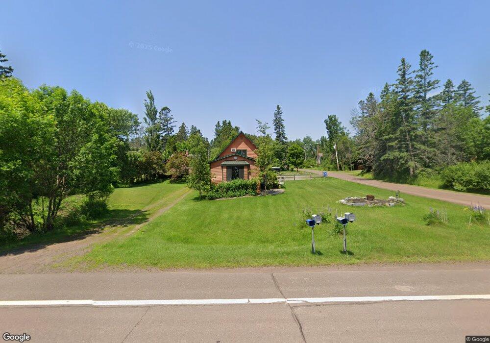
5283 N Shore Dr Duluth, MN 55804
Estimated Value: $423,000 - $491,000
2
Beds
1
Bath
1,696
Sq Ft
$266/Sq Ft
Est. Value
About This Home
This home is located at 5283 N Shore Dr, Duluth, MN 55804 and is currently estimated at $451,964, approximately $266 per square foot. 5283 N Shore Dr is a home with nearby schools including Minnehaha Elementary School, Two Harbors Secondary, and North Shore Community School.
Ownership History
Date
Name
Owned For
Owner Type
Purchase Details
Closed on
Oct 13, 2023
Sold by
Trust Agreement Of Thomas Joseph Roi And
Bought by
Makky Vicky
Current Estimated Value
Purchase Details
Closed on
Jul 19, 2007
Sold by
Kessler John and Kessler Marilynn A
Bought by
Roi Thomas J and Roi Jean M
Home Financials for this Owner
Home Financials are based on the most recent Mortgage that was taken out on this home.
Original Mortgage
$255,000
Interest Rate
6.76%
Mortgage Type
Purchase Money Mortgage
Create a Home Valuation Report for This Property
The Home Valuation Report is an in-depth analysis detailing your home's value as well as a comparison with similar homes in the area
Purchase History
| Date | Buyer | Sale Price | Title Company |
|---|---|---|---|
| Makky Vicky | $415,000 | Results Title | |
| Roi Thomas J | $222,000 | Arrow Abst |
Source: Public Records
Mortgage History
| Date | Status | Borrower | Loan Amount |
|---|---|---|---|
| Previous Owner | Roi Thomas J | $255,000 |
Source: Public Records
Tax History
| Year | Tax Paid | Tax Assessment Tax Assessment Total Assessment is a certain percentage of the fair market value that is determined by local assessors to be the total taxable value of land and additions on the property. | Land | Improvement |
|---|---|---|---|---|
| 2024 | $3,576 | $419,000 | $58,500 | $360,500 |
| 2023 | $3,576 | $357,100 | $52,300 | $304,800 |
| 2022 | $3,164 | $270,600 | $40,700 | $229,900 |
| 2021 | $2,952 | $250,500 | $58,000 | $192,500 |
| 2020 | $3,046 | $237,500 | $53,500 | $184,000 |
| 2019 | $3,006 | $232,600 | $53,500 | $179,100 |
| 2018 | $3,034 | $235,800 | $68,600 | $167,200 |
| 2017 | $3,360 | $235,800 | $68,600 | $167,200 |
| 2016 | $3,184 | $251,700 | $79,400 | $172,300 |
| 2015 | $3,203 | $222,600 | $70,800 | $151,800 |
| 2014 | $3,203 | $222,600 | $70,800 | $151,800 |
Source: Public Records
Map
Nearby Homes
- 5257 Greenwood Rd
- 5377 Mcquade Rd
- 5503 Nordling Rd
- 5616 Mcquade Rd
- XXXX Mcdonnell Rd
- 8353 Congdon Blvd
- xxxx Lakewood Rd Unit XXXX E. Superior St
- 50XX Lakewood Rd
- 5722 Homestead Rd
- 2643 Lauren Rd
- 2597 Lauren Rd
- 1838 E Shilhon Rd
- 2783 Lauren Rd
- 1430 Stoney Point Dr
- 119 Montauk Ln
- 1491 Wildwood Rd
- 2980 Roberg Rd
- 5875 N Shore Dr
- XXXX E Pioneer Rd Unit 6294 E Pioneer Jct R
- 5570 Lester River Rd
- 5281 N Shore Dr
- 5279 N Shore Dr
- 5277 N Shore Dr
- 5290 Pine Tree Rd
- 5275 N Shore Dr
- 5320 Greenwood Rd
- 5316 Greenwood Rd
- 5273 N Shore Dr
- 5330 Greenwood Rd
- 5330 Greenwood Rd
- 5293 N Shore Dr
- 5269 N Shore Dr
- 5325 Greenwood Rd
- 5334 Greenwood Rd
- 5315 Greenwood Rd
- 5315 Greenwood Rd
- 5295 N Shore Dr
- 5329 Greenwood Rd
- 5265 N Shore Dr
- 5311 Greenwood Rd
Your Personal Tour Guide
Ask me questions while you tour the home.