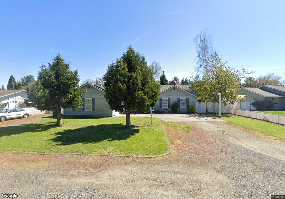
5284 Raymond Way Central Point, OR 97502
Estimated Value: $544,196 - $662,000
3
Beds
2
Baths
2,100
Sq Ft
$285/Sq Ft
Est. Value
About This Home
This home is located at 5284 Raymond Way, Central Point, OR 97502 and is currently estimated at $599,549, approximately $285 per square foot. 5284 Raymond Way is a home located in Jackson County with nearby schools including Jewett Elementary School, Scenic Middle School, and Crater High School.
Ownership History
Date
Name
Owned For
Owner Type
Purchase Details
Closed on
Aug 6, 1998
Sold by
Fogleman Elwood L and Fogleman Loree D
Bought by
Stockton Jay R and Stockton Michelle R
Current Estimated Value
Home Financials for this Owner
Home Financials are based on the most recent Mortgage that was taken out on this home.
Original Mortgage
$166,000
Outstanding Balance
$34,661
Interest Rate
6.93%
Estimated Equity
$564,888
Create a Home Valuation Report for This Property
The Home Valuation Report is an in-depth analysis detailing your home's value as well as a comparison with similar homes in the area
Home Values in the Area
Average Home Value in this Area
Purchase History
| Date | Buyer | Sale Price | Title Company |
|---|---|---|---|
| Stockton Jay R | $190,000 | Jackson County Title |
Source: Public Records
Mortgage History
| Date | Status | Borrower | Loan Amount |
|---|---|---|---|
| Open | Stockton Jay R | $166,000 |
Source: Public Records
Tax History Compared to Growth
Tax History
| Year | Tax Paid | Tax Assessment Tax Assessment Total Assessment is a certain percentage of the fair market value that is determined by local assessors to be the total taxable value of land and additions on the property. | Land | Improvement |
|---|---|---|---|---|
| 2025 | $5,572 | $335,170 | $79,960 | $255,210 |
| 2024 | $5,572 | $325,410 | $77,630 | $247,780 |
| 2023 | $5,393 | $315,940 | $75,360 | $240,580 |
| 2022 | $5,267 | $315,940 | $75,360 | $240,580 |
| 2021 | $5,117 | $306,740 | $73,170 | $233,570 |
| 2020 | $4,968 | $297,810 | $71,030 | $226,780 |
| 2019 | $4,845 | $280,720 | $66,960 | $213,760 |
| 2018 | $4,697 | $272,550 | $65,010 | $207,540 |
| 2017 | $4,579 | $272,550 | $65,010 | $207,540 |
| 2016 | $4,446 | $256,920 | $61,280 | $195,640 |
| 2015 | $4,259 | $256,920 | $61,280 | $195,640 |
| 2014 | $4,151 | $242,180 | $57,770 | $184,410 |
Source: Public Records
Map
Nearby Homes
- 4035 Rock Way
- 335 Applewood Dr
- 920 N 10th St
- 356 Marian Ave Unit 40
- 1010 N 3rd St
- 0 Peninger Rd
- 4626 N Pacific Hwy
- 327 Brookhaven Dr
- 905 Comet Ave
- 426 Bridge Creek Dr
- 833 Hazel St
- 741 Hazel St
- 413 Sand Pointe Dr
- 422 Castle Rock Dr
- 55 Crater Ln
- 1167 Boulder Ridge St
- 405 N 9th St
- 431 N 5th St
- 342 Hazel St
- 526 Stone Pointe Dr
- 5296 Raymond Way
- 5266 Raymond Way
- 5273 Raymond Way
- 5285 Raymond Way
- 4927 Old Upton Rd
- 5329 Raymond Way
- 5267 Teresa Way
- 5336 Raymond Way
- 5247 Teresa Way
- 5315 Teresa Way
- 5337 Raymond Way
- 4945 Old Upton Rd
- 5358 Raymond Way
- 5325 Teresa Way Unit 1
- 5325 Teresa Way
- 5359 Raymond Way
- 4952 Old Upton Rd
- 5380 Raymond Way
- 5351 Teresa Way