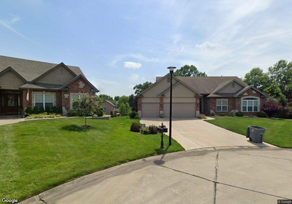
529 Auburn Trace Ln Saint Peters, MO 63376
Estimated Value: $547,866 - $647,000
3
Beds
3
Baths
2,133
Sq Ft
$282/Sq Ft
Est. Value
About This Home
This home is located at 529 Auburn Trace Ln, Saint Peters, MO 63376 and is currently estimated at $600,467, approximately $281 per square foot. 529 Auburn Trace Ln is a home located in St. Charles County with nearby schools including Progress South Elementary School, Fort Zumwalt South Middle School, and Fort Zumwalt South High School.
Ownership History
Date
Name
Owned For
Owner Type
Purchase Details
Closed on
Feb 2, 2011
Sold by
Executive Homes Inc
Bought by
Schultz William and Schultz Cheri
Current Estimated Value
Home Financials for this Owner
Home Financials are based on the most recent Mortgage that was taken out on this home.
Original Mortgage
$220,000
Outstanding Balance
$150,898
Interest Rate
4.83%
Mortgage Type
New Conventional
Estimated Equity
$449,569
Create a Home Valuation Report for This Property
The Home Valuation Report is an in-depth analysis detailing your home's value as well as a comparison with similar homes in the area
Home Values in the Area
Average Home Value in this Area
Purchase History
| Date | Buyer | Sale Price | Title Company |
|---|---|---|---|
| Schultz William | $291,096 | Ctc |
Source: Public Records
Mortgage History
| Date | Status | Borrower | Loan Amount |
|---|---|---|---|
| Open | Schultz William | $220,000 |
Source: Public Records
Tax History Compared to Growth
Tax History
| Year | Tax Paid | Tax Assessment Tax Assessment Total Assessment is a certain percentage of the fair market value that is determined by local assessors to be the total taxable value of land and additions on the property. | Land | Improvement |
|---|---|---|---|---|
| 2025 | $6,293 | $96,186 | -- | -- |
| 2023 | $6,299 | $95,986 | $0 | $0 |
| 2022 | $5,723 | $81,312 | $0 | $0 |
| 2021 | $5,738 | $81,312 | $0 | $0 |
| 2020 | $5,580 | $75,964 | $0 | $0 |
| 2019 | $5,593 | $75,964 | $0 | $0 |
| 2018 | $5,119 | $66,495 | $0 | $0 |
| 2017 | $5,054 | $66,495 | $0 | $0 |
| 2016 | $4,809 | $60,777 | $0 | $0 |
| 2015 | $4,482 | $60,777 | $0 | $0 |
| 2014 | $3,973 | $53,096 | $0 | $0 |
Source: Public Records
Map
Nearby Homes
- 661 Clifton Hill Dr
- 421 Jacobs Place Dr
- 212 Jacobs Way
- 225 Jacobs Way
- 120 Glenallen Dr
- 213 Black Oak Dr
- 201 Dardenne Farms Dr
- 60 Loganberry Ct
- 1 Pauley Cir
- 1017 Windsor Crest Ct
- 1700 Birdie Hills Rd
- 6355 Sprucefield Dr
- 1228 Cold Spring Dr
- 0 the Rainier@weiss Rd
- New Build Forest J at Weiss Rd
- 0 the Indigo@weiss Rd
- New Build Forest H at Weiss Rd
- 1218 Cold Spring Dr
- 511 Roaring Fork Ct
- 7 Park City Ct
- 531 Auburn Trace Ln
- 527 Auburn Trace Ln
- 112 Auburn Trace Pointe Ct
- 634 Castlebrook Dr
- 114 Auburn Trace Point
- 630 Castlebrook Dr
- 638 Castlebrook Dr
- 626 Castlebrook Dr
- 530 Auburn Trace Ln
- 525 Auburn Trace Ln
- 110 Auburn Trace Point
- 642 Castlebrook Dr
- 528 Auburn Trace Ln
- 622 Castlebrook Dr
- 108 Auburn Trace Point
- 523 Auburn Trace Ln
- 526 Auburn Trace Ln
- 646 Castlebrook Dr
- 633 Castlebrook Dr
- 629 Castlebrook Dr