Estimated Value: $154,000 - $206,000
3
Beds
1
Bath
1,551
Sq Ft
$118/Sq Ft
Est. Value
About This Home
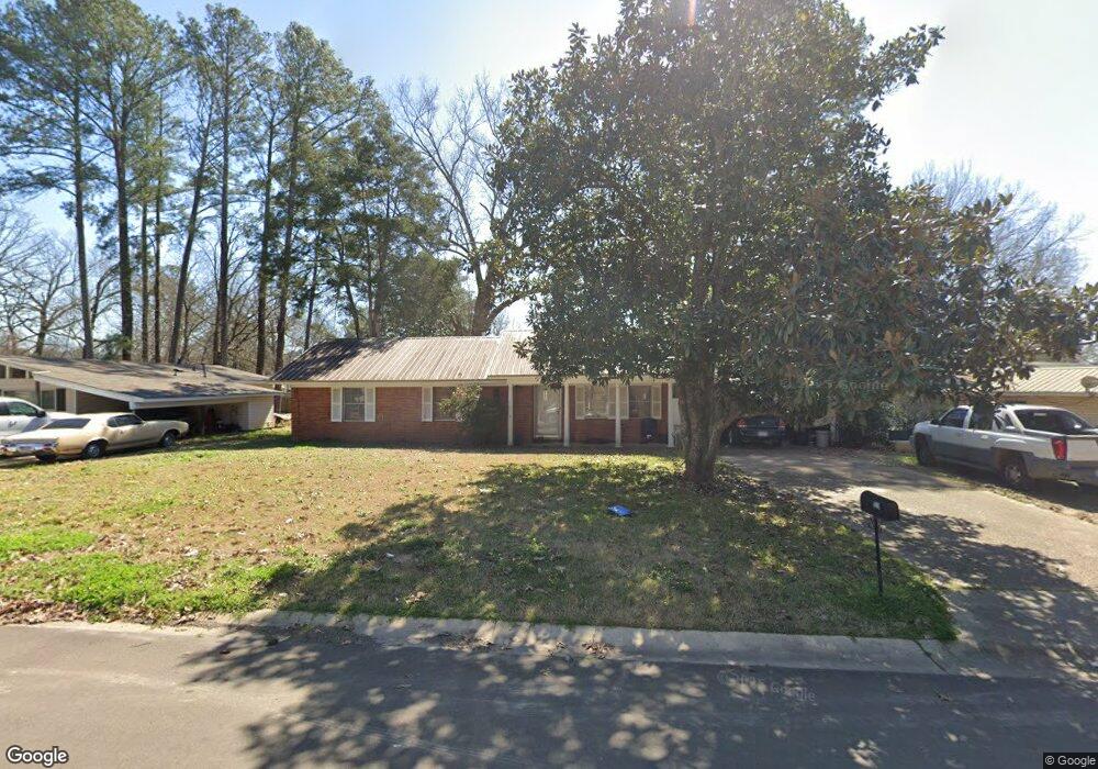
This home is located at 529 Sardis St, Pearl, MS 39208 and is currently estimated at $182,755, approximately $117 per square foot. 529 Sardis St is a home located in Rankin County with nearby schools including Pearl Lower Elementary School, Pearl Upper School, and Northside Elementary School.
Ownership History
Date
Name
Owned For
Owner Type
Purchase Details
Closed on
Dec 27, 2019
Sold by
Gullette Properties Llc
Bought by
Guy Sharon and Guy Wilburn J
Current Estimated Value
Home Financials for this Owner
Home Financials are based on the most recent Mortgage that was taken out on this home.
Original Mortgage
$77,600
Outstanding Balance
$67,972
Interest Rate
3.6%
Mortgage Type
New Conventional
Estimated Equity
$114,783
Purchase Details
Closed on
Aug 8, 2012
Sold by
Comfort Elvin W
Bought by
Comfort Or His Successors In Trust Elvin W and The Elvin W Comfort Revocable
Create a Home Valuation Report for This Property
The Home Valuation Report is an in-depth analysis detailing your home's value as well as a comparison with similar homes in the area
Home Values in the Area
Average Home Value in this Area
Purchase History
| Date | Buyer | Sale Price | Title Company |
|---|---|---|---|
| Guy Sharon | -- | None Available | |
| Comfort Or His Successors In Trust Elvin W | -- | -- |
Source: Public Records
Mortgage History
| Date | Status | Borrower | Loan Amount |
|---|---|---|---|
| Open | Guy Sharon | $77,600 |
Source: Public Records
Tax History Compared to Growth
Tax History
| Year | Tax Paid | Tax Assessment Tax Assessment Total Assessment is a certain percentage of the fair market value that is determined by local assessors to be the total taxable value of land and additions on the property. | Land | Improvement |
|---|---|---|---|---|
| 2024 | $881 | $9,266 | $0 | $0 |
| 2023 | -- | $6,630 | $0 | $0 |
| 2022 | $0 | $6,630 | $0 | $0 |
| 2021 | $0 | $6,630 | $0 | $0 |
| 2020 | $0 | $6,630 | $0 | $0 |
| 2019 | $0 | $6,005 | $0 | $0 |
| 2018 | $0 | $6,005 | $0 | $0 |
| 2017 | $0 | $6,005 | $0 | $0 |
| 2016 | $0 | $6,679 | $0 | $0 |
| 2015 | -- | $6,679 | $0 | $0 |
| 2014 | -- | $6,679 | $0 | $0 |
| 2013 | -- | $6,573 | $0 | $0 |
Source: Public Records
Map
Nearby Homes
- 256 Bruin Ave
- 150 Pemberton Dr
- 250 Maxine Cir
- 230 Jeffries Dr
- 2723 Sycamore Cove N
- 302 Saint Paul St
- 5204 U S 80
- 356 Saint Paul St
- 3175 Stark Dr
- 469 Robert Michael Dr
- 119 Hill Cir
- 118 Hill Cir
- 257 Ann Dr
- 606 Silver Cove
- 3426 Marguerite Dr
- 0 U S 80 Unit 143012
- 3443 Marguerite Dr
- 510 Marbury St
- 3340 Harle St
- 3370 Harle St