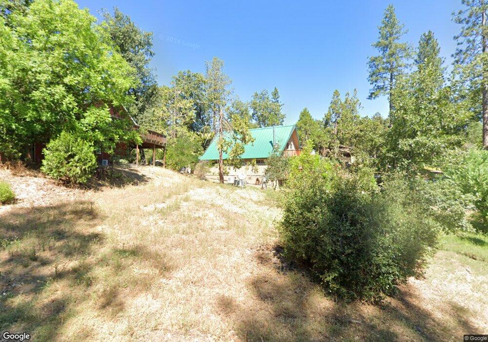
52905 Balsam Dr Oakhurst, CA 93644
Estimated Value: $374,129 - $445,000
3
Beds
3
Baths
1,760
Sq Ft
$228/Sq Ft
Est. Value
About This Home
This home is located at 52905 Balsam Dr, Oakhurst, CA 93644 and is currently estimated at $401,782, approximately $228 per square foot. 52905 Balsam Dr is a home located in Madera County with nearby schools including Oakhurst Elementary School, Oak Creek Intermediate School, and Oakhurst Seventh-day Adventist School.
Ownership History
Date
Name
Owned For
Owner Type
Purchase Details
Closed on
Oct 9, 2024
Sold by
Dela Torre Jose M and Dela Teri A
Bought by
Jose M De La Torre And Teri A De La Torre Rev and Latorre De La
Current Estimated Value
Purchase Details
Closed on
Jul 19, 2000
Sold by
Monagle Kathleen L
Bought by
Delatorre Jose M and Delatorre Teri
Home Financials for this Owner
Home Financials are based on the most recent Mortgage that was taken out on this home.
Original Mortgage
$103,500
Interest Rate
8.16%
Create a Home Valuation Report for This Property
The Home Valuation Report is an in-depth analysis detailing your home's value as well as a comparison with similar homes in the area
Home Values in the Area
Average Home Value in this Area
Purchase History
| Date | Buyer | Sale Price | Title Company |
|---|---|---|---|
| Jose M De La Torre And Teri A De La Torre Rev | -- | None Listed On Document | |
| Delatorre Jose M | $115,000 | First American Title Co |
Source: Public Records
Mortgage History
| Date | Status | Borrower | Loan Amount |
|---|---|---|---|
| Previous Owner | Delatorre Jose M | $103,500 |
Source: Public Records
Tax History Compared to Growth
Tax History
| Year | Tax Paid | Tax Assessment Tax Assessment Total Assessment is a certain percentage of the fair market value that is determined by local assessors to be the total taxable value of land and additions on the property. | Land | Improvement |
|---|---|---|---|---|
| 2025 | $1,782 | $173,260 | $60,260 | $113,000 |
| 2023 | $1,782 | $166,534 | $57,921 | $108,613 |
| 2022 | $1,730 | $163,270 | $56,786 | $106,484 |
| 2021 | $1,707 | $160,070 | $55,673 | $104,397 |
| 2020 | $1,699 | $158,430 | $55,103 | $103,327 |
| 2019 | $1,667 | $155,324 | $54,023 | $101,301 |
| 2018 | $1,628 | $152,279 | $52,964 | $99,315 |
| 2017 | $1,599 | $149,294 | $51,926 | $97,368 |
| 2016 | $1,548 | $146,367 | $50,908 | $95,459 |
| 2015 | $1,527 | $144,170 | $50,144 | $94,026 |
| 2014 | $1,503 | $141,347 | $49,162 | $92,185 |
Source: Public Records
Map
Nearby Homes
- 52854 Balsam Dr
- 52815 Balsam Dr
- 39314 Manzanita Dr
- 52861 Cedar Dr
- 52830 Pine Dr
- 11 Suncrest Dr
- 52038 Road 426
- 40333 Road 222
- 40333 Road 222 Unit 102
- 51793 Quail Ridge Rd
- 39828 Granite Ridge Ln
- 53637 Road 432
- 53473 Road 432
- 39656 Red Bud
- 39351 Blue Jay Dr
- 39550 Saunders
- 50840 Smoke Tree Trail
- 40501 Road 222 Unit 105
- 39317 Point
- 50824 Smoke Tree Trail
- 52885 Balsam Dr
- 39400 Boulder Dr
- 39417 Summit Dr
- 52867 Balsam Dr
- 16 N Summit Dr Dr
- 39405 Boulder Dr
- 52851 Balsam Dr
- 52912 Balsam Dr
- 52898 Balsam Dr
- 52882 Balsam Dr
- 39440 Boulder Dr
- 52868 Balsam Dr
- 39425 Boulder Dr
- 52926 Balsam Dr
- 52943 Balsam Dr
- 39445 Boulder Dr
- 52835 Balsam Dr
- 52840 Balsam Dr
- 39464 Boulder Dr
- 39420 Manzanita Dr