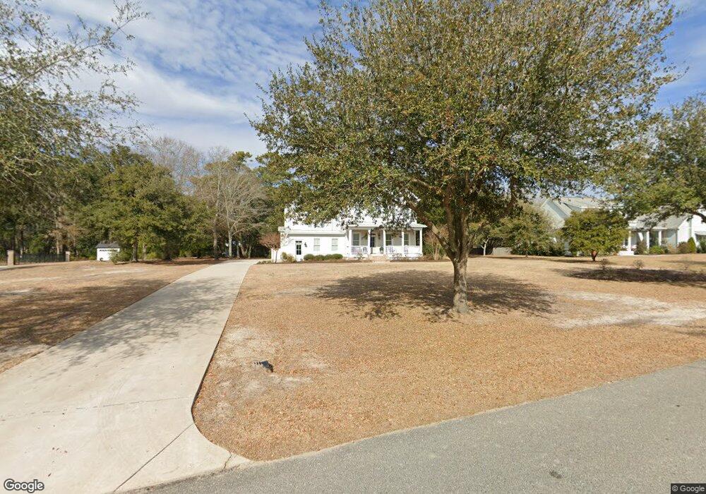
53 Ballast Point Rd Hampstead, NC 28443
Estimated Value: $960,000 - $1,581,000
5
Beds
5
Baths
3,842
Sq Ft
$346/Sq Ft
Est. Value
About This Home
This home is located at 53 Ballast Point Rd, Hampstead, NC 28443 and is currently estimated at $1,330,471, approximately $346 per square foot. 53 Ballast Point Rd is a home with nearby schools including North Topsail Elementary School, Topsail Middle School, and Topsail High School.
Ownership History
Date
Name
Owned For
Owner Type
Purchase Details
Closed on
Aug 22, 2022
Sold by
Blalock Iii James A and Blalock Michele Dawn
Bought by
Blalock James A and Blalock Dawn Michele
Current Estimated Value
Purchase Details
Closed on
Aug 14, 2020
Sold by
Teachey Dawn Michele
Bought by
Blalock James A and Teachey Dawn Michele
Home Financials for this Owner
Home Financials are based on the most recent Mortgage that was taken out on this home.
Original Mortgage
$510,400
Interest Rate
3%
Mortgage Type
New Conventional
Purchase Details
Closed on
Jun 4, 2019
Sold by
Teachey Jack Lewis
Bought by
Teachey Dawn Michele
Home Financials for this Owner
Home Financials are based on the most recent Mortgage that was taken out on this home.
Original Mortgage
$600,000
Interest Rate
4.1%
Mortgage Type
New Conventional
Create a Home Valuation Report for This Property
The Home Valuation Report is an in-depth analysis detailing your home's value as well as a comparison with similar homes in the area
Home Values in the Area
Average Home Value in this Area
Purchase History
| Date | Buyer | Sale Price | Title Company |
|---|---|---|---|
| Blalock James A | -- | Rizzo & Blackburn Pllc | |
| Blalock James A | -- | Orange Coast Lender Services | |
| Teachey Dawn Michele | -- | None Available |
Source: Public Records
Mortgage History
| Date | Status | Borrower | Loan Amount |
|---|---|---|---|
| Previous Owner | Blalock James A | $510,400 | |
| Previous Owner | Blalock James A | $200,000 | |
| Previous Owner | Teachey Dawn Michele | $600,000 |
Source: Public Records
Tax History
| Year | Tax Paid | Tax Assessment Tax Assessment Total Assessment is a certain percentage of the fair market value that is determined by local assessors to be the total taxable value of land and additions on the property. | Land | Improvement |
|---|---|---|---|---|
| 2025 | $5,316 | $834,318 | $150,300 | $684,018 |
| 2024 | $5,316 | $553,116 | $150,300 | $402,816 |
| 2023 | $5,316 | $553,116 | $150,300 | $402,816 |
| 2022 | $4,715 | $553,116 | $150,300 | $402,816 |
| 2021 | $4,825 | $553,116 | $150,300 | $402,816 |
| 2020 | $4,825 | $553,116 | $150,300 | $402,816 |
| 2019 | $1,251 | $150,300 | $150,300 | $0 |
| 2018 | $1,311 | $150,300 | $150,300 | $0 |
Source: Public Records
Map
Nearby Homes
- 283 Ballast Point Rd
- Lot 17 Redd Banks Ln
- 114 Cove Side Ln
- 38 Reston Bluff
- L15r Shipyard Ln
- Lot 21r Shipyard Ln
- 114 Old Farm Rd
- 207 Moores Landing Rd
- 203 Moores Landing Ct
- 400 Camden Trail
- 13 E Cannon Cove
- 278 Batson Rd
- 400 S Kingfisher Ln
- Tract B Twin Oaks Dr
- Tract A Twin Oaks Dr
- 6 Oak View Ln
- 135 E High Bluff Dr
- 17 E Brenda Lee Dr
- 202 Topsail Watch Dr
- Lot 35 E High Bluff Dr
- 81 Ballast Point Rd
- 21 Redd Banks
- 88 Family Ln
- 54 Ballast Point Rd
- 105 Ballast Point Rd
- 15 Redd Banks Ln
- 24 Ballast Point Rd
- 98 Ballast Point Rd
- 2520 Sloop Point Rd
- 2532 Sloop Point Rd
- 2434 Sloop Point Rd
- 229 Family Ln
- 153 Ballast Point Rd
- 114 Seven Oaks Ct
- Lot 11b Sloop Point
- 110 Seven Oaks Ct
- 0 Family Unit 20634490
- 279 Zonnie Ln
- 108 Seven Oaks Ct
- 112 Seven Oaks Ct
