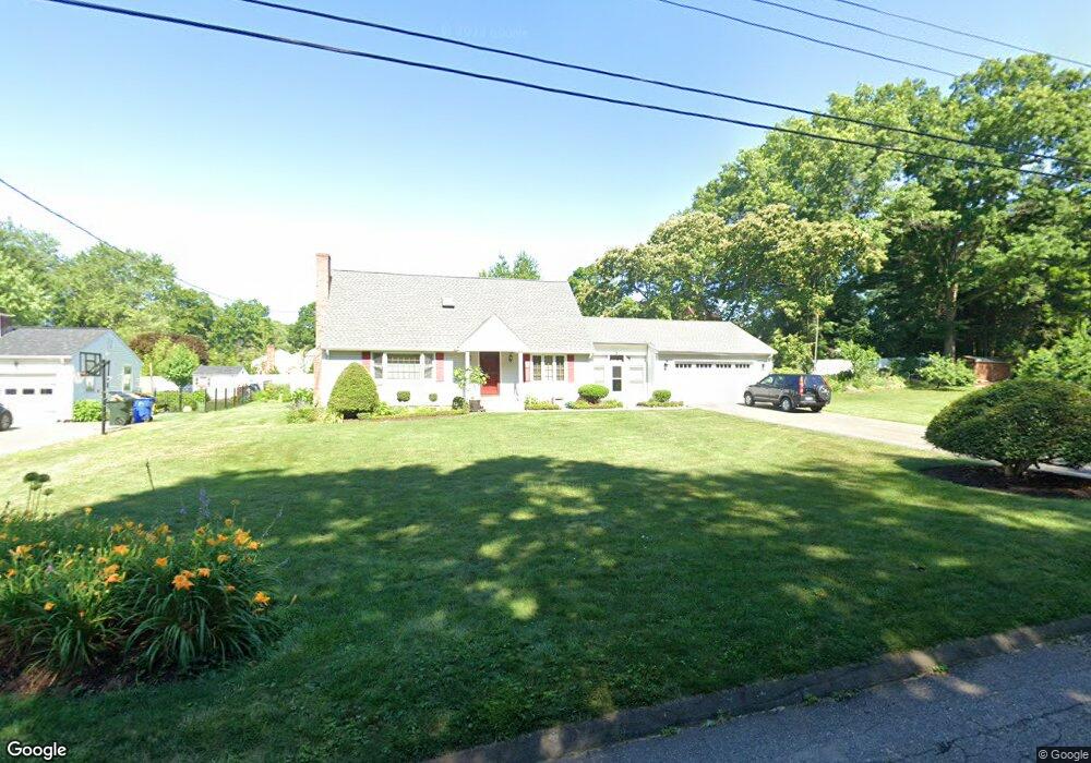
53 Cheston Cir Wethersfield, CT 06109
Estimated Value: $426,000 - $595,000
3
Beds
2
Baths
1,870
Sq Ft
$263/Sq Ft
Est. Value
About This Home
This home is located at 53 Cheston Cir, Wethersfield, CT 06109 and is currently estimated at $492,573, approximately $263 per square foot. 53 Cheston Cir is a home located in Hartford County with nearby schools including Highcrest School, Silas Deane Middle School, and Wethersfield High School.
Create a Home Valuation Report for This Property
The Home Valuation Report is an in-depth analysis detailing your home's value as well as a comparison with similar homes in the area
Home Values in the Area
Average Home Value in this Area
Tax History
| Year | Tax Paid | Tax Assessment Tax Assessment Total Assessment is a certain percentage of the fair market value that is determined by local assessors to be the total taxable value of land and additions on the property. | Land | Improvement |
|---|---|---|---|---|
| 2025 | $12,429 | $301,520 | $93,490 | $208,030 |
| 2024 | $8,478 | $196,170 | $79,890 | $116,280 |
| 2023 | $8,196 | $196,170 | $79,890 | $116,280 |
| 2022 | $8,059 | $196,170 | $79,890 | $116,280 |
| 2021 | $7,978 | $196,170 | $79,890 | $116,280 |
| 2020 | $7,982 | $196,170 | $79,890 | $116,280 |
| 2019 | $7,992 | $196,170 | $79,890 | $116,280 |
| 2018 | $7,826 | $191,900 | $79,000 | $112,900 |
| 2017 | $7,632 | $191,900 | $79,000 | $112,900 |
| 2016 | $7,396 | $191,900 | $79,000 | $112,900 |
| 2015 | $7,329 | $191,900 | $79,000 | $112,900 |
| 2014 | $7,025 | $191,200 | $79,000 | $112,200 |
Source: Public Records
Map
Nearby Homes
- 89 Merriman Rd
- 38 Wheeler Rd
- 31 Ox Yoke Dr
- 268 Fox Hill Rd
- 455 Brimfield Rd
- 0 Collier Rd
- 137 Dale Rd
- 72 Concord Dr
- 50 Concord Dr Unit 50
- 101 Collier Rd
- 25 Sutton Rd
- 155 Old Common Rd
- 5 Robeth Ln
- 22 Winesap Cir Unit 22
- 18 Mcintosh Cir Unit 18
- 195 Middletown Ave
- 108 Chamberlain Rd
- 104 Willow St
- 1610 Silas Deane Hwy
- 35 Stillwold Dr
Your Personal Tour Guide
Ask me questions while you tour the home.