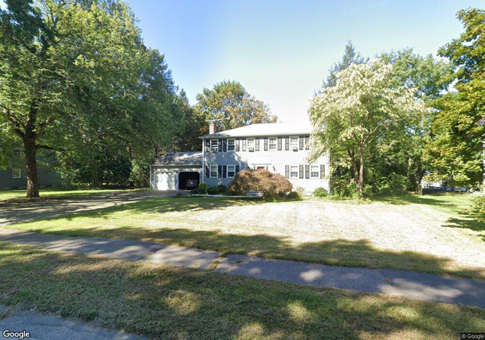
53 Dalton Rd Holliston, MA 01746
Estimated Value: $900,956 - $1,009,000
4
Beds
3
Baths
2,492
Sq Ft
$378/Sq Ft
Est. Value
About This Home
This home is located at 53 Dalton Rd, Holliston, MA 01746 and is currently estimated at $942,489, approximately $378 per square foot. 53 Dalton Rd is a home located in Middlesex County with nearby schools including Miller Elementary School, Robert H. Adams Middle School, and Holliston High School.
Ownership History
Date
Name
Owned For
Owner Type
Purchase Details
Closed on
Jun 1, 2017
Sold by
Goldberg Allen D
Bought by
Goldberg Janna V and Rowe Stephen M
Current Estimated Value
Home Financials for this Owner
Home Financials are based on the most recent Mortgage that was taken out on this home.
Original Mortgage
$360,000
Outstanding Balance
$299,034
Interest Rate
3.97%
Mortgage Type
New Conventional
Estimated Equity
$643,455
Purchase Details
Closed on
Jan 9, 1992
Sold by
Hammel Charles R and Hammel Barbara N
Bought by
Goldberg Allen D and Goldberg Michele A
Home Financials for this Owner
Home Financials are based on the most recent Mortgage that was taken out on this home.
Original Mortgage
$191,250
Interest Rate
8.64%
Mortgage Type
Purchase Money Mortgage
Create a Home Valuation Report for This Property
The Home Valuation Report is an in-depth analysis detailing your home's value as well as a comparison with similar homes in the area
Home Values in the Area
Average Home Value in this Area
Purchase History
| Date | Buyer | Sale Price | Title Company |
|---|---|---|---|
| Goldberg Janna V | $540,000 | -- | |
| Goldberg Allen D | $278,000 | -- |
Source: Public Records
Mortgage History
| Date | Status | Borrower | Loan Amount |
|---|---|---|---|
| Open | Goldberg Janna V | $360,000 | |
| Previous Owner | Goldberg Allen D | $35,000 | |
| Previous Owner | Goldberg Allen D | $181,000 | |
| Previous Owner | Goldberg Allen D | $191,250 | |
| Previous Owner | Goldberg Allen D | $32,000 |
Source: Public Records
Tax History Compared to Growth
Tax History
| Year | Tax Paid | Tax Assessment Tax Assessment Total Assessment is a certain percentage of the fair market value that is determined by local assessors to be the total taxable value of land and additions on the property. | Land | Improvement |
|---|---|---|---|---|
| 2025 | $11,363 | $775,600 | $273,100 | $502,500 |
| 2024 | $10,587 | $703,000 | $273,100 | $429,900 |
| 2023 | $10,024 | $650,900 | $273,100 | $377,800 |
| 2022 | $10,319 | $593,700 | $273,100 | $320,600 |
| 2021 | $9,901 | $554,700 | $240,100 | $314,600 |
| 2020 | $9,862 | $523,200 | $244,900 | $278,300 |
| 2019 | $9,368 | $497,500 | $225,100 | $272,400 |
| 2018 | $9,288 | $497,500 | $225,100 | $272,400 |
| 2017 | $9,112 | $492,000 | $232,000 | $260,000 |
| 2016 | $8,814 | $469,100 | $209,200 | $259,900 |
| 2015 | $8,651 | $446,400 | $180,100 | $266,300 |
Source: Public Records
Map
Nearby Homes
- 156 Mitchell Rd
- 266 Willowgate Rise
- 30 Powderhorn Ln
- 27 Richardson Dr Unit 27
- 121 Bullard St
- 1 Jameson Dr Unit 1
- 3 Jameson Dr Unit 3
- 140 Goulding St
- 18 Lansing Way Unit 18
- 20 Lansing Way Unit 20
- 625 Norfolk St
- 6 Glen Ellen Blvd Unit 6
- 73 Orchard St
- 2 Towne Lyne Rd
- 50 Walnut St
- 154 Union St
- 1366 Washington St
- 0 Hill St
- 84 Middlesex St
- 1037 Washington St