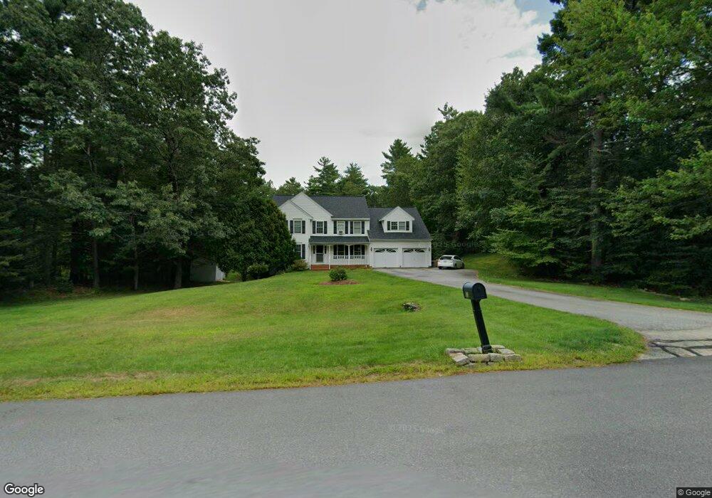
53 Laurel Crest Dr Brookline, NH 03033
Estimated Value: $700,493 - $866,000
4
Beds
3
Baths
3,139
Sq Ft
$246/Sq Ft
Est. Value
About This Home
This home is located at 53 Laurel Crest Dr, Brookline, NH 03033 and is currently estimated at $771,373, approximately $245 per square foot. 53 Laurel Crest Dr is a home with nearby schools including Richard Maghakian Memorial School, Captain Samuel Douglass Academy, and Hollis-Brookline Middle School.
Ownership History
Date
Name
Owned For
Owner Type
Purchase Details
Closed on
Feb 17, 2004
Sold by
Barry Ellen J
Bought by
Sheppard Leonard A and Sheppard Liana T
Current Estimated Value
Home Financials for this Owner
Home Financials are based on the most recent Mortgage that was taken out on this home.
Original Mortgage
$256,400
Interest Rate
5.82%
Mortgage Type
Purchase Money Mortgage
Purchase Details
Closed on
Oct 2, 2002
Sold by
Davis James W and Davis Michele A
Bought by
Barry Ellen J
Create a Home Valuation Report for This Property
The Home Valuation Report is an in-depth analysis detailing your home's value as well as a comparison with similar homes in the area
Home Values in the Area
Average Home Value in this Area
Purchase History
| Date | Buyer | Sale Price | Title Company |
|---|---|---|---|
| Sheppard Leonard A | $409,900 | -- | |
| Barry Ellen J | $389,200 | -- |
Source: Public Records
Mortgage History
| Date | Status | Borrower | Loan Amount |
|---|---|---|---|
| Open | Barry Ellen J | $231,610 | |
| Closed | Barry Ellen J | $243,300 | |
| Closed | Barry Ellen J | $84,000 | |
| Closed | Barry Ellen J | $256,400 |
Source: Public Records
Tax History Compared to Growth
Tax History
| Year | Tax Paid | Tax Assessment Tax Assessment Total Assessment is a certain percentage of the fair market value that is determined by local assessors to be the total taxable value of land and additions on the property. | Land | Improvement |
|---|---|---|---|---|
| 2024 | $14,267 | $631,000 | $206,600 | $424,400 |
| 2023 | $13,112 | $631,000 | $206,600 | $424,400 |
| 2022 | $11,133 | $374,600 | $121,800 | $252,800 |
| 2021 | $10,706 | $374,600 | $121,800 | $252,800 |
| 2020 | $10,414 | $374,600 | $121,800 | $252,800 |
| 2019 | $11,189 | $374,600 | $121,800 | $252,800 |
| 2018 | $11,073 | $374,600 | $121,800 | $252,800 |
| 2017 | $10,383 | $315,200 | $99,500 | $215,700 |
| 2016 | $10,217 | $313,800 | $99,500 | $214,300 |
| 2015 | $9,743 | $313,800 | $99,500 | $214,300 |
| 2014 | $10,308 | $313,800 | $99,500 | $214,300 |
| 2013 | $9,925 | $313,800 | $99,500 | $214,300 |
Source: Public Records
Map
Nearby Homes
- 9 Winterberry Rd
- 7 Winterberry Rd
- 15 N End Rd
- 364 Townsend Hill Rd
- 0 Brookline St
- 1235 Townsend Rd
- 64 Meadow Rd
- 46 Oak Hill Rd
- 6 High Oaks Path
- 91 Highland St
- 10 Stearns Ave
- 21 Cranberry St
- 6 Flint Meadow Dr
- 167 Route 13
- 22 Hobart Hill Rd
- 110 Haynes Rd
- 18 Bridle Path
- 1 Depot Street Extension Unit 2
- 1 Depot Street Extension Unit 5
- 1 Depot Street Extension Unit 3
- 51 Laurel Crest Dr
- 55 Laurel Crest Dr
- 28 Laurel Crest Dr
- 49 Laurel Crest Dr
- J-39-49 Laurel Crest Dr
- 52 Laurelcrest Dr
- 57 Laurelcrest Dr
- 54 Laurel Crest Dr
- 56 Laurel Crest Dr
- 50 Laurelcrest Dr
- 50 Laurel Crest Dr
- 58 Laurelcrest Dr
- 47 Laurel Crest Dr
- 48 Laurelcrest Dr
- 48 Laurel Crest Dr
- 59 Laurel Crest Dr
- 62 Laurel Crest Dr
- 46 Laurel Crest Dr
- 43 Laurel Crest Dr
- 44 Laurelcrest Dr