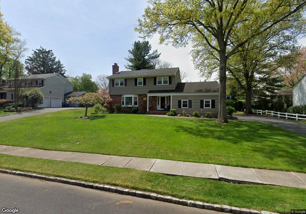
53 Manitou Cir Westfield, NJ 07090
Estimated Value: $1,009,000 - $1,112,551
--
Bed
--
Bath
2,200
Sq Ft
$484/Sq Ft
Est. Value
About This Home
This home is located at 53 Manitou Cir, Westfield, NJ 07090 and is currently estimated at $1,064,388, approximately $483 per square foot. 53 Manitou Cir is a home located in Union County with nearby schools including Washington Elementary School, Edison Intermediate School, and Westfield Senior High School.
Ownership History
Date
Name
Owned For
Owner Type
Purchase Details
Closed on
Dec 7, 2011
Sold by
Ierardi Joseph A and Ierardi Vivian A
Bought by
Saltzman David M and Saltzman Michele L
Current Estimated Value
Home Financials for this Owner
Home Financials are based on the most recent Mortgage that was taken out on this home.
Original Mortgage
$480,000
Outstanding Balance
$328,353
Interest Rate
4.01%
Mortgage Type
New Conventional
Estimated Equity
$736,035
Create a Home Valuation Report for This Property
The Home Valuation Report is an in-depth analysis detailing your home's value as well as a comparison with similar homes in the area
Home Values in the Area
Average Home Value in this Area
Purchase History
| Date | Buyer | Sale Price | Title Company |
|---|---|---|---|
| Saltzman David M | $600,000 | Multiple |
Source: Public Records
Mortgage History
| Date | Status | Borrower | Loan Amount |
|---|---|---|---|
| Open | Saltzman David M | $480,000 |
Source: Public Records
Tax History Compared to Growth
Tax History
| Year | Tax Paid | Tax Assessment Tax Assessment Total Assessment is a certain percentage of the fair market value that is determined by local assessors to be the total taxable value of land and additions on the property. | Land | Improvement |
|---|---|---|---|---|
| 2025 | $15,620 | $693,600 | $432,800 | $260,800 |
| 2024 | $15,301 | $693,600 | $432,800 | $260,800 |
| 2023 | $15,301 | $693,600 | $432,800 | $260,800 |
| 2022 | $14,982 | $693,600 | $432,800 | $260,800 |
| 2021 | $15,003 | $693,600 | $432,800 | $260,800 |
| 2020 | $14,968 | $693,600 | $432,800 | $260,800 |
| 2019 | $14,912 | $693,600 | $432,800 | $260,800 |
| 2018 | $14,531 | $156,300 | $82,300 | $74,000 |
| 2017 | $14,452 | $156,300 | $82,300 | $74,000 |
| 2016 | $14,112 | $156,300 | $82,300 | $74,000 |
| 2015 | $13,831 | $156,300 | $82,300 | $74,000 |
| 2014 | $13,375 | $156,300 | $82,300 | $74,000 |
Source: Public Records
Map
Nearby Homes
- 58 Sandra Cir Unit B-3
- 41 C Sandra Cir Unit C3
- 1806 Park Place
- 403 Park Place
- 3211 Park Place
- 5 Penn Rd
- 128 Woodland Ave
- 2 Brown Terrace
- 14 Bennett Place
- 203 Beech St
- 28 S Derby Rd
- 874 Mountain Ave
- 26 Benjamin Dr
- 89 Glenwood Rd
- 35 Sherwood Rd
- 820 E Broad St
- 33 Park Dr
- 684 Gallows Hill Rd
- 12 Edgewood Ave
- 131 Wells St
- 49 Manitou Cir
- 57 Manitou Cir
- 17 Manitou Cir
- 21 Manitou Cir
- 11 Manitou Cir
- 45 Manitou Cir
- 78 Nomahegan Dr
- 60 Manitou Cir
- 25 Manitou Cir
- 59 Unami Terrace
- 56 Manitou Cir
- 41 Manitou Cir
- 66 Nomahegan Dr
- 29 Manitou Cir
- 12 Manitou Cir
- 73 Nomahegan Dr
- 77 Nomahegan Dr
- 69 Nomahegan Dr
- 52 Manitou Cir
- 81 Nomahegan Dr